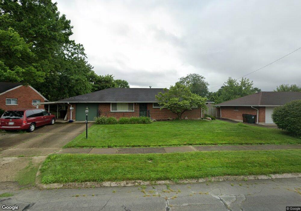
2176 Burnside Dr Dayton, OH 45439
Woodbourne-Hyde Park NeighborhoodEstimated Value: $183,000 - $212,000
2
Beds
2
Baths
1,464
Sq Ft
$132/Sq Ft
Est. Value
About This Home
This home is located at 2176 Burnside Dr, Dayton, OH 45439 and is currently estimated at $193,473, approximately $132 per square foot. 2176 Burnside Dr is a home located in Montgomery County with nearby schools including West Carrollton High School, Miami Valley Academies, and St. Albert the Great Catholic School.
Ownership History
Date
Name
Owned For
Owner Type
Purchase Details
Closed on
Aug 24, 2016
Sold by
Slicker Allan R and Slicker Linda L
Bought by
Slicker Roger R
Current Estimated Value
Purchase Details
Closed on
Dec 19, 2011
Sold by
Swafford Andrew T
Bought by
Slicker Allan R and Slicker Linda L
Create a Home Valuation Report for This Property
The Home Valuation Report is an in-depth analysis detailing your home's value as well as a comparison with similar homes in the area
Home Values in the Area
Average Home Value in this Area
Purchase History
| Date | Buyer | Sale Price | Title Company |
|---|---|---|---|
| Slicker Roger R | -- | None Available | |
| Slicker Allan R | $63,500 | Fidelity Lawyers Title Agenc |
Source: Public Records
Tax History Compared to Growth
Tax History
| Year | Tax Paid | Tax Assessment Tax Assessment Total Assessment is a certain percentage of the fair market value that is determined by local assessors to be the total taxable value of land and additions on the property. | Land | Improvement |
|---|---|---|---|---|
| 2024 | $3,813 | $54,280 | $7,820 | $46,460 |
| 2023 | $3,813 | $54,280 | $7,820 | $46,460 |
| 2022 | $3,306 | $36,430 | $5,250 | $31,180 |
| 2021 | $3,065 | $36,430 | $5,250 | $31,180 |
| 2020 | $3,058 | $36,430 | $5,250 | $31,180 |
| 2019 | $2,634 | $27,360 | $5,250 | $22,110 |
| 2018 | $2,464 | $27,360 | $5,250 | $22,110 |
| 2017 | $2,448 | $27,360 | $5,250 | $22,110 |
| 2016 | $2,544 | $26,860 | $5,250 | $21,610 |
| 2015 | $2,940 | $26,860 | $5,250 | $21,610 |
| 2014 | $2,940 | $33,480 | $5,250 | $28,230 |
| 2012 | -- | $32,200 | $7,000 | $25,200 |
Source: Public Records
Map
Nearby Homes
- 1952 Tait Circle Rd
- 2090 Mattis Dr
- 4629 Richwood Dr
- 1905 Tait Circle Rd
- 4661 Richwood Dr
- 4301 Tait Rd
- 2050 William Ln
- 1673 W Stroop Rd
- 4207 S Dixie Dr
- 4792 Loxley Dr
- 1692 Hillwood Dr
- 2571 Cluster Ave
- 4051 Ellery Ave
- 1955 Kresswood Cir
- 5084 Mays Ave
- 2639 Blanchard Ave
- 2399 Polo Park Dr
- 5239 Mallet Club Dr
- 5048 Oak Manor Ct
- 3720 Ridgeleigh Rd Unit D
- 2190 Burnside Dr
- 2162 Burnside Dr
- 2185 Kajean Ave
- 2173 Kajean Ave
- 2201 Kajean Ave
- 2150 Burnside Dr
- 2202 Burnside Dr
- 2171 Burnside Dr
- 2183 Burnside Dr
- 2159 Kajean Ave
- 2157 Burnside Dr
- 2213 Kajean Ave
- 2199 Burnside Dr
- 2214 Burnside Dr
- 2138 Burnside Dr
- 2145 Burnside Dr
- 2147 Kajean Ave
- 2211 Burnside Dr
- 2227 Kajean Ave
- 2180 Kajean Ave