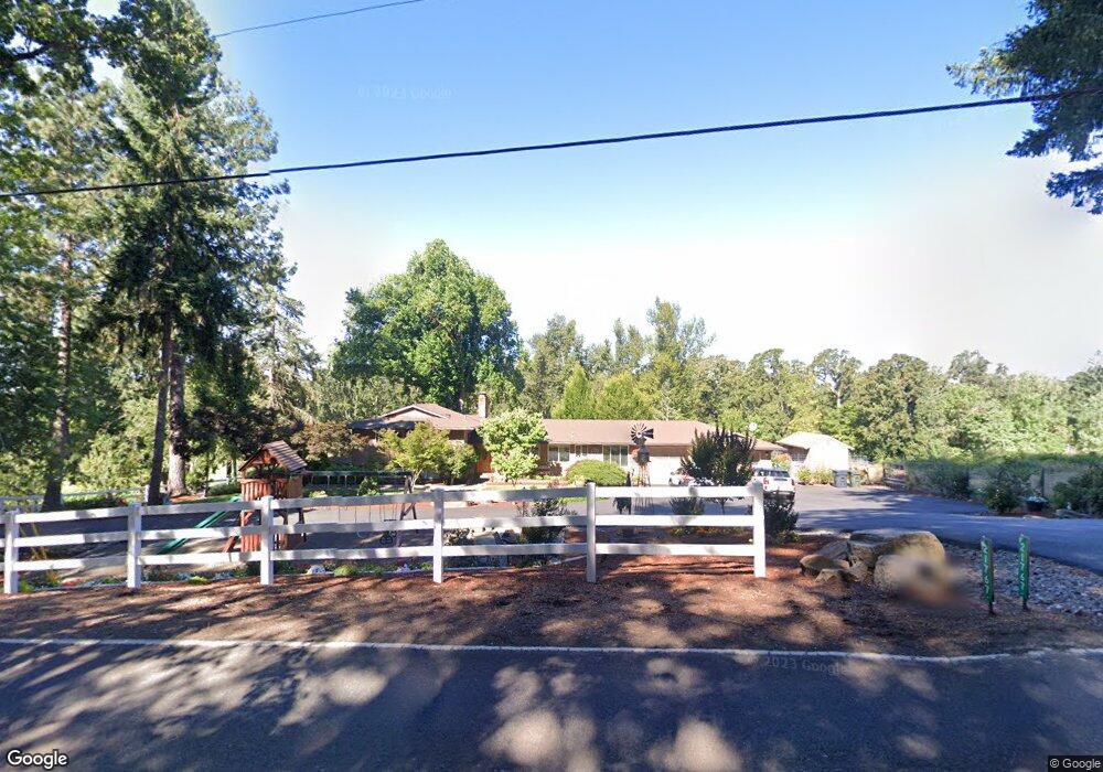
21767 S Central Point Rd Oregon City, OR 97045
Estimated Value: $821,000 - $1,575,000
--
Bed
3
Baths
2,118
Sq Ft
$495/Sq Ft
Est. Value
About This Home
This home is located at 21767 S Central Point Rd, Oregon City, OR 97045 and is currently estimated at $1,048,537, approximately $495 per square foot. 21767 S Central Point Rd is a home located in Clackamas County with nearby schools including Josefa L. Sambrano Elementary School, Cecile Trost Elementary School, and Carus School.
Ownership History
Date
Name
Owned For
Owner Type
Purchase Details
Closed on
Apr 26, 2002
Sold by
Jazdinski Frank A and Jazdinski Gayla L
Bought by
Brown Daniel R and Brown Pamela J
Current Estimated Value
Home Financials for this Owner
Home Financials are based on the most recent Mortgage that was taken out on this home.
Original Mortgage
$267,200
Outstanding Balance
$112,165
Interest Rate
7.13%
Estimated Equity
$936,372
Create a Home Valuation Report for This Property
The Home Valuation Report is an in-depth analysis detailing your home's value as well as a comparison with similar homes in the area
Home Values in the Area
Average Home Value in this Area
Purchase History
| Date | Buyer | Sale Price | Title Company |
|---|---|---|---|
| Brown Daniel R | $334,000 | Chicago Title Insurance Co |
Source: Public Records
Mortgage History
| Date | Status | Borrower | Loan Amount |
|---|---|---|---|
| Open | Brown Daniel R | $267,200 |
Source: Public Records
Tax History Compared to Growth
Tax History
| Year | Tax Paid | Tax Assessment Tax Assessment Total Assessment is a certain percentage of the fair market value that is determined by local assessors to be the total taxable value of land and additions on the property. | Land | Improvement |
|---|---|---|---|---|
| 2025 | $6,400 | $447,244 | -- | -- |
| 2024 | $6,223 | $434,218 | -- | -- |
| 2023 | $6,223 | $421,571 | $0 | $0 |
| 2022 | $5,690 | $409,293 | $0 | $0 |
| 2021 | $5,468 | $397,372 | $0 | $0 |
| 2020 | $5,385 | $385,799 | $0 | $0 |
| 2019 | $5,104 | $374,563 | $0 | $0 |
| 2018 | $4,999 | $363,653 | $0 | $0 |
| 2017 | $4,877 | $353,061 | $0 | $0 |
| 2016 | $4,709 | $342,778 | $0 | $0 |
| 2015 | $4,541 | $332,794 | $0 | $0 |
| 2014 | $4,411 | $323,101 | $0 | $0 |
Source: Public Records
Map
Nearby Homes
- 10038 S New Era Rd Unit 78
- 21303 S Central Point Rd
- 20721 S May Rd
- 10285 S New Era Rd
- 12426 S Criteser Rd
- 11700 S Makin Ln
- 12950 S New Era Rd
- 31616 SW Isle Way Ln
- 22396 S Parrot Creek Rd
- 12720 S Carus Rd
- 32088 SW Peach Cove Rd
- 2125 NE Spitz Rd
- 2123 NE Spitz Rd
- 11800 S Carus Rd
- 20337 S Leland Rd
- 1947 NE 21st Ave
- 19903 Leland Rd
- 19600 S End Rd
- 12118 Tolstrup Dr
- 11220 S Parkland Ct
- 21612 S Central Point Rd
- 21842 S Central Point Rd
- 21861 S Central Point Rd
- 21720 S Central Point Rd
- 21613 S Central Point Rd
- 11222 S New Era Rd
- 22025 S Central Point Rd
- 11592 S New Era Rd
- 21584 S Central Point Rd
- 11572 S New Era Rd
- 22038 S Central Point Rd
- 22018 S Central Point Rd
- 22030 S Central Point Rd
- 21367 S Central Point Rd
- 11174 S New Era Rd
- 11124 S New Era Rd
- 11620 S New Era Rd
- 21398 S Central Point Rd
- 22151 S Central Point Rd
- 22060 S Central Point Rd