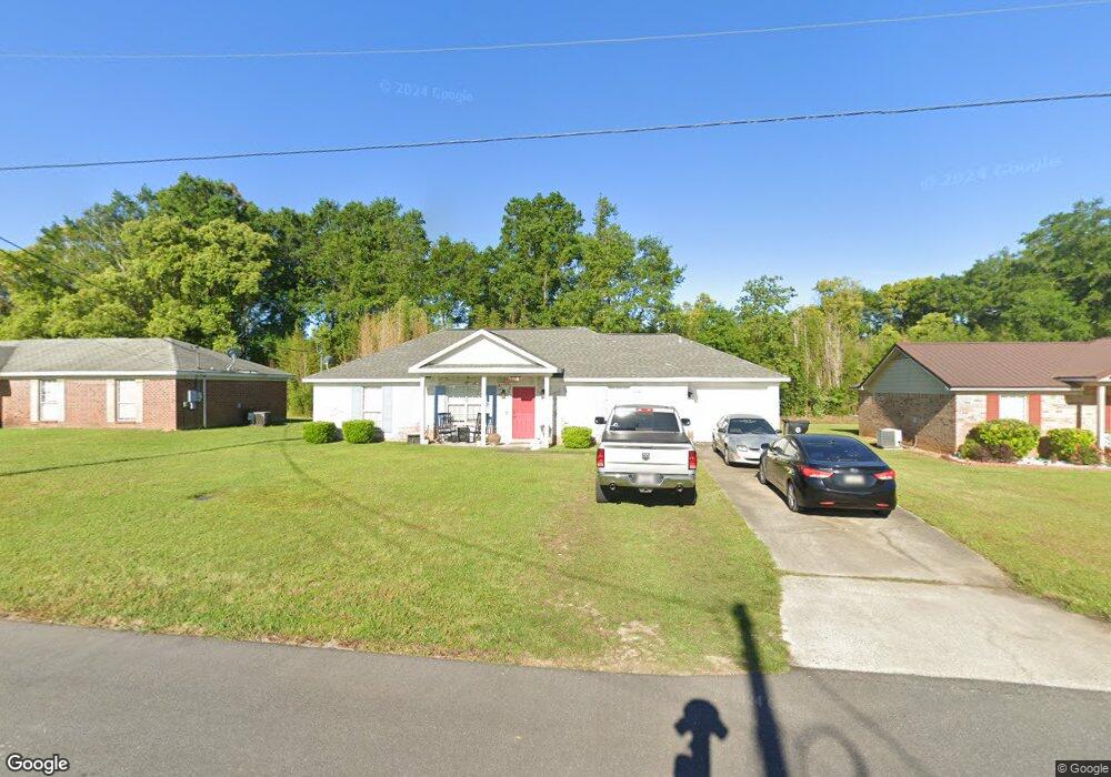
21769 Kelsey Dr Robertsdale, AL 36567
Estimated Value: $225,983 - $243,000
3
Beds
2
Baths
1,300
Sq Ft
$181/Sq Ft
Est. Value
About This Home
This home is located at 21769 Kelsey Dr, Robertsdale, AL 36567 and is currently estimated at $235,496, approximately $181 per square foot. 21769 Kelsey Dr is a home located in Baldwin County with nearby schools including Robertsdale Elementary School, Central Baldwin Middle School, and Robertsdale High School.
Ownership History
Date
Name
Owned For
Owner Type
Purchase Details
Closed on
May 16, 2011
Sold by
Gillaspy Ernestine W
Bought by
Schmidt Chadwick Joseph and Schmidt Whitneye Holley
Current Estimated Value
Home Financials for this Owner
Home Financials are based on the most recent Mortgage that was taken out on this home.
Original Mortgage
$101,554
Outstanding Balance
$70,478
Interest Rate
4.85%
Mortgage Type
New Conventional
Estimated Equity
$165,018
Create a Home Valuation Report for This Property
The Home Valuation Report is an in-depth analysis detailing your home's value as well as a comparison with similar homes in the area
Home Values in the Area
Average Home Value in this Area
Purchase History
| Date | Buyer | Sale Price | Title Company |
|---|---|---|---|
| Schmidt Chadwick Joseph | -- | Alt |
Source: Public Records
Mortgage History
| Date | Status | Borrower | Loan Amount |
|---|---|---|---|
| Open | Schmidt Chadwick Joseph | $101,554 |
Source: Public Records
Tax History Compared to Growth
Tax History
| Year | Tax Paid | Tax Assessment Tax Assessment Total Assessment is a certain percentage of the fair market value that is determined by local assessors to be the total taxable value of land and additions on the property. | Land | Improvement |
|---|---|---|---|---|
| 2024 | $553 | $16,620 | $2,760 | $13,860 |
| 2023 | $516 | $15,580 | $3,260 | $12,320 |
| 2022 | $442 | $13,520 | $0 | $0 |
| 2021 | $347 | $11,880 | $0 | $0 |
| 2020 | $330 | $11,360 | $0 | $0 |
| 2019 | $313 | $10,860 | $0 | $0 |
| 2018 | $292 | $10,200 | $0 | $0 |
| 2017 | $267 | $9,440 | $0 | $0 |
| 2016 | $261 | $9,260 | $0 | $0 |
| 2015 | $257 | $9,140 | $0 | $0 |
| 2014 | $220 | $8,020 | $0 | $0 |
| 2013 | -- | $5,660 | $0 | $0 |
Source: Public Records
Map
Nearby Homes
- 18952 E Silverhill Ave
- 0 County Road 83 Unit 376330
- 21580 Talbot Ln
- 804 Cee Bee St Unit 15
- 435 Cee Bee St Unit 14
- 18882 Georgia St
- 18260 Memphis Way
- 18914 Florida St
- 21630 Palmer Ct
- 21600 Palmer Ct
- 22081 Pearson St
- 19335 Oak Hillcrest Dr
- 18975 Florida St
- 22248 Fairway Dr
- 0 W Hammond St Unit 13, 14, 15 373473
- 18105 Scott Ave
- 18281 Aden Dr
- 21201 Explorer Dr
- 19310 County Road 48
- 22095 Buck Rd
- 21771 Kelsey Dr
- 21768 Kelsey Dr
- 21776 Kelsey Dr
- 21773 Kelsey Dr
- 21762 Kelsey Dr
- 21765 Kelsey Dr
- 21775 Kelsey Dr
- 21777 Kelsey Dr
- 18922 Dalewood Cir
- 21778 Dalewood Cir
- 21763 Kelsey Dr
- 21760 Kelsey Dr
- 21761 Kelsey Dr
- 21842 Mahan Dr
- 21779 Kelsey Dr
- 21844 Mahan Dr
- 21836 Mahan Dr
- 21759 Kelsey Dr
- 21759 Kelsey Dr
- 22176 Kelsey Dr