Estimated Value: $632,000 - $669,000
5
Beds
4
Baths
2,962
Sq Ft
$220/Sq Ft
Est. Value
About This Home
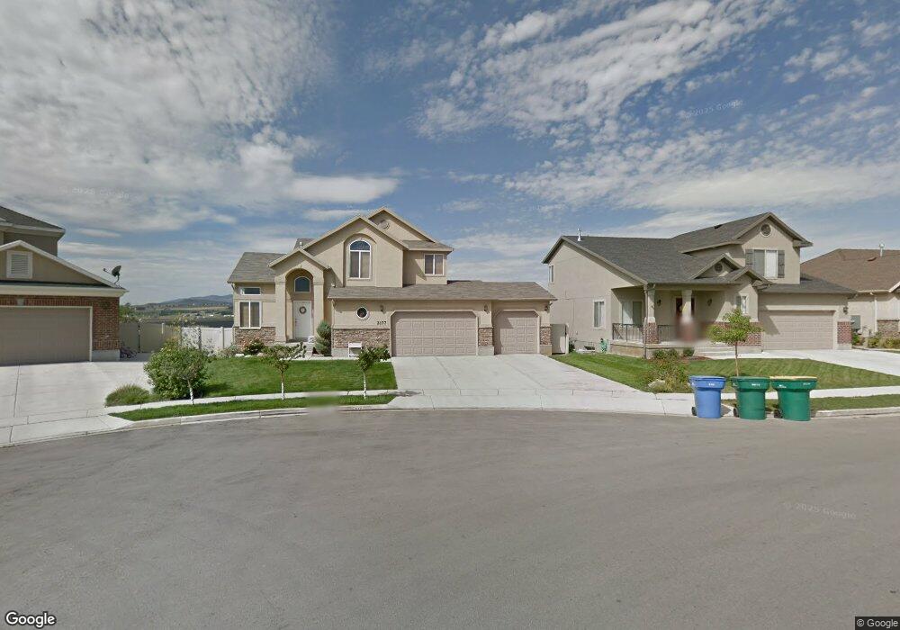
This home is located at 2177 N 2600 W, Lehi, UT 84043 and is currently estimated at $650,564, approximately $219 per square foot. 2177 N 2600 W is a home located in Utah County with nearby schools including Liberty Hills Elementary School, Skyridge High School, and Ascent Academies of Utah - Lehi Campus.
Ownership History
Date
Name
Owned For
Owner Type
Purchase Details
Closed on
Dec 19, 2007
Sold by
Ivory Homes Ltd
Bought by
Musick Spencer J and Musick Danielle M
Current Estimated Value
Home Financials for this Owner
Home Financials are based on the most recent Mortgage that was taken out on this home.
Original Mortgage
$30,998
Interest Rate
6.15%
Mortgage Type
Stand Alone Second
Create a Home Valuation Report for This Property
The Home Valuation Report is an in-depth analysis detailing your home's value as well as a comparison with similar homes in the area
Home Values in the Area
Average Home Value in this Area
Purchase History
| Date | Buyer | Sale Price | Title Company |
|---|---|---|---|
| Musick Spencer J | -- | Cottonwood Title Insurance | |
| Ivory Homes Ltd | -- | Cottonwood Title Insurance |
Source: Public Records
Mortgage History
| Date | Status | Borrower | Loan Amount |
|---|---|---|---|
| Closed | Ivory Homes Ltd | $30,998 | |
| Open | Musick Spencer J | $248,240 |
Source: Public Records
Tax History Compared to Growth
Tax History
| Year | Tax Paid | Tax Assessment Tax Assessment Total Assessment is a certain percentage of the fair market value that is determined by local assessors to be the total taxable value of land and additions on the property. | Land | Improvement |
|---|---|---|---|---|
| 2025 | $2,535 | $317,735 | $220,600 | $357,100 |
| 2024 | $2,535 | $296,615 | $0 | $0 |
| 2023 | $2,389 | $303,600 | $0 | $0 |
| 2022 | $2,562 | $315,645 | $0 | $0 |
| 2021 | $2,303 | $428,900 | $127,700 | $301,200 |
| 2020 | $2,171 | $399,700 | $118,200 | $281,500 |
| 2019 | $1,935 | $370,300 | $118,200 | $252,100 |
| 2018 | $1,883 | $340,600 | $111,400 | $229,200 |
| 2017 | $1,844 | $177,375 | $0 | $0 |
| 2016 | $1,884 | $168,080 | $0 | $0 |
| 2015 | $1,940 | $164,340 | $0 | $0 |
| 2014 | $1,844 | $155,265 | $0 | $0 |
Source: Public Records
Map
Nearby Homes
- 2189 N 2600 W
- 2464 W 2250 N
- 2196 N 2350 W
- Huntington Plan at Pioneer Meadows
- Silver Lake Plan at Pioneer Meadows
- Summit Plan at Pioneer Meadows
- Palisade Plan at Pioneer Meadows
- 1968 N 2040 W Unit 40
- 1969 N 2040 St W
- 2013 N 2040 W
- 1990 N 2040 W
- 1990 N 2040 W Unit 41
- 1854 N 2230 W
- 1970 N 2090 St W
- 1842 N 2230 W
- 1870 N 2230 W
- 1870 N 2230 W Unit 23
- 1896 N 2230 W
- 1908 N 2230 W
- 1832 N 2230 W