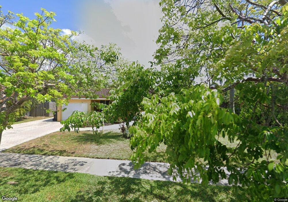
2177 NE 61st Ct Fort Lauderdale, FL 33308
Imperial Point NeighborhoodEstimated Value: $578,000 - $691,000
2
Beds
2
Baths
1,250
Sq Ft
$510/Sq Ft
Est. Value
About This Home
This home is located at 2177 NE 61st Ct, Fort Lauderdale, FL 33308 and is currently estimated at $637,442, approximately $509 per square foot. 2177 NE 61st Ct is a home located in Broward County with nearby schools including McNab Elementary School, Pompano Beach Middle School, and Northeast High School.
Ownership History
Date
Name
Owned For
Owner Type
Purchase Details
Closed on
May 31, 2002
Sold by
Canning Patrick D and Canning Tami Lisa
Bought by
Shapiro David M and Shapiro Nancy L
Current Estimated Value
Home Financials for this Owner
Home Financials are based on the most recent Mortgage that was taken out on this home.
Original Mortgage
$230,375
Outstanding Balance
$97,270
Interest Rate
6.79%
Estimated Equity
$540,172
Purchase Details
Closed on
Oct 28, 1993
Sold by
Antonello Joseph A and Antonello Grace
Bought by
Canning Patrick D and Canning Tami Lisa
Home Financials for this Owner
Home Financials are based on the most recent Mortgage that was taken out on this home.
Original Mortgage
$115,200
Interest Rate
7.07%
Create a Home Valuation Report for This Property
The Home Valuation Report is an in-depth analysis detailing your home's value as well as a comparison with similar homes in the area
Home Values in the Area
Average Home Value in this Area
Purchase History
| Date | Buyer | Sale Price | Title Company |
|---|---|---|---|
| Shapiro David M | $242,500 | Homepartners Title Inc | |
| Canning Patrick D | $128,000 | -- |
Source: Public Records
Mortgage History
| Date | Status | Borrower | Loan Amount |
|---|---|---|---|
| Open | Shapiro David M | $230,375 | |
| Previous Owner | Canning Patrick D | $115,200 |
Source: Public Records
Tax History Compared to Growth
Tax History
| Year | Tax Paid | Tax Assessment Tax Assessment Total Assessment is a certain percentage of the fair market value that is determined by local assessors to be the total taxable value of land and additions on the property. | Land | Improvement |
|---|---|---|---|---|
| 2025 | $4,363 | $248,260 | -- | -- |
| 2024 | $4,255 | $241,270 | -- | -- |
| 2023 | $4,255 | $234,250 | $0 | $0 |
| 2022 | $4,020 | $227,430 | $0 | $0 |
| 2021 | $3,899 | $220,810 | $0 | $0 |
| 2020 | $3,827 | $217,770 | $0 | $0 |
| 2019 | $3,507 | $212,880 | $0 | $0 |
| 2018 | $3,301 | $208,920 | $0 | $0 |
| 2017 | $3,276 | $204,630 | $0 | $0 |
| 2016 | $3,295 | $200,430 | $0 | $0 |
| 2015 | $3,330 | $199,040 | $0 | $0 |
| 2014 | $3,357 | $197,470 | $0 | $0 |
| 2013 | -- | $213,360 | $74,590 | $138,770 |
Source: Public Records
Map
Nearby Homes
- 2185 NE 61st Ct
- 6210 NE 21st Rd
- 2175 NE 59th Ct
- 2210 NE 61st Ct
- 2210 NE 62nd St
- 6240 NE 21st Rd
- 5930 NE 21st Dr
- 6331 NE 22nd Ave
- 2261 NE 62nd St
- 5900 NE 21st Ln
- 2121 NE 62nd St
- 6000 NE 22nd Way Unit 1E
- 6000 NE 22nd Way Unit 6C
- 2116 NE 62nd St
- 6200 NE 22nd Way Unit 305
- 2133 NE 63rd Ct
- 2113 NE 62nd St
- 5921 NE 22nd Way
- 2108 NE 63rd St
- 2105 NE 62nd St
- 2181 NE 61st Ct
- 2173 NE 61st Ct
- 2176 NE 62nd St
- 2176 NE 62nd St Unit ID390317P
- 2176 NE 62nd St
- 2172 NE 62nd St
- 2180 NE 62nd St
- 2169 NE 61st Ct
- 2176 NE 61st Ct
- 2168 NE 62nd St
- 2172 NE 61st Ct
- 2180 NE 61st Ct
- 2184 NE 62nd St
- 2168 NE 61st Ct
- 2184 NE 61st Ct
- 2164 NE 62nd St
- 2189 NE 61st Ct
- 2165 NE 61st Ct
- 2167 NE 62nd Ct
- 2188 NE 62nd St