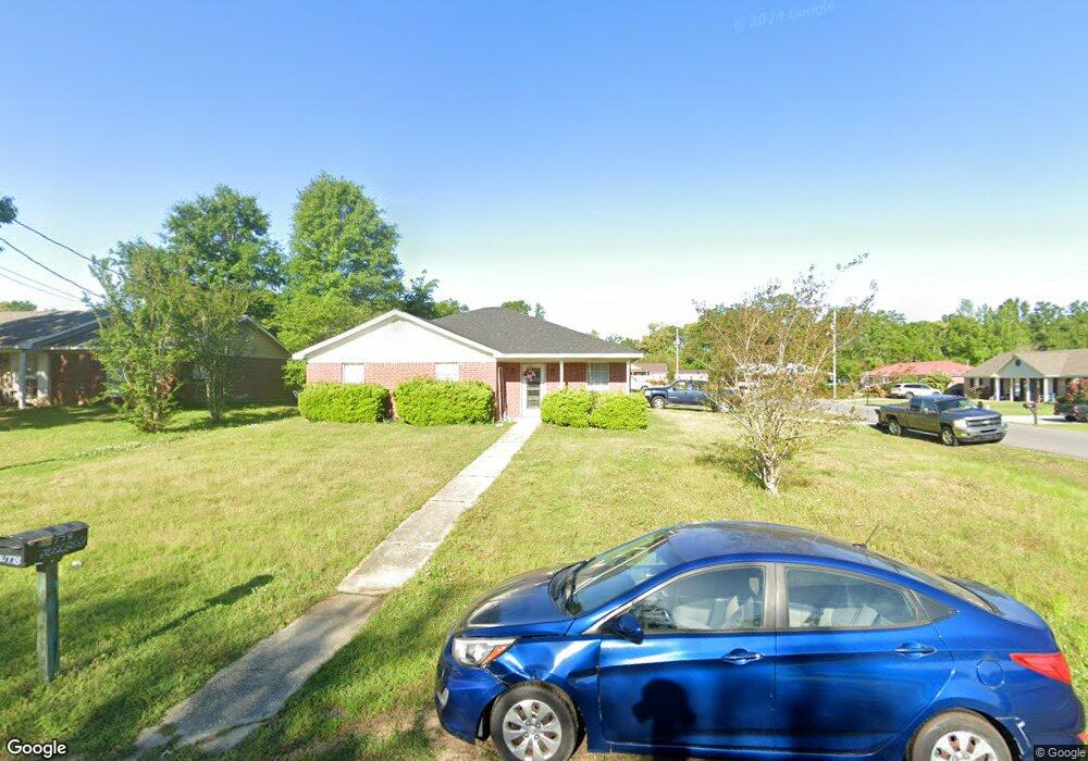
21778 Dalewood Cir Robertsdale, AL 36567
Estimated Value: $177,000 - $180,000
3
Beds
2
Baths
1,416
Sq Ft
$126/Sq Ft
Est. Value
About This Home
This home is located at 21778 Dalewood Cir, Robertsdale, AL 36567 and is currently estimated at $178,333, approximately $125 per square foot. 21778 Dalewood Cir is a home with nearby schools including Robertsdale Elementary School, Central Baldwin Middle School, and Robertsdale High School.
Ownership History
Date
Name
Owned For
Owner Type
Purchase Details
Closed on
Dec 5, 2024
Sold by
Meredith Jonathan and Richey Robert A
Bought by
Frolik Ryan
Current Estimated Value
Purchase Details
Closed on
May 3, 2018
Sold by
Meredith Jonathan and Meredith Shirley
Bought by
Meredith Jonathan and Richey Robert A
Home Financials for this Owner
Home Financials are based on the most recent Mortgage that was taken out on this home.
Original Mortgage
$88,200
Interest Rate
4.4%
Mortgage Type
New Conventional
Purchase Details
Closed on
Nov 3, 2005
Sold by
Campbell Brian C and Campbell Audra
Bought by
Meredith Jonathan and Meredith Shirley
Home Financials for this Owner
Home Financials are based on the most recent Mortgage that was taken out on this home.
Original Mortgage
$107,550
Interest Rate
5.76%
Mortgage Type
New Conventional
Create a Home Valuation Report for This Property
The Home Valuation Report is an in-depth analysis detailing your home's value as well as a comparison with similar homes in the area
Home Values in the Area
Average Home Value in this Area
Purchase History
| Date | Buyer | Sale Price | Title Company |
|---|---|---|---|
| Frolik Ryan | $175,000 | None Listed On Document | |
| Meredith Jonathan | $7,500 | First American Mortgage Solu | |
| Meredith Jonathan | -- | Slt |
Source: Public Records
Mortgage History
| Date | Status | Borrower | Loan Amount |
|---|---|---|---|
| Previous Owner | Meredith Jonathan | $88,200 | |
| Previous Owner | Meredith Jonathan | $107,550 |
Source: Public Records
Tax History Compared to Growth
Tax History
| Year | Tax Paid | Tax Assessment Tax Assessment Total Assessment is a certain percentage of the fair market value that is determined by local assessors to be the total taxable value of land and additions on the property. | Land | Improvement |
|---|---|---|---|---|
| 2024 | $1,165 | $32,360 | $5,500 | $26,860 |
| 2023 | $1,094 | $30,380 | $6,500 | $23,880 |
| 2022 | $943 | $26,200 | $0 | $0 |
| 2021 | $760 | $23,020 | $0 | $0 |
| 2020 | $727 | $22,020 | $0 | $0 |
| 2019 | $726 | $22,000 | $0 | $0 |
| 2018 | $683 | $20,700 | $0 | $0 |
| 2017 | $632 | $19,140 | $0 | $0 |
| 2016 | $619 | $18,380 | $0 | $0 |
| 2015 | $595 | $17,760 | $0 | $0 |
| 2014 | -- | $15,400 | $0 | $0 |
| 2013 | -- | $10,680 | $0 | $0 |
Source: Public Records
Map
Nearby Homes
- 18952 E Silverhill Ave
- 21580 Talbot Ln
- 0 County Road 83 Unit 376330
- 804 Cee Bee St Unit 15
- 435 Cee Bee St Unit 14
- 18882 Georgia St
- 18914 Florida St
- 22081 Pearson St
- 19335 Oak Hillcrest Dr
- 18260 Memphis Way
- 18975 Florida St
- 21630 Palmer Ct
- 21600 Palmer Ct
- 22248 Fairway Dr
- 0 W Hammond St Unit 13, 14, 15 373473
- 22095 Buck Rd
- 18105 Scott Ave
- 2000 Plan at Forest Park
- 1348 Plan at Forest Park
- 18281 Aden Dr
- 18922 Dalewood Cir
- 22176 Kelsey Dr
- 21776 Kelsey Dr
- 21768 Kelsey Dr
- 21779 Kelsey Dr
- 21760 Kelsey Dr
- 21781 Kelsey Dr
- 18915 Dalewood Cir
- 21777 Kelsey Dr
- 21762 Kelsey Dr
- 18923 Dalewood Cir
- 18916 Dalewood Cir
- 18925 Dalewood Cir
- 21775 Kelsey Dr
- 18914 Dalewood Cir
- 21846 Mahan Dr
- 21769 Kelsey Dr
- 18927 Dalewood Cir
- 18913 Dalewood Cir
- 21759 Kelsey Dr