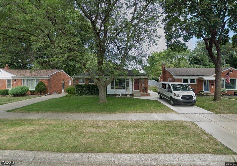
21781 Mauer St Saint Clair Shores, MI 48080
Estimated Value: $213,609 - $240,000
3
Beds
1
Bath
1,097
Sq Ft
$207/Sq Ft
Est. Value
About This Home
This home is located at 21781 Mauer St, Saint Clair Shores, MI 48080 and is currently estimated at $227,402, approximately $207 per square foot. 21781 Mauer St is a home located in Macomb County with nearby schools including South Lake Middle School, South Lake High School, and St. Joan of Arc Elementary School.
Ownership History
Date
Name
Owned For
Owner Type
Purchase Details
Closed on
Oct 24, 2024
Sold by
William And Mary Ann Vinton Revocable Li and Vinton William G
Bought by
Vinton William G and Vinton Mary Ann
Current Estimated Value
Purchase Details
Closed on
Jul 22, 2021
Sold by
Vinton Patricia Ann and Vinton William Gene
Bought by
Vinton William Gene
Purchase Details
Closed on
Oct 11, 2013
Sold by
Vinton William Gene
Bought by
Vinton William G and Vinton Mary Ann
Purchase Details
Closed on
Jul 22, 2004
Sold by
Vinton Patricia Ann
Bought by
Vinton William Gene
Create a Home Valuation Report for This Property
The Home Valuation Report is an in-depth analysis detailing your home's value as well as a comparison with similar homes in the area
Home Values in the Area
Average Home Value in this Area
Purchase History
| Date | Buyer | Sale Price | Title Company |
|---|---|---|---|
| Vinton William G | -- | None Listed On Document | |
| Vinton William Gene | -- | None Available | |
| Vinton William G | -- | None Available | |
| Vinton William Gene | -- | -- |
Source: Public Records
Tax History Compared to Growth
Tax History
| Year | Tax Paid | Tax Assessment Tax Assessment Total Assessment is a certain percentage of the fair market value that is determined by local assessors to be the total taxable value of land and additions on the property. | Land | Improvement |
|---|---|---|---|---|
| 2025 | $2,776 | $97,800 | $0 | $0 |
| 2024 | $2,776 | $93,600 | $0 | $0 |
| 2023 | $2,645 | $83,700 | $0 | $0 |
| 2022 | $2,510 | $73,200 | $0 | $0 |
| 2021 | $2,472 | $71,300 | $0 | $0 |
| 2020 | $2,471 | $65,700 | $0 | $0 |
| 2019 | $2,126 | $59,500 | $0 | $0 |
| 2018 | $2,257 | $50,100 | $0 | $0 |
| 2017 | $2,257 | $45,000 | $7,500 | $37,500 |
| 2016 | $2,126 | $45,000 | $0 | $0 |
| 2015 | $2,088 | $39,100 | $0 | $0 |
| 2012 | -- | $41,700 | $6,900 | $34,800 |
Source: Public Records
Map
Nearby Homes
- 21751 Edmunton St
- 21701 Chalon St
- 21640 Chalon St
- 22141 Edmunton St
- 22035 Sunnyside St
- 21525 Brys Dr
- 20618 Sunnyside St
- 22017 Rosedale St
- 21737 Roslyn Rd
- 21715 Alger St
- 21835 Alger St
- 2104 Roslyn Rd
- 22026 Alger St
- 2169 Roslyn Rd
- 2147 Roslyn Rd
- 20418 Edmunton St
- 20406 Mauer St
- 22109 Alger St
- 20505 Shady Lane Ave
- 20608 Rosedale St
- 21801 Mauer St
- 21771 Mauer St
- 21811 Mauer St
- 21761 Mauer St
- 21821 Mauer St
- 21751 Mauer St
- 21780 Mauer St
- 21808 Shady Lane Ave
- 21770 Mauer St
- 21810 Mauer St
- 21831 Mauer St
- 21741 Mauer St
- 21760 Mauer St
- 21816 Shady Lane Ave
- 21714 Shady Lane Ave
- 21820 Mauer St
- 21750 Mauer St
- 21731 Mauer St
- 21800 Shady Lane Ave
- 21824 Shady Lane Ave