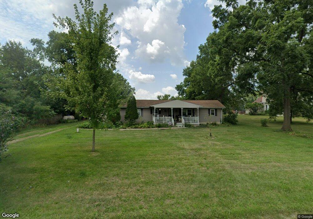
21783 State Route 347 Raymond, OH 43067
Estimated Value: $140,000 - $210,000
3
Beds
2
Baths
924
Sq Ft
$186/Sq Ft
Est. Value
About This Home
This home is located at 21783 State Route 347, Raymond, OH 43067 and is currently estimated at $171,500, approximately $185 per square foot. 21783 State Route 347 is a home located in Union County with nearby schools including Raymond Elementary School, Creekview Intermediate Elementary School, and Bunsold Middle School.
Ownership History
Date
Name
Owned For
Owner Type
Purchase Details
Closed on
Jul 7, 2011
Sold by
Bump Marion and Bump Karen
Bought by
Khalili Belkacem and Khalili Fatiha
Current Estimated Value
Purchase Details
Closed on
Dec 21, 2009
Sold by
Miller Morgan S and Miller Jackie C
Bought by
Bump Marion and Bump Karen
Create a Home Valuation Report for This Property
The Home Valuation Report is an in-depth analysis detailing your home's value as well as a comparison with similar homes in the area
Home Values in the Area
Average Home Value in this Area
Purchase History
| Date | Buyer | Sale Price | Title Company |
|---|---|---|---|
| Khalili Belkacem | $52,000 | Attorney | |
| Bump Marion | $55,000 | Attorney |
Source: Public Records
Tax History Compared to Growth
Tax History
| Year | Tax Paid | Tax Assessment Tax Assessment Total Assessment is a certain percentage of the fair market value that is determined by local assessors to be the total taxable value of land and additions on the property. | Land | Improvement |
|---|---|---|---|---|
| 2024 | $1,404 | $30,250 | $4,130 | $26,120 |
| 2023 | $1,404 | $30,250 | $4,130 | $26,120 |
| 2022 | $1,551 | $30,250 | $4,130 | $26,120 |
| 2021 | $1,284 | $24,050 | $3,180 | $20,870 |
| 2020 | $1,228 | $24,050 | $3,180 | $20,870 |
| 2019 | $1,802 | $24,050 | $3,180 | $20,870 |
| 2018 | $1,180 | $21,530 | $2,600 | $18,930 |
| 2017 | $1,113 | $21,530 | $2,600 | $18,930 |
| 2016 | $1,109 | $21,530 | $2,600 | $18,930 |
| 2015 | $1,140 | $20,570 | $2,600 | $17,970 |
| 2014 | $1,119 | $20,570 | $2,600 | $17,970 |
| 2013 | $1,061 | $20,700 | $2,600 | $18,100 |
Source: Public Records
Map
Nearby Homes
- 21630 Main St
- 23156 State Route 739
- 0 Powder Lick Rd Unit 1016484
- 21875 Liberty Rd W
- 20971 Peoria Loop Rd
- 25400 Storms Rd
- 0 Liberty Rd W Unit 225028227
- 24097 Lunda Rd
- 24805 Rapp Dean Rd
- 20499 Bear Swamp Rd
- 20350 Bear Swamp Rd
- 25883 Lunda Rd
- 0 Johnson Rd Unit 225027964
- 0 Johnson Rd Unit 222024368
- 0 Johnson Rd Unit Lot 2 222024351
- 0 Benton Rd Unit Lot B 225022637
- 0 Benton Rd Unit Lot A 225022636
- 1299 Forest Edge Dr
- 1322 Forest Edge Dr
- 19463 Bear Swamp Rd
- 21783 Main St
- 21771 State Route 347
- 21801 State Route 347
- 21801 Main St
- 21763 Main St
- 21774 State Route 347
- 21761 Ohio 347
- 21872 Main Peoria St
- 21796 State Route 347
- 21764 Ohio 347
- 21751 State Route 347
- 21829 State Route 347
- 21748 Main St
- 21743 State Route 347
- 21748 State Route 347
- 21743 Ohio 347
- 21737 State Route 347
- 21734 State Route 347
- 21729 State Route 347
- 21913 Ohio 347