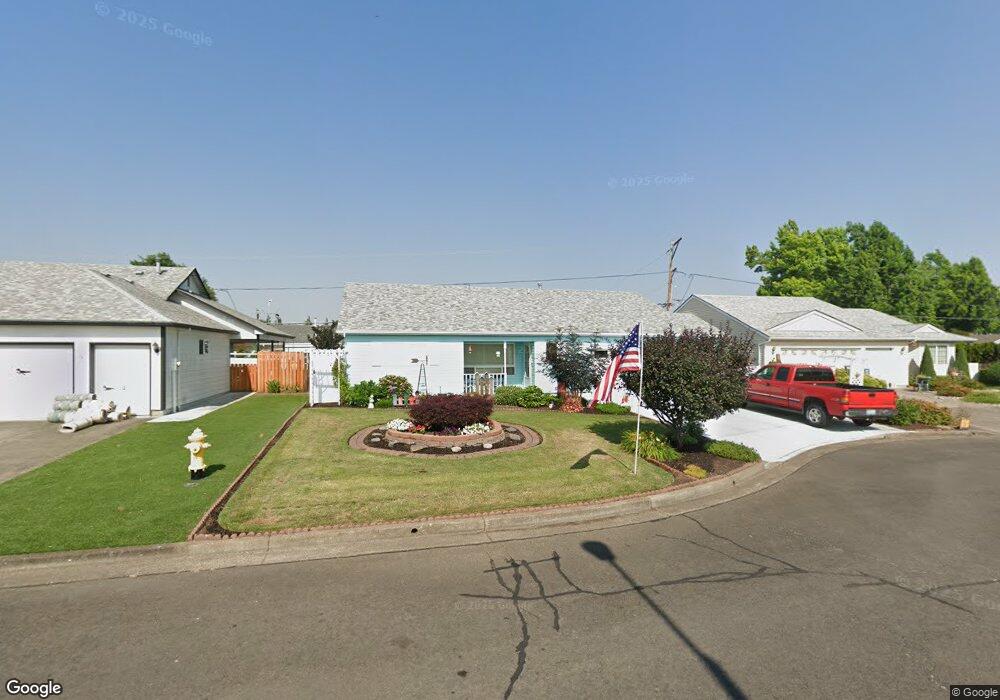
2179 Heather Way Woodburn, OR 97071
Estimated Value: $371,000 - $427,000
2
Beds
2
Baths
1,429
Sq Ft
$279/Sq Ft
Est. Value
About This Home
This home is located at 2179 Heather Way, Woodburn, OR 97071 and is currently estimated at $398,645, approximately $278 per square foot. 2179 Heather Way is a home located in Marion County with nearby schools including Lincoln Elementary School, French Prairie Middle School, and Woodburn Arthur Academy.
Ownership History
Date
Name
Owned For
Owner Type
Purchase Details
Closed on
Mar 16, 2017
Sold by
Hancock Saundra D
Bought by
Hartley Micheal and Hartley Darlene
Current Estimated Value
Home Financials for this Owner
Home Financials are based on the most recent Mortgage that was taken out on this home.
Original Mortgage
$268,580
Outstanding Balance
$222,124
Interest Rate
4.16%
Mortgage Type
VA
Estimated Equity
$176,521
Purchase Details
Closed on
Aug 10, 2005
Sold by
Anderson Lucille V
Bought by
Hancock John F and Hancock Saundra D
Create a Home Valuation Report for This Property
The Home Valuation Report is an in-depth analysis detailing your home's value as well as a comparison with similar homes in the area
Home Values in the Area
Average Home Value in this Area
Purchase History
| Date | Buyer | Sale Price | Title Company |
|---|---|---|---|
| Hartley Micheal | $260,000 | Ticor Title Company Of Or | |
| Hancock John F | $230,000 | Ticor Title |
Source: Public Records
Mortgage History
| Date | Status | Borrower | Loan Amount |
|---|---|---|---|
| Open | Hartley Micheal | $268,580 |
Source: Public Records
Tax History Compared to Growth
Tax History
| Year | Tax Paid | Tax Assessment Tax Assessment Total Assessment is a certain percentage of the fair market value that is determined by local assessors to be the total taxable value of land and additions on the property. | Land | Improvement |
|---|---|---|---|---|
| 2025 | $4,401 | $234,480 | -- | -- |
| 2024 | $4,401 | $227,660 | -- | -- |
| 2023 | $4,374 | $221,030 | $0 | $0 |
| 2022 | $4,143 | $214,600 | $0 | $0 |
| 2021 | $4,022 | $208,350 | $0 | $0 |
| 2020 | $3,902 | $202,290 | $0 | $0 |
| 2019 | $3,794 | $196,400 | $0 | $0 |
| 2018 | $3,714 | $0 | $0 | $0 |
| 2017 | $3,606 | $0 | $0 | $0 |
| 2016 | $3,499 | $0 | $0 | $0 |
| 2015 | $3,166 | $0 | $0 | $0 |
| 2014 | $2,895 | $0 | $0 | $0 |
Source: Public Records
Map
Nearby Homes
- 2296 Umpqua Rd
- 2365 Umpqua Rd
- 1740 Jansen Way
- 1720 Jansen Way
- 1753 Jansen Way
- 1999 Jansen Way Unit 16
- 1999 Jansen Way Unit 6 Wy
- 1999 Jansen Way Unit 29
- 1999 Jansen Way Unit 6
- 1255 Parkside Ave
- 1285 Parkside Ave
- 1251 Parkside Ave
- 1233 Parkside Ave
- 1136 Parkside Ave
- 1171 Parkside Ave
- 1215 Parkside Ave
- 1122 Parkside Ave
- 1185 Parkside Ave
- Cayuse Plan at Dove Landing
- McKenzie Plan at Dove Landing
- 2161 Heather Way
- 2276 Umpqua Rd
- 2256 Umpqua Rd
- 1393 Mulberry Dr
- 2236 Umpqua Rd
- 2133 Heather Way
- 2184 Heather Way
- 1387 Mulberry Dr
- 2216 Umpqua Rd
- 2160 Heather Way
- 1375 Mulberry Dr
- 2132 Heather Way
- 2263 Umpqua Rd
- 2273 Umpqua Rd
- 2312 Umpqua Rd
- 2199 Lilac Way
- 2245 Umpqua Rd
- 2295 Umpqua Rd
- 1329 Mulberry Dr
- 2165 Lilac Way