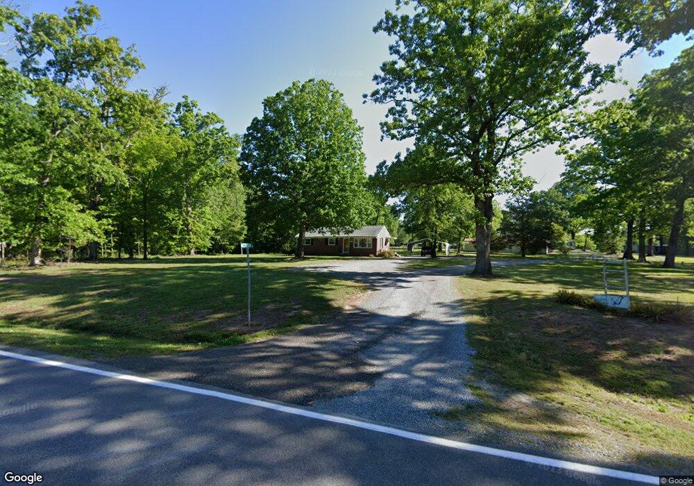
2179 Wolf Trap Rd South Boston, VA 24592
Estimated Value: $120,000 - $184,000
2
Beds
1
Bath
984
Sq Ft
$145/Sq Ft
Est. Value
About This Home
This home is located at 2179 Wolf Trap Rd, South Boston, VA 24592 and is currently estimated at $142,837, approximately $145 per square foot. 2179 Wolf Trap Rd is a home located in Halifax County with nearby schools including South Boston Elementary School, Halifax County Middle School, and Halifax County High School.
Ownership History
Date
Name
Owned For
Owner Type
Purchase Details
Closed on
Apr 18, 2011
Sold by
Williamson Sharon
Bought by
Brandon Michael D
Current Estimated Value
Home Financials for this Owner
Home Financials are based on the most recent Mortgage that was taken out on this home.
Original Mortgage
$42,400
Outstanding Balance
$29,375
Interest Rate
4.89%
Mortgage Type
New Conventional
Estimated Equity
$113,462
Create a Home Valuation Report for This Property
The Home Valuation Report is an in-depth analysis detailing your home's value as well as a comparison with similar homes in the area
Home Values in the Area
Average Home Value in this Area
Purchase History
| Date | Buyer | Sale Price | Title Company |
|---|---|---|---|
| Brandon Michael D | $53,000 | -- |
Source: Public Records
Mortgage History
| Date | Status | Borrower | Loan Amount |
|---|---|---|---|
| Open | Brandon Michael D | $42,400 |
Source: Public Records
Tax History Compared to Growth
Tax History
| Year | Tax Paid | Tax Assessment Tax Assessment Total Assessment is a certain percentage of the fair market value that is determined by local assessors to be the total taxable value of land and additions on the property. | Land | Improvement |
|---|---|---|---|---|
| 2025 | $376 | $75,248 | $9,800 | $65,448 |
| 2024 | $376 | $75,248 | $9,800 | $65,448 |
| 2023 | $342 | $68,453 | $9,800 | $58,653 |
| 2022 | $342 | $68,453 | $9,800 | $58,653 |
| 2021 | $261 | $52,135 | $9,800 | $42,335 |
| 2020 | $261 | $52,135 | $9,800 | $42,335 |
| 2019 | $261 | $52,135 | $9,800 | $42,335 |
| 2018 | $250 | $52,135 | $9,800 | $42,335 |
| 2016 | $254 | $52,967 | $9,800 | $43,167 |
| 2015 | $254 | $53,499 | $9,918 | $43,581 |
| 2014 | $246 | $53,499 | $9,918 | $43,581 |
| 2013 | $248 | $55,187 | $9,959 | $45,228 |
Source: Public Records
Map
Nearby Homes
- 0 Wolf Trap Rd
- 00 Good Trail
- 1194 Wolf Trap Rd
- 1058 James D Hagood Hwy
- 1039 Azalea Ln
- 00 Alphonse Dairy Rd
- 509 Bellwood Ln
- 4507 Brentwood Dr
- 302 Dunncroft Ct
- 1002 John Randolph Blvd
- 725 Magnolia Dr
- 0 Parker Ave
- 2100 Rivoli St
- 618 Cedar Ave
- 8 LOTS Vaughan St
- 1-16 Vaughan St
- 104 Elizabeth Ct
- 00 Boyds Ferry Trail
- 0 Mcrae Dr Unit 70431
- 1312 Willingham Ave
- 2176 Wolf Trap Rd
- 2130 Wolf Trap Rd
- 2122 Wolf Trap Rd
- 2186 Wolf Trap Rd
- 2102 Wolf Trap Rd
- 2101 Wolf Trap Rd
- 2210 Wolf Trap Rd
- 1037 Janies Trail
- 1035 Janies Trail
- 2078 Wolf Trap Rd
- 2077 Wolf Trap Rd
- 2074 Wolf Trap Rd
- 2071 Wolf Trap Rd
- 1015 Walker Trail
- 1021 Mcgregor Trail
- 2244 Wolf Trap Rd
- 2057 Wolf Trap Rd
- 1092 Janies Trail
- 1091 Janies Trail
- 1097 Janies Trail