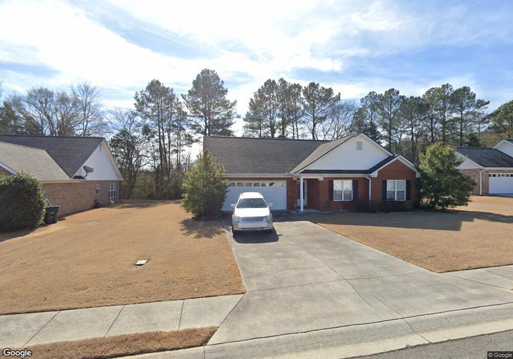
218 Brookstone Dr SW Calhoun, GA 30701
Estimated Value: $293,581 - $334,000
3
Beds
2
Baths
1,670
Sq Ft
$185/Sq Ft
Est. Value
About This Home
This home is located at 218 Brookstone Dr SW, Calhoun, GA 30701 and is currently estimated at $308,395, approximately $184 per square foot. 218 Brookstone Dr SW is a home located in Gordon County with nearby schools including Swain Elementary School, Ashworth Middle School, and Gordon Central High School.
Ownership History
Date
Name
Owned For
Owner Type
Purchase Details
Closed on
Sep 18, 2024
Sold by
Penick Faynelle Duncan
Bought by
Williams John Tanner and Williams Payton Greeson
Current Estimated Value
Home Financials for this Owner
Home Financials are based on the most recent Mortgage that was taken out on this home.
Original Mortgage
$254,700
Outstanding Balance
$251,831
Interest Rate
6.46%
Mortgage Type
New Conventional
Estimated Equity
$56,564
Purchase Details
Closed on
Jun 20, 2014
Sold by
Provance Gary
Bought by
Penick Fred R and Penick Fay D
Purchase Details
Closed on
Oct 22, 2003
Sold by
Calhoun Realty & Development Co Inc
Bought by
Provance Gary and Provance Linda
Create a Home Valuation Report for This Property
The Home Valuation Report is an in-depth analysis detailing your home's value as well as a comparison with similar homes in the area
Home Values in the Area
Average Home Value in this Area
Purchase History
| Date | Buyer | Sale Price | Title Company |
|---|---|---|---|
| Williams John Tanner | $286,500 | -- | |
| Penick Fred R | $132,500 | -- | |
| Provance Gary | $131,000 | -- |
Source: Public Records
Mortgage History
| Date | Status | Borrower | Loan Amount |
|---|---|---|---|
| Open | Williams John Tanner | $254,700 |
Source: Public Records
Tax History Compared to Growth
Tax History
| Year | Tax Paid | Tax Assessment Tax Assessment Total Assessment is a certain percentage of the fair market value that is determined by local assessors to be the total taxable value of land and additions on the property. | Land | Improvement |
|---|---|---|---|---|
| 2024 | $1,240 | $101,200 | $5,200 | $96,000 |
| 2023 | $1,136 | $94,240 | $5,200 | $89,040 |
| 2022 | $816 | $87,760 | $5,200 | $82,560 |
| 2021 | $858 | $71,800 | $7,000 | $64,800 |
| 2020 | $800 | $66,640 | $7,000 | $59,640 |
| 2019 | $796 | $66,640 | $7,000 | $59,640 |
| 2018 | $571 | $61,280 | $7,000 | $54,280 |
| 2017 | $551 | $58,040 | $7,000 | $51,040 |
| 2016 | $552 | $58,040 | $7,000 | $51,040 |
| 2015 | $506 | $56,960 | $7,000 | $49,960 |
| 2014 | $516 | $54,393 | $7,000 | $47,393 |
Source: Public Records
Map
Nearby Homes
- 130 Brookstone Dr SW
- 137 Regency Row SW
- 121 Foxhall Dr SW
- 413 Beamer Rd SW
- 176 Village Way SW
- The Braselton II Plan at Fair Oak
- The Reynolds Plan at Fair Oak
- The Buford II Plan at Fair Oak
- The Lawson Plan at Fair Oak
- The Caldwell Plan at Fair Oak
- The Benson II Plan at Fair Oak
- The Greenbrier II Plan at Fair Oak
- 210 Madison Dr SW
- 0 Highway 53 Spur SW Unit 7529096
- 215 Wilson St
- 227 Mcconnell Rd
- 00 Belmont Dr
- 139 Red Oak Ln
- 100 Neal St
- 85 Professional Place Unit 14
- 216 Brookstone Dr SW
- 220 Brookstone Dr SW
- 213 Brookstone Dr SW
- 214 Brookstone Dr SW
- 222 Brookstone Dr SW
- 215 Brookstone Dr SW
- 211 Brookstone Dr SW
- 212 Brookstone Dr SW
- 217 Brookstone Dr SW
- 310 Hillside Dr SW
- 224 Brookstone Dr SW
- 308 Hillside Dr SW
- 210 Brookstone Dr SW
- 209 Brookstone Dr SW
- 219 Brookstone Dr SW
- 312 Hillside Dr SW
- 221 Brookstone Dr SW
- 208 Brookstone Dr SW
- 226 Brookstone Dr SW
- 306 Hillside Dr SW