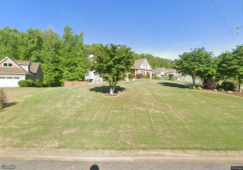
218 Erin Ln Ball Ground, GA 30107
Estimated Value: $537,934 - $547,000
4
Beds
3
Baths
2,698
Sq Ft
$201/Sq Ft
Est. Value
About This Home
This home is located at 218 Erin Ln, Ball Ground, GA 30107 and is currently estimated at $542,467, approximately $201 per square foot. 218 Erin Ln is a home located in Cherokee County with nearby schools including Ball Ground Elementary School, Creekland Middle School, and Creekview High School.
Ownership History
Date
Name
Owned For
Owner Type
Purchase Details
Closed on
May 1, 2014
Sold by
Harwell Owens Builders Inc
Bought by
Hamilton Mitchell and Hamilton Rebecca
Current Estimated Value
Home Financials for this Owner
Home Financials are based on the most recent Mortgage that was taken out on this home.
Original Mortgage
$252,035
Outstanding Balance
$192,867
Interest Rate
4.44%
Mortgage Type
New Conventional
Estimated Equity
$349,600
Purchase Details
Closed on
Oct 3, 2013
Sold by
T H O Associates
Bought by
Harwell Owens Builders Inc
Home Financials for this Owner
Home Financials are based on the most recent Mortgage that was taken out on this home.
Original Mortgage
$188,000
Interest Rate
4.58%
Mortgage Type
New Conventional
Create a Home Valuation Report for This Property
The Home Valuation Report is an in-depth analysis detailing your home's value as well as a comparison with similar homes in the area
Home Values in the Area
Average Home Value in this Area
Purchase History
| Date | Buyer | Sale Price | Title Company |
|---|---|---|---|
| Hamilton Mitchell | $265,300 | -- | |
| Harwell Owens Builders Inc | $30,000 | -- |
Source: Public Records
Mortgage History
| Date | Status | Borrower | Loan Amount |
|---|---|---|---|
| Open | Hamilton Mitchell | $252,035 | |
| Previous Owner | Harwell Owens Builders Inc | $188,000 |
Source: Public Records
Tax History Compared to Growth
Tax History
| Year | Tax Paid | Tax Assessment Tax Assessment Total Assessment is a certain percentage of the fair market value that is determined by local assessors to be the total taxable value of land and additions on the property. | Land | Improvement |
|---|---|---|---|---|
| 2024 | $5,540 | $203,880 | $37,200 | $166,680 |
| 2023 | $4,643 | $186,240 | $32,400 | $153,840 |
| 2022 | $4,834 | $173,680 | $32,400 | $141,280 |
| 2021 | $4,102 | $130,600 | $22,400 | $108,200 |
| 2020 | $4,281 | $135,120 | $22,400 | $112,720 |
| 2019 | $4,066 | $128,840 | $20,400 | $108,440 |
| 2018 | $3,785 | $116,960 | $20,400 | $96,560 |
| 2017 | $3,669 | $282,700 | $16,000 | $97,080 |
| 2016 | $3,503 | $263,600 | $20,000 | $85,440 |
| 2015 | $3,465 | $255,700 | $16,000 | $86,280 |
| 2014 | $1,562 | $112,100 | $6,080 | $38,760 |
Source: Public Records
Map
Nearby Homes
- 210 S Mountain Brook Way
- 417 Tom Avery Dr
- 421 Tom Avery Dr
- 450 Tom Avery Dr
- 608 Madison Ct
- 463 Tom Avery Dr
- 338 Reese Way
- 323 Reese Way
- The Dillard Plan at Malone’s Pond
- The Evans Plan at Malone’s Pond
- The Vinings Plan at Malone’s Pond
- The Brooks Plan at Malone’s Pond
- The Bainbridge Plan at Malone’s Pond
- The Ashburn Plan at Malone’s Pond
- The Trenton Plan at Malone’s Pond
- The Desoto Plan at Malone’s Pond
- 127 Mills Ln
- 277 Reese Way
- 326 Reese Way
- 553 Groover St
- 407 Tom Avery Dr
- 220 Erin Ln
- 403 Tom Avery Dr
- 219 Erin Ln
- 222 Erin Ln
- 409 Tom Avery Dr
- 223 Erin Ln
- 215 Erin Ln
- 402 Tom Avery Dr
- 411 Tom Avery Dr
- 948 Old Dawsonville Rd
- 221 Erin Ln
- 213 Erin Ln
- 406 Tom Avery Dr
- 413 Tom Avery Dr
- 0 Erin Ln Unit 7441579
- 0 Erin Ln Unit 7359034
- 0 Erin Ln Unit 7352227
- 0 Erin Ln Unit 7206119
- 0 Erin Ln Unit 7051791