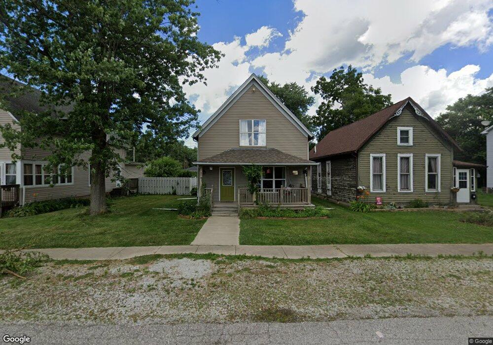
218 Grant Ave Chesterton, IN 46304
Estimated Value: $222,697 - $290,000
3
Beds
3
Baths
1,380
Sq Ft
$181/Sq Ft
Est. Value
About This Home
This home is located at 218 Grant Ave, Chesterton, IN 46304 and is currently estimated at $250,174, approximately $181 per square foot. 218 Grant Ave is a home located in Porter County with nearby schools including Westchester Intermediate School, Brummitt Elementary School, and Chesterton Middle School.
Ownership History
Date
Name
Owned For
Owner Type
Purchase Details
Closed on
Jan 27, 2015
Sold by
R & A Asset Holding Llc
Bought by
Riley Richard and Riley Annamarie
Current Estimated Value
Purchase Details
Closed on
Jan 23, 2013
Sold by
Calengas Peter L
Bought by
R&A Asset Holdings Llc
Purchase Details
Closed on
Dec 22, 2009
Sold by
Calengas Leonard
Bought by
Calengas Peter L
Create a Home Valuation Report for This Property
The Home Valuation Report is an in-depth analysis detailing your home's value as well as a comparison with similar homes in the area
Home Values in the Area
Average Home Value in this Area
Purchase History
| Date | Buyer | Sale Price | Title Company |
|---|---|---|---|
| Riley Richard | -- | None Available | |
| R&A Asset Holdings Llc | -- | Community Title Company | |
| Calengas Peter L | -- | None Available |
Source: Public Records
Tax History Compared to Growth
Tax History
| Year | Tax Paid | Tax Assessment Tax Assessment Total Assessment is a certain percentage of the fair market value that is determined by local assessors to be the total taxable value of land and additions on the property. | Land | Improvement |
|---|---|---|---|---|
| 2024 | $3,454 | $166,600 | $17,700 | $148,900 |
| 2023 | $3,184 | $153,900 | $15,800 | $138,100 |
| 2022 | $3,144 | $141,600 | $15,800 | $125,800 |
| 2021 | $2,926 | $141,900 | $15,800 | $126,100 |
| 2020 | $3,175 | $137,600 | $15,100 | $122,500 |
| 2019 | $2,100 | $92,800 | $15,100 | $77,700 |
| 2018 | $2,007 | $88,600 | $15,100 | $73,500 |
| 2017 | $1,159 | $49,400 | $15,100 | $34,300 |
| 2016 | $1,179 | $51,300 | $16,100 | $35,200 |
| 2014 | $1,106 | $48,000 | $15,100 | $32,900 |
| 2013 | -- | $45,900 | $15,300 | $30,600 |
Source: Public Records
Map
Nearby Homes
- 506 W Morgan Ave
- 108 Indian Boundary Rd
- 422 Jefferson Ave
- 522 S Calumet Rd
- 225 Jefferson Ave
- 319 Michigami Trail
- 525 S Calumet Rd
- 669 S 2nd St
- 647 N Calumet Rd
- 511 E Morgan Ave
- 2535 State St
- 701 S Park Dr
- 604 Oakwood Dr
- 0 Haglund Rd Unit NRA821369
- 135 Michael Dr
- 134 Michael Dr
- 133 Michael Dr
- 401 S 15th St
- 315 Franklin St
- 140 N Jackson Blvd