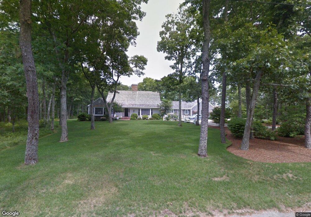
218 Ice Valley Rd Osterville, MA 02655
Osterville NeighborhoodEstimated Value: $3,686,260 - $4,703,000
4
Beds
4
Baths
3,488
Sq Ft
$1,228/Sq Ft
Est. Value
About This Home
This home is located at 218 Ice Valley Rd, Osterville, MA 02655 and is currently estimated at $4,282,065, approximately $1,227 per square foot. 218 Ice Valley Rd is a home located in Barnstable County with nearby schools including West Villages Elementary School, Barnstable United Elementary School, and Barnstable Intermediate School.
Ownership History
Date
Name
Owned For
Owner Type
Purchase Details
Closed on
Oct 15, 2019
Sold by
65 Scudder Lane Llc
Bought by
Ice Valley Road T
Current Estimated Value
Purchase Details
Closed on
Jun 10, 2011
Sold by
Pernix Equity Investme
Bought by
65 Scudder Lane Llc
Purchase Details
Closed on
Oct 4, 2005
Sold by
Jones Strong Jonathan and Jones Hobart Joy
Bought by
Pernix Equity Inv Inc
Create a Home Valuation Report for This Property
The Home Valuation Report is an in-depth analysis detailing your home's value as well as a comparison with similar homes in the area
Home Values in the Area
Average Home Value in this Area
Purchase History
| Date | Buyer | Sale Price | Title Company |
|---|---|---|---|
| Ice Valley Road T | $2,300,000 | -- | |
| 65 Scudder Lane Llc | $1,500,000 | -- | |
| Pernix Equity Inv Inc | $1,269,000 | -- |
Source: Public Records
Tax History Compared to Growth
Tax History
| Year | Tax Paid | Tax Assessment Tax Assessment Total Assessment is a certain percentage of the fair market value that is determined by local assessors to be the total taxable value of land and additions on the property. | Land | Improvement |
|---|---|---|---|---|
| 2025 | $26,563 | $3,283,400 | $1,263,600 | $2,019,800 |
| 2024 | $24,490 | $3,135,700 | $1,263,600 | $1,872,100 |
| 2023 | $23,576 | $2,826,800 | $1,161,000 | $1,665,800 |
| 2022 | $22,991 | $2,385,000 | $978,900 | $1,406,100 |
| 2021 | $22,713 | $2,165,200 | $1,048,800 | $1,116,400 |
| 2020 | $20,657 | $1,884,800 | $1,007,700 | $877,100 |
| 2019 | $67,725 | $1,717,400 | $974,100 | $743,300 |
| 2018 | $17,127 | $1,526,500 | $891,100 | $635,400 |
| 2017 | $16,072 | $1,493,700 | $891,100 | $602,600 |
| 2016 | $16,281 | $1,493,700 | $891,100 | $602,600 |
| 2015 | $15,433 | $1,422,400 | $871,200 | $551,200 |
Source: Public Records
Map
Nearby Homes
- 38 Beach Plum Hill Rd
- 60 Smoke Valley Rd
- 476 Baxters Neck Rd
- 476 Baxter Neck Rd
- 359 Baxter Neck Rd
- 431 Baxters Neck Rd
- 98 Bunker Hill Rd
- 24 Indigo Ln
- 139 Prince Ave
- 268 Bumps River Rd
- 40 Waterfield Rd
- 369 Bumps River Rd
- 24 Bay Rd
- 3040 Falmouth Rd Unit H
- 3040 Falmouth Rd Unit H
- 71 Sand Point
- 81 Falling Leaf Ln
- 64 Bay St
- 920 Main St Unit 1 Building 2
- 920 Main St Unit 2-1
- 280 Ice Valley Rd
- 182 Ice Valley Rd
- 231 Ice Valley Rd
- 185 Ice Valley Rd
- 175 Smoke Valley Rd
- 152 Ice Valley Rd
- 275 Ice Valley Rd
- 155 Ice Valley Rd
- 39 Fox Island Rd
- 201 Smoke Valley Rd
- 235 Smoke Valley Rd
- 50 Fox Island Rd
- 155 Smoke Valley Rd
- 140 Ice Valley Rd
- 135 Ice Valley Rd
- 39 Fox Island Rd
- 170 Smoke Valley Rd
- 270 Smoke Valley Rd
- 125 Smoke Valley Rd
- 84 Farm Valley Rd