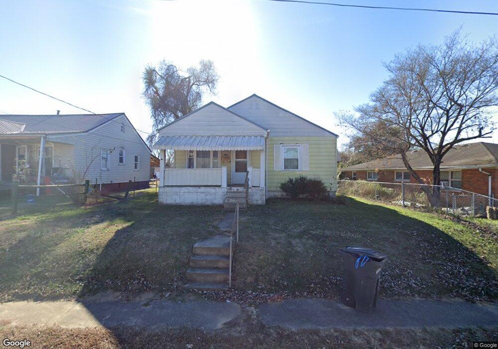
218 Memorial St Coal Grove, OH 45638
Estimated Value: $81,000 - $104,000
2
Beds
2
Baths
896
Sq Ft
$99/Sq Ft
Est. Value
About This Home
This home is located at 218 Memorial St, Coal Grove, OH 45638 and is currently estimated at $88,872, approximately $99 per square foot. 218 Memorial St is a home located in Lawrence County with nearby schools including Dawson-Bryant Elementary School, Dawson-Bryant Middle School, and Dawson-Bryant High School.
Ownership History
Date
Name
Owned For
Owner Type
Purchase Details
Closed on
Oct 14, 1997
Sold by
Boggs Ralph L
Bought by
Reynolds Christy Dawn
Current Estimated Value
Purchase Details
Closed on
Oct 15, 1986
Sold by
Conley Edna A
Bought by
Boggs Ralph L
Create a Home Valuation Report for This Property
The Home Valuation Report is an in-depth analysis detailing your home's value as well as a comparison with similar homes in the area
Home Values in the Area
Average Home Value in this Area
Purchase History
| Date | Buyer | Sale Price | Title Company |
|---|---|---|---|
| Reynolds Christy Dawn | $28,000 | -- | |
| Boggs Ralph L | $28,000 | -- |
Source: Public Records
Tax History Compared to Growth
Tax History
| Year | Tax Paid | Tax Assessment Tax Assessment Total Assessment is a certain percentage of the fair market value that is determined by local assessors to be the total taxable value of land and additions on the property. | Land | Improvement |
|---|---|---|---|---|
| 2024 | -- | $20,230 | $3,620 | $16,610 |
| 2023 | $423 | $20,230 | $3,620 | $16,610 |
| 2022 | $443 | $20,230 | $3,620 | $16,610 |
| 2021 | $289 | $18,470 | $3,360 | $15,110 |
| 2020 | $390 | $18,470 | $3,360 | $15,110 |
| 2019 | $389 | $18,470 | $3,360 | $15,110 |
| 2018 | $392 | $18,470 | $3,360 | $15,110 |
| 2017 | $392 | $18,470 | $3,360 | $15,110 |
| 2016 | $367 | $18,470 | $3,360 | $15,110 |
| 2015 | $305 | $15,680 | $3,360 | $12,320 |
| 2014 | $288 | $15,680 | $3,360 | $12,320 |
| 2013 | $288 | $15,680 | $3,360 | $12,320 |
Source: Public Records
Map
Nearby Homes
- 805 1/2 High St
- 514 Lane St
- 303 Pike St
- 125 Center St
- 519 Lane St
- 309 High St
- 309 High St Unit LAO-5
- 119 Remy St
- 103 Carrico Dr
- 1003 Marion Pike
- 0 Central & Mlk
- 1100 Price St
- 1409 Hoods Creek Pike
- 0 Kentucky 5
- 508 16th St
- 156 Township Road 181
- 321 Wyanoke St
- 2721 S 8th St
- 2088 State Route 243
- 1824 Carter Ave
- 220 Memorial St
- 216 Memorial St
- 212 Memorial St
- 215 Memorial St
- 221 Memorial St
- 217 Saint Charles St
- 226 Memorial St
- 223 Memorial St
- 221 Saint Charles St
- 227 Memorial St
- 218 Saint Charles St
- 228 Memorial St
- 229 Memorial St
- 231 Memorial St
- 229 Saint Charles St
- 222 Saint Charles St
- 0 Memorial St Unit Old Monitor School
- 224 Saint Charles St
- 226 Saint Charles St
- 233 Memorial St