Estimated Value: $72,240 - $108,000
3
Beds
1
Bath
1,696
Sq Ft
$53/Sq Ft
Est. Value
About This Home
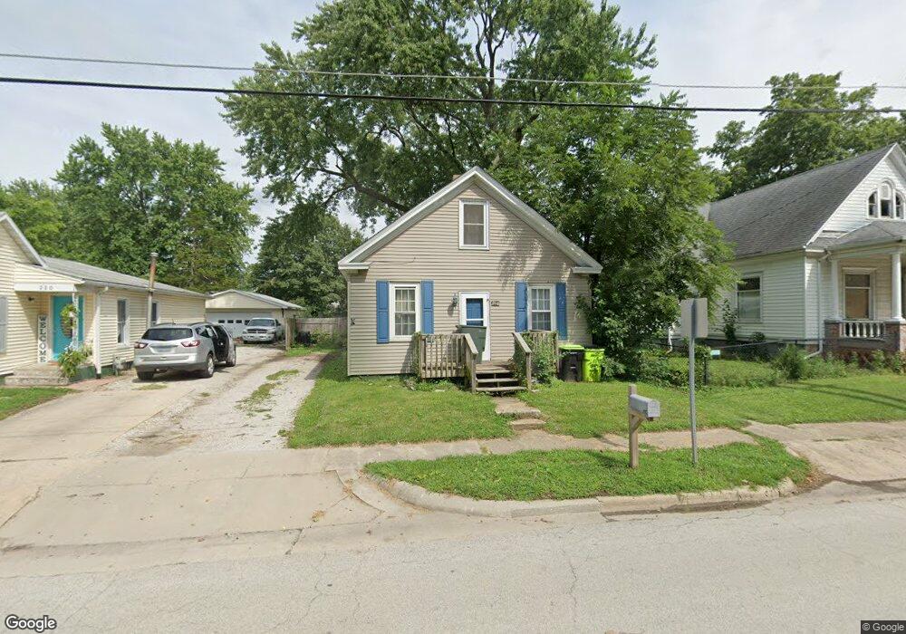
This home is located at 218 N Wood St, Maroa, IL 61756 and is currently estimated at $89,560, approximately $52 per square foot. 218 N Wood St is a home located in Macon County with nearby schools including Maroa-Forsyth Grade School, Maroa-Forsyth Middle School, and Maroa-Forsyth Senior High School.
Ownership History
Date
Name
Owned For
Owner Type
Purchase Details
Closed on
Sep 7, 2007
Sold by
Lloyd Jeff
Bought by
Wright Tron A
Current Estimated Value
Home Financials for this Owner
Home Financials are based on the most recent Mortgage that was taken out on this home.
Original Mortgage
$45,000
Outstanding Balance
$28,695
Interest Rate
6.71%
Mortgage Type
New Conventional
Estimated Equity
$60,865
Purchase Details
Closed on
Dec 1, 2002
Create a Home Valuation Report for This Property
The Home Valuation Report is an in-depth analysis detailing your home's value as well as a comparison with similar homes in the area
Home Values in the Area
Average Home Value in this Area
Purchase History
| Date | Buyer | Sale Price | Title Company |
|---|---|---|---|
| Wright Tron A | $45,000 | None Available | |
| -- | $44,000 | -- |
Source: Public Records
Mortgage History
| Date | Status | Borrower | Loan Amount |
|---|---|---|---|
| Open | Wright Tron A | $45,000 |
Source: Public Records
Tax History Compared to Growth
Tax History
| Year | Tax Paid | Tax Assessment Tax Assessment Total Assessment is a certain percentage of the fair market value that is determined by local assessors to be the total taxable value of land and additions on the property. | Land | Improvement |
|---|---|---|---|---|
| 2024 | $1,965 | $21,518 | $2,263 | $19,255 |
| 2023 | $1,854 | $19,995 | $2,103 | $17,892 |
| 2022 | $1,757 | $18,862 | $1,984 | $16,878 |
| 2021 | $1,702 | $17,917 | $1,885 | $16,032 |
| 2020 | $1,560 | $16,885 | $1,777 | $15,108 |
| 2019 | $1,560 | $16,885 | $1,777 | $15,108 |
| 2018 | $1,492 | $16,485 | $1,735 | $14,750 |
| 2017 | $1,560 | $16,554 | $1,742 | $14,812 |
| 2016 | $1,557 | $16,534 | $1,740 | $14,794 |
| 2015 | $1,472 | $16,052 | $1,689 | $14,363 |
| 2014 | $1,425 | $15,893 | $1,672 | $14,221 |
| 2013 | $1,439 | $15,893 | $1,672 | $14,221 |
Source: Public Records
Map
Nearby Homes
- 212 W Main St
- 303 W Main St
- 309 N Linden St
- 14479 N Oakland Ave
- 3371 Hilltop Ct
- 6690 Little Galilee Rd
- 9150 N Route 51
- 6119 Little Galilee Rd
- 8349 Sawyer Rd
- 5434 Brittany Ln
- 7689 U S 51
- 0 Betty Ln Unit 10514801
- 164 Shadow Ridge Blvd
- 16 Holly Dr
- 157 Shadow Ridge Blvd
- 120 Shadow Ridge Blvd
- 6080 Stagecoach Rd
- 31 Colonial Dr
- 4789 Leghorn Rd
- 68 Somerset Dr