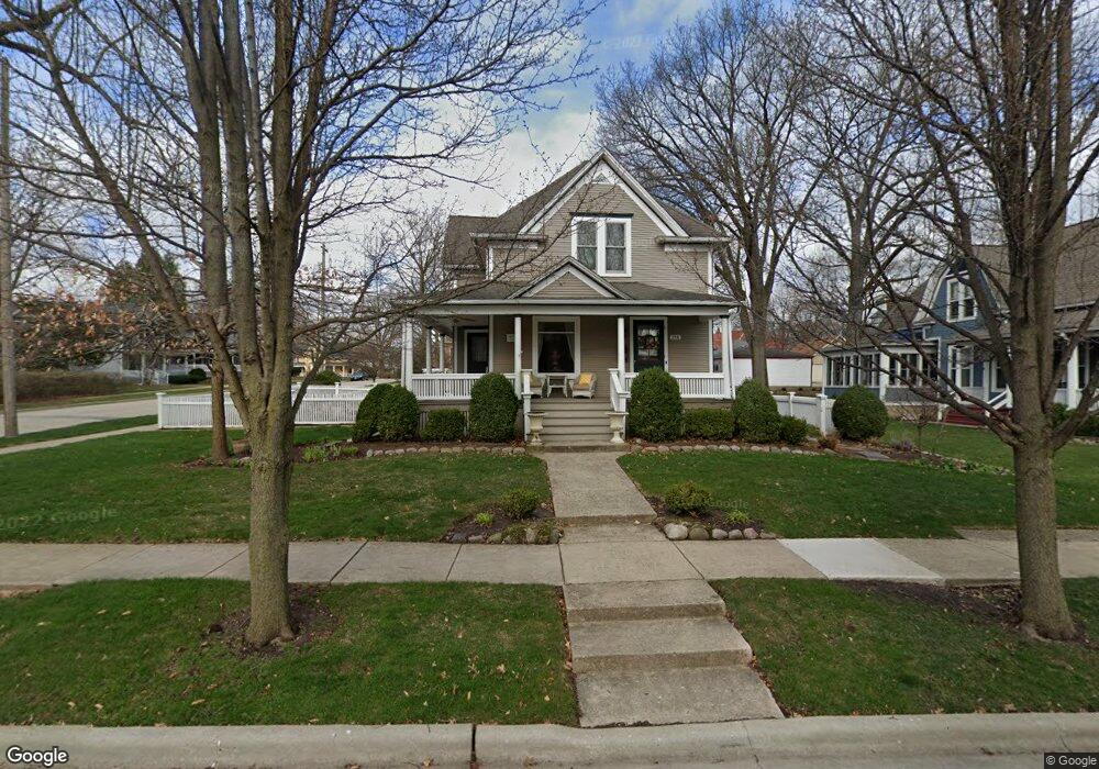
218 S 2nd St West Dundee, IL 60118
Estimated Value: $421,771 - $490,000
4
Beds
2
Baths
2,366
Sq Ft
$190/Sq Ft
Est. Value
About This Home
This home is located at 218 S 2nd St, West Dundee, IL 60118 and is currently estimated at $448,943, approximately $189 per square foot. 218 S 2nd St is a home located in Kane County with nearby schools including Dundee Highlands Elementary School, Dundee Middle School, and Dundee-Crown High School.
Ownership History
Date
Name
Owned For
Owner Type
Purchase Details
Closed on
Jul 31, 2017
Sold by
Pietraszewski Carl
Bought by
Youngquist Keith E and Youngquist Laury E
Current Estimated Value
Purchase Details
Closed on
Jan 31, 2006
Sold by
Peterson Donald Victor
Bought by
Pietraszewski Carl and Pietraszewski Rebecca L
Home Financials for this Owner
Home Financials are based on the most recent Mortgage that was taken out on this home.
Original Mortgage
$281,900
Interest Rate
5.87%
Mortgage Type
Purchase Money Mortgage
Create a Home Valuation Report for This Property
The Home Valuation Report is an in-depth analysis detailing your home's value as well as a comparison with similar homes in the area
Home Values in the Area
Average Home Value in this Area
Purchase History
| Date | Buyer | Sale Price | Title Company |
|---|---|---|---|
| Youngquist Keith E | $346,000 | Heritage Title Co | |
| Pietraszewski Carl | $352,500 | Law Title Insurance |
Source: Public Records
Mortgage History
| Date | Status | Borrower | Loan Amount |
|---|---|---|---|
| Previous Owner | Pietraszewski Carl | $281,900 |
Source: Public Records
Tax History Compared to Growth
Tax History
| Year | Tax Paid | Tax Assessment Tax Assessment Total Assessment is a certain percentage of the fair market value that is determined by local assessors to be the total taxable value of land and additions on the property. | Land | Improvement |
|---|---|---|---|---|
| 2024 | $9,228 | $129,215 | $19,631 | $109,584 |
| 2023 | $8,580 | $116,263 | $17,663 | $98,600 |
| 2022 | $8,126 | $103,235 | $17,663 | $85,572 |
| 2021 | $7,814 | $97,474 | $16,677 | $80,797 |
| 2020 | $7,658 | $95,282 | $16,302 | $78,980 |
| 2019 | $7,386 | $90,452 | $15,476 | $74,976 |
| 2018 | $7,007 | $79,466 | $15,170 | $64,296 |
| 2017 | $6,132 | $68,859 | $14,191 | $54,668 |
| 2016 | $6,246 | $66,672 | $13,740 | $52,932 |
| 2015 | -- | $56,597 | $19,493 | $37,104 |
| 2014 | -- | $55,034 | $18,955 | $36,079 |
| 2013 | -- | $56,718 | $19,535 | $37,183 |
Source: Public Records
Map
Nearby Homes
- 112 Liberty St
- 93 Liberty St
- 505 S 3rd St
- 512 Lisa Rd
- 516 S 1st St
- Lot 1 View St
- 560 S 5th St
- 7 King William St
- 436 Barrington Ave
- 0000 Strom Dr
- 4 Summit St
- 432 Illinois St
- 510 N Van Buren St
- 519 Oak Dr
- 152 King Ave
- 849 Hemlock Dr
- 709 Timothy Ct Unit 171
- 1042 Chateau Bluff Ln
- 1 S Lincoln Ave
- 152 Aberdeen Dr