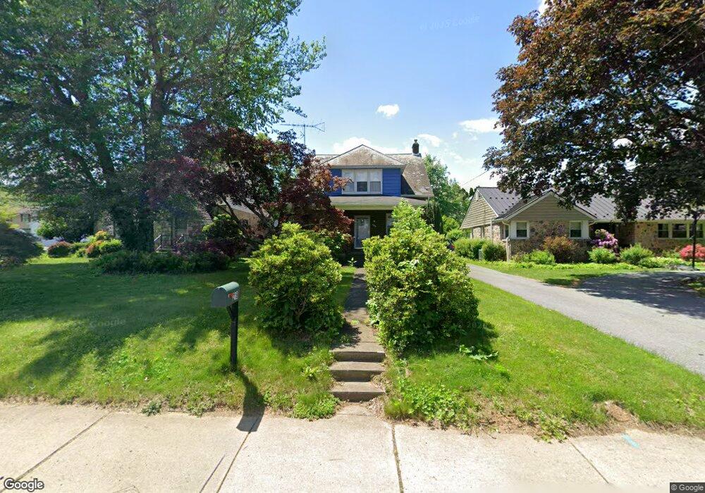
218 S Church St Macungie, PA 18062
Estimated Value: $306,970 - $355,000
3
Beds
1
Bath
1,395
Sq Ft
$241/Sq Ft
Est. Value
About This Home
This home is located at 218 S Church St, Macungie, PA 18062 and is currently estimated at $335,743, approximately $240 per square foot. 218 S Church St is a home located in Lehigh County with nearby schools including Macungie Elementary School, Eyer Middle School, and Emmaus High School.
Ownership History
Date
Name
Owned For
Owner Type
Purchase Details
Closed on
Dec 14, 2007
Sold by
Lermitte Christopher P
Bought by
Krulle Patricia
Current Estimated Value
Home Financials for this Owner
Home Financials are based on the most recent Mortgage that was taken out on this home.
Original Mortgage
$150,000
Outstanding Balance
$94,944
Interest Rate
6.3%
Mortgage Type
New Conventional
Estimated Equity
$240,799
Purchase Details
Closed on
Oct 15, 2002
Sold by
Knauss Lewis D
Bought by
Lermitte Christopher P and Lermitte Debra A
Purchase Details
Closed on
Jul 9, 1940
Bought by
Knauss Donald and Knauss Miriam
Create a Home Valuation Report for This Property
The Home Valuation Report is an in-depth analysis detailing your home's value as well as a comparison with similar homes in the area
Home Values in the Area
Average Home Value in this Area
Purchase History
| Date | Buyer | Sale Price | Title Company |
|---|---|---|---|
| Krulle Patricia | $227,500 | -- | |
| Lermitte Christopher P | $147,500 | -- | |
| Knauss Donald | $500 | -- |
Source: Public Records
Mortgage History
| Date | Status | Borrower | Loan Amount |
|---|---|---|---|
| Open | Krulle Patricia | $150,000 |
Source: Public Records
Tax History Compared to Growth
Tax History
| Year | Tax Paid | Tax Assessment Tax Assessment Total Assessment is a certain percentage of the fair market value that is determined by local assessors to be the total taxable value of land and additions on the property. | Land | Improvement |
|---|---|---|---|---|
| 2025 | $4,564 | $157,200 | $26,300 | $130,900 |
| 2024 | $4,433 | $157,200 | $26,300 | $130,900 |
| 2023 | $4,355 | $157,200 | $26,300 | $130,900 |
| 2022 | $4,265 | $157,200 | $130,900 | $26,300 |
| 2021 | $4,186 | $157,200 | $26,300 | $130,900 |
| 2020 | $4,152 | $157,200 | $26,300 | $130,900 |
| 2019 | $4,130 | $157,200 | $26,300 | $130,900 |
| 2018 | $4,044 | $157,200 | $26,300 | $130,900 |
| 2017 | $3,904 | $157,200 | $26,300 | $130,900 |
| 2016 | -- | $157,200 | $26,300 | $130,900 |
| 2015 | -- | $157,200 | $26,300 | $130,900 |
| 2014 | -- | $157,200 | $26,300 | $130,900 |
Source: Public Records
Map
Nearby Homes
- 211 S Church St
- Lot 1 Mountain Rd
- 167 Aspen Ln
- 6405 Robin Rd
- 0 Mountain Lot 1
- 725 E Main St
- 6709 Mountain Rd
- 830 E Main St
- 6903 Lincoln Dr
- 3814 Clay Dr
- 0 Clauss Hunt Knight Dr Unit 10 Units 763578
- 204 Ridings Cir Unit F204
- 2845 Donegal Dr
- 2840 Donegal Dr
- 353 Abby Rd Unit Lot 40
- 353 Abby Rd
- 4759 Sheep Rock Rd
- 6635 Blue Heather Ct
- 308 Abby Rd
- 308 Abby Rd Unit Lot 5
- 214 S Church St Unit 216
- 220 S Church St
- 212 S Church St
- 225 S Church St
- 231 S Church St
- 206 S Church St
- 6245 Mountain Rd
- 217 S Church St
- 209 S Church St
- 205 S Church St
- 6261 Mountain Rd
- 165 S Church St Unit 167
- 15 W Chestnut St
- 13 W Chestnut St
- 17 W Chestnut St
- 21 W Chestnut St
- 11 W Chestnut St
- 19 W Chestnut St
- 25 W Chestnut St
- 29 W Chestnut St