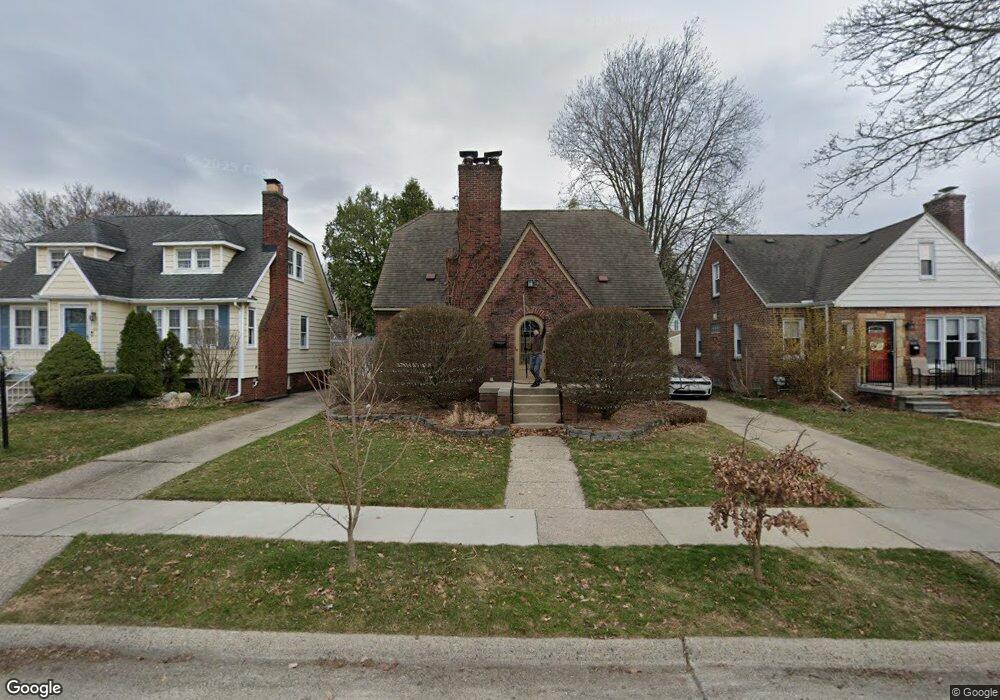
218 S Kenwood Ave Royal Oak, MI 48067
Estimated Value: $345,655 - $388,000
3
Beds
2
Baths
1,380
Sq Ft
$269/Sq Ft
Est. Value
About This Home
This home is located at 218 S Kenwood Ave, Royal Oak, MI 48067 and is currently estimated at $371,414, approximately $269 per square foot. 218 S Kenwood Ave is a home located in Oakland County with nearby schools including Oakland Elementary School, Royal Oak Middle School, and Royal Oak High School.
Ownership History
Date
Name
Owned For
Owner Type
Purchase Details
Closed on
Jun 2, 2004
Sold by
Lane Frank R
Bought by
Nielander Brian H and Nielander Amy C
Current Estimated Value
Purchase Details
Closed on
Dec 7, 1998
Sold by
Feldman Jerome B
Bought by
Lane Frank R
Home Financials for this Owner
Home Financials are based on the most recent Mortgage that was taken out on this home.
Original Mortgage
$133,600
Interest Rate
6.76%
Create a Home Valuation Report for This Property
The Home Valuation Report is an in-depth analysis detailing your home's value as well as a comparison with similar homes in the area
Home Values in the Area
Average Home Value in this Area
Purchase History
| Date | Buyer | Sale Price | Title Company |
|---|---|---|---|
| Nielander Brian H | $231,100 | First American Title | |
| Lane Frank R | $167,000 | -- |
Source: Public Records
Mortgage History
| Date | Status | Borrower | Loan Amount |
|---|---|---|---|
| Previous Owner | Lane Frank R | $133,600 |
Source: Public Records
Tax History Compared to Growth
Tax History
| Year | Tax Paid | Tax Assessment Tax Assessment Total Assessment is a certain percentage of the fair market value that is determined by local assessors to be the total taxable value of land and additions on the property. | Land | Improvement |
|---|---|---|---|---|
| 2024 | $3,268 | $139,760 | $0 | $0 |
| 2022 | $3,862 | $125,180 | $0 | $0 |
| 2020 | $3,176 | $110,530 | $0 | $0 |
| 2018 | $3,862 | $109,050 | $0 | $0 |
| 2017 | $3,548 | $109,050 | $0 | $0 |
| 2015 | -- | $93,680 | $0 | $0 |
| 2014 | -- | $81,590 | $0 | $0 |
| 2011 | -- | $78,410 | $0 | $0 |
Source: Public Records
Map
Nearby Homes
- 131 S Dorchester Ave
- 116 S Kenwood Ave
- 122 S Edgeworth Ave
- 202 S Campbell Rd
- 515 S Kenwood Ave
- 117 N Wilson Ave
- 209 Helene Ave
- 305 N Kenwood Ave
- 2214 Baxter Ave
- 303 N Dorchester Ave
- 632 S Edison Ave
- 709 S Edison Ave
- 302 S Vermont Ave
- 940 Mace Ave
- 932 Mace Ave
- 415 N Stephenson Hwy
- 400 N Wilson Ave
- 603 S Vermont Ave
- 1721 E Lincoln Ave
- 636 S Connecticut Ave
- 212 S Kenwood Ave
- 228 S Kenwood Ave
- 217 S Dorchester Ave
- 204 S Kenwood Ave
- 219 S Dorchester Ave
- 215 S Dorchester Ave
- 223 S Dorchester Ave
- 225 S Dorchester Ave
- 202 S Dorchester Ave
- 209 S Dorchester Ave
- 227 S Dorchester Ave
- 210 S Dorchester Ave
- 214 S Dorchester Ave
- 205 S Dorchester Ave
- 215 S Kenwood Ave
- 225 S Kenwood Ave
- 301 S Dorchester Ave
- 304 S Kenwood Ave
- 220 S Dorchester Ave
- 128 S Kenwood Ave