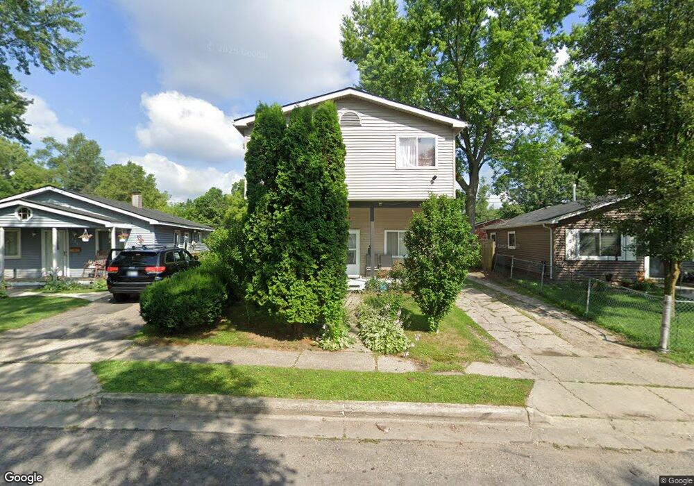
218 S Merrimac St Pontiac, MI 48340
Estimated Value: $211,687 - $258,000
5
Beds
2
Baths
2,359
Sq Ft
$102/Sq Ft
Est. Value
About This Home
This home is located at 218 S Merrimac St, Pontiac, MI 48340 and is currently estimated at $241,172, approximately $102 per square foot. 218 S Merrimac St is a home located in Oakland County with nearby schools including Alcott School, Pontiac Middle School, and Pontiac High School.
Ownership History
Date
Name
Owned For
Owner Type
Purchase Details
Closed on
Oct 25, 2010
Sold by
Stewart Brian
Bought by
Stewart Elida
Current Estimated Value
Purchase Details
Closed on
Nov 14, 2007
Sold by
Cazier Ron K and Cazier Linda M
Bought by
Stewart Elida and Stewart Brian
Purchase Details
Closed on
Jun 6, 2005
Sold by
Denise Michal and De Nise Alison
Bought by
Cazir Ron K and Mezsets Kristen J
Purchase Details
Closed on
Dec 20, 2004
Sold by
Denise Michael and Denise Alison
Bought by
Denise Michael and Denise Alison
Purchase Details
Closed on
May 18, 2001
Sold by
Berard Sarah E
Bought by
Denise Michael
Create a Home Valuation Report for This Property
The Home Valuation Report is an in-depth analysis detailing your home's value as well as a comparison with similar homes in the area
Home Values in the Area
Average Home Value in this Area
Purchase History
| Date | Buyer | Sale Price | Title Company |
|---|---|---|---|
| Stewart Elida | -- | None Available | |
| Stewart Elida | $130,000 | None Available | |
| Cazir Ron K | $58,000 | First Michigan Title Inc | |
| Denise Michael | -- | -- | |
| Denise Michael | -- | -- |
Source: Public Records
Tax History Compared to Growth
Tax History
| Year | Tax Paid | Tax Assessment Tax Assessment Total Assessment is a certain percentage of the fair market value that is determined by local assessors to be the total taxable value of land and additions on the property. | Land | Improvement |
|---|---|---|---|---|
| 2024 | $1,181 | $91,750 | $0 | $0 |
| 2023 | $1,126 | $81,160 | $0 | $0 |
| 2022 | $1,156 | $72,830 | $0 | $0 |
| 2021 | $1,123 | $63,580 | $0 | $0 |
| 2020 | $1,023 | $55,520 | $0 | $0 |
| 2019 | $1,095 | $47,640 | $0 | $0 |
| 2018 | $1,056 | $37,680 | $0 | $0 |
| 2017 | $1,001 | $35,970 | $0 | $0 |
| 2016 | $1,025 | $30,720 | $0 | $0 |
| 2015 | -- | $29,750 | $0 | $0 |
| 2014 | -- | $28,160 | $0 | $0 |
| 2011 | -- | $33,370 | $0 | $0 |
Source: Public Records
Map
Nearby Homes
- 201 Parkdale Ave
- 119 W Kennett Rd
- 109 W Kennett Rd
- 998 Dewey St
- 0000 Blaine Ave
- 32 N Merrimac St
- 686 Lounsbury Ave
- 1017 Cherrylawn Dr
- 255 W Rutgers Ave
- 33 W Beverly Ave
- 841 Orlando Ave
- 793 Orlando Ave
- 240 W Fairmount Ave
- 89 W Fairmount Ave
- 134 W Fairmount Ave
- 207 W Strathmore Ave
- 0 Cesar Chavez Ave Unit 20240016653
- 54 Hudson Ave
- 117 W Strathmore Ave
- 1123 Cherrylawn Dr
- 226 S Merrimac St
- 214 S Merrimac St
- 206 S Merrimac St
- 231 Parkdale Ave
- 223 Parkdale Ave
- 202 S Merrimac St
- 217 Parkdale Ave
- 198 S Merrimac St
- 209 Parkdale Ave
- 194 S Merrimac St
- 205 Parkdale Ave
- 833 Woodland Ave
- 190 S Merrimac St
- 841 Woodland Ave
- 228 Parkdale Ave
- 845 Woodland Ave
- 186 S Merrimac St
- 849 Woodland Ave
- 813 Woodland Ave
- 182 S Merrimac St