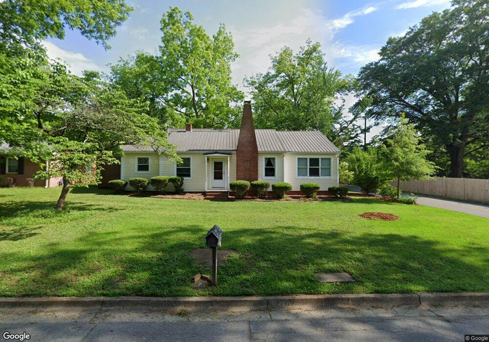
218 Sims St Carrollton, GA 30117
Estimated Value: $270,000 - $300,276
3
Beds
3
Baths
1,214
Sq Ft
$234/Sq Ft
Est. Value
About This Home
This home is located at 218 Sims St, Carrollton, GA 30117 and is currently estimated at $284,569, approximately $234 per square foot. 218 Sims St is a home located in Carroll County with nearby schools including Carrollton Elementary School, Carrollton Upper Elementary School, and Carrollton Middle School.
Ownership History
Date
Name
Owned For
Owner Type
Purchase Details
Closed on
Sep 8, 2016
Sold by
Bakos Daniel F
Bought by
Smith Donald W and Smith Deanna E
Current Estimated Value
Home Financials for this Owner
Home Financials are based on the most recent Mortgage that was taken out on this home.
Original Mortgage
$126,003
Outstanding Balance
$100,711
Interest Rate
3.45%
Mortgage Type
New Conventional
Estimated Equity
$183,858
Purchase Details
Closed on
Dec 18, 1998
Sold by
Mcdowell Dennis H
Bought by
Bakos Daniel F
Purchase Details
Closed on
Mar 20, 1998
Bought by
Mcdowell Dennis H
Create a Home Valuation Report for This Property
The Home Valuation Report is an in-depth analysis detailing your home's value as well as a comparison with similar homes in the area
Home Values in the Area
Average Home Value in this Area
Purchase History
| Date | Buyer | Sale Price | Title Company |
|---|---|---|---|
| Smith Donald W | $129,900 | -- | |
| Bakos Daniel F | $15,500 | -- | |
| Mcdowell Dennis H | -- | -- |
Source: Public Records
Mortgage History
| Date | Status | Borrower | Loan Amount |
|---|---|---|---|
| Open | Smith Donald W | $126,003 |
Source: Public Records
Tax History Compared to Growth
Tax History
| Year | Tax Paid | Tax Assessment Tax Assessment Total Assessment is a certain percentage of the fair market value that is determined by local assessors to be the total taxable value of land and additions on the property. | Land | Improvement |
|---|---|---|---|---|
| 2024 | $2,512 | $111,062 | $7,400 | $103,662 |
| 2023 | $2,512 | $101,644 | $7,400 | $94,244 |
| 2022 | $2,049 | $81,689 | $6,000 | $75,689 |
| 2021 | $1,817 | $70,875 | $6,000 | $64,875 |
| 2020 | $1,463 | $56,990 | $6,000 | $50,990 |
| 2019 | $1,378 | $53,266 | $6,000 | $47,266 |
| 2018 | $1,046 | $39,827 | $4,000 | $35,827 |
| 2017 | $1,049 | $39,827 | $4,000 | $35,827 |
| 2016 | $1,049 | $39,827 | $4,000 | $35,827 |
| 2015 | $971 | $34,724 | $4,000 | $30,725 |
| 2014 | $846 | $30,116 | $4,000 | $26,116 |
Source: Public Records
Map
Nearby Homes
- 201 Stewart St
- 119 Oxford Square
- 120 Stewart St
- 322 Cedar St
- 541 N White St Unit 12
- 541 N White St
- 122 Mandeville Ave
- 123 Autumn Glen Dr
- 777 College St
- 123 Cedar Park Way
- 114 Green Point Way
- 325 Almon Rd
- 103 W Chandler St
- 110 Town Walk Ln
- 0 Ward St Unit 10390499
- 111 Lakeview Dr
- 205 Johnson Ave Unit 231
- 114 Bennett Cir
- 108 Springwood Dr
- 405 N Park St
- 218 Sims St
- 214 Sims St
- 110 Peachtree St
- 302 Sims St
- 105 Peachtree St
- 219 Sims St
- 301 Sims St
- 112 Peachtree St
- 109 Peachtree St
- 205 Stewart St
- 305 Sims St
- 0 Peachtree St Unit 7149677
- 0 Peachtree St Unit 8580563
- 0 Peachtree St Unit 8325705
- 0 Peachtree St Unit 8156937
- 129 Stewart St
- 115 Peachtree St
- 314 Sims St
- 209 Stewart St
- 309 Sims St