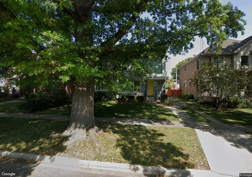
218 Stanley Ave Park Ridge, IL 60068
Estimated Value: $602,000 - $871,000
3
Beds
2
Baths
1,324
Sq Ft
$596/Sq Ft
Est. Value
About This Home
This home is located at 218 Stanley Ave, Park Ridge, IL 60068 and is currently estimated at $789,233, approximately $596 per square foot. 218 Stanley Ave is a home located in Cook County with nearby schools including Theodore Roosevelt Elementary School, Lincoln Middle School, and Maine South High School.
Ownership History
Date
Name
Owned For
Owner Type
Purchase Details
Closed on
Feb 21, 2012
Sold by
Declaration Iwata Tazuru
Bought by
Mccarty Justin A and Mccarty Sarah P
Current Estimated Value
Home Financials for this Owner
Home Financials are based on the most recent Mortgage that was taken out on this home.
Original Mortgage
$228,750
Outstanding Balance
$156,642
Interest Rate
3.88%
Mortgage Type
New Conventional
Estimated Equity
$632,591
Purchase Details
Closed on
Sep 21, 1998
Sold by
Iwata Roy T and Iwata Tazuru
Bought by
Iwata Tazutu and Tazura Iwata Trust
Create a Home Valuation Report for This Property
The Home Valuation Report is an in-depth analysis detailing your home's value as well as a comparison with similar homes in the area
Home Values in the Area
Average Home Value in this Area
Purchase History
| Date | Buyer | Sale Price | Title Company |
|---|---|---|---|
| Mccarty Justin A | $305,000 | First American Title | |
| Iwata Tazutu | -- | -- |
Source: Public Records
Mortgage History
| Date | Status | Borrower | Loan Amount |
|---|---|---|---|
| Open | Mccarty Justin A | $228,750 |
Source: Public Records
Tax History Compared to Growth
Tax History
| Year | Tax Paid | Tax Assessment Tax Assessment Total Assessment is a certain percentage of the fair market value that is determined by local assessors to be the total taxable value of land and additions on the property. | Land | Improvement |
|---|---|---|---|---|
| 2024 | $16,470 | $59,304 | $10,625 | $48,679 |
| 2023 | $15,755 | $64,000 | $10,625 | $53,375 |
| 2022 | $15,755 | $64,000 | $10,625 | $53,375 |
| 2021 | $7,659 | $28,514 | $6,562 | $21,952 |
| 2020 | $7,422 | $28,514 | $6,562 | $21,952 |
| 2019 | $10,775 | $44,772 | $6,562 | $38,210 |
| 2018 | $8,991 | $34,852 | $5,625 | $29,227 |
| 2017 | $8,969 | $34,852 | $5,625 | $29,227 |
| 2016 | $8,877 | $34,852 | $5,625 | $29,227 |
| 2015 | $9,557 | $30,985 | $4,687 | $26,298 |
| 2014 | $9,368 | $30,985 | $4,687 | $26,298 |
| 2013 | $8,874 | $30,985 | $4,687 | $26,298 |
Source: Public Records
Map
Nearby Homes
- 400 S Northwest Hwy Unit 312B
- 460 S Northwest Hwy Unit 307A
- 6858 N Northwest Hwy Unit 2E
- 6852 N Northwest Hwy Unit 2B
- 718 S Washington Ave
- 6841 N Northwest Hwy Unit 3C
- 249 S Vine Ave Unit B
- 6815 N Olmsted Ave Unit 203
- 6919 N Overhill Ave
- 301 S Prospect Ave
- 623 S Prospect Ave
- 6681 N Northwest Hwy
- 1021 Cleveland Ave
- 7101 N Ottawa Ave
- 320 Grant Place
- 316 S Fairview Ave
- 6625 N Northwest Hwy Unit 202
- 170 N Northwest Hwy Unit 407
- 170 N Northwest Hwy Unit 410
- 1220 Canfield Rd
- 222 Stanley Ave
- 214 Stanley Ave
- 228 Stanley Ave
- 212 Stanley Ave
- 221 Lake Ave
- 215 Lake Ave
- 225 Lake Ave
- 230 Stanley Ave
- 208 Stanley Ave
- 227 Lake Ave
- 219 Stanley Ave
- 215 Stanley Ave
- 221 Stanley Ave
- 234 Stanley Ave
- 233 Lake Ave
- 130 Stanley Ave
- 211 Stanley Ave
- 227 Stanley Ave
- 209 Stanley Ave
- 229 Stanley Ave