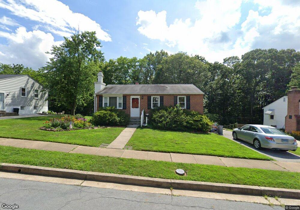
218 Stonewall Rd Catonsville, MD 21228
Estimated Value: $422,901 - $497,000
--
Bed
2
Baths
1,073
Sq Ft
$440/Sq Ft
Est. Value
About This Home
This home is located at 218 Stonewall Rd, Catonsville, MD 21228 and is currently estimated at $471,725, approximately $439 per square foot. 218 Stonewall Rd is a home located in Baltimore County with nearby schools including Westchester Elementary School, Catonsville Middle School, and Catonsville High School.
Ownership History
Date
Name
Owned For
Owner Type
Purchase Details
Closed on
Mar 8, 2025
Sold by
Pasquarella Elizabeth A
Bought by
Pasquarella Robert and Pasquarella Richard
Current Estimated Value
Purchase Details
Closed on
Sep 5, 2001
Sold by
Newell Josephine M
Bought by
Pasquarella Elizabeth A
Purchase Details
Closed on
Jan 23, 1997
Sold by
Newell Josephine M
Bought by
Newell Josephine M
Purchase Details
Closed on
Jun 27, 1996
Sold by
Newell Josephine M
Bought by
Newell Josephine M and Pasquarella Elizabeth A
Create a Home Valuation Report for This Property
The Home Valuation Report is an in-depth analysis detailing your home's value as well as a comparison with similar homes in the area
Home Values in the Area
Average Home Value in this Area
Purchase History
| Date | Buyer | Sale Price | Title Company |
|---|---|---|---|
| Pasquarella Robert | -- | None Listed On Document | |
| Pasquarella Robert | -- | None Listed On Document | |
| Pasquarella Elizabeth A | -- | -- | |
| Newell Josephine M | -- | -- | |
| Newell Josephine M | -- | -- |
Source: Public Records
Tax History Compared to Growth
Tax History
| Year | Tax Paid | Tax Assessment Tax Assessment Total Assessment is a certain percentage of the fair market value that is determined by local assessors to be the total taxable value of land and additions on the property. | Land | Improvement |
|---|---|---|---|---|
| 2025 | $4,169 | $325,500 | -- | -- |
| 2024 | $4,169 | $289,800 | $108,700 | $181,100 |
| 2023 | $1,908 | $278,400 | $0 | $0 |
| 2022 | $3,691 | $267,000 | $0 | $0 |
| 2021 | $3,609 | $255,600 | $108,700 | $146,900 |
| 2020 | $3,609 | $251,533 | $0 | $0 |
| 2019 | $3,522 | $247,467 | $0 | $0 |
| 2018 | $3,389 | $243,400 | $98,200 | $145,200 |
| 2017 | $3,153 | $230,800 | $0 | $0 |
| 2016 | $2,743 | $218,200 | $0 | $0 |
| 2015 | $2,743 | $205,600 | $0 | $0 |
| 2014 | $2,743 | $205,600 | $0 | $0 |
Source: Public Records
Map
Nearby Homes
- 311 Radstock Rd
- 302 Wessling Cir
- 2305 Rockwell Ave
- 2110 Edmondson Ave
- 231 Gralan Rd
- 2621 Westchester Ave
- 720 Mary Jo Way
- 19 Clay Lodge Ln Unit 104
- 11 Clay Lodge Ln Unit 204
- 627 Meyers Dr
- 627 Meyers Dr Unit PARCEL 108
- 3 Rumford Dr Unit 202
- 2308 Quilting Bee Rd
- 8369 Governor Grayson Way
- 8 Seminole Ave
- 1100 Lisadale Cir Unit 1A
- 9794 Blue Ivy Way
- 2100 Chantilla Rd
- 1300 Rice Ave
- 3598 Fels Ln
- 220 Stonewall Rd
- 216 Stonewall Rd
- 222 Stonewall Rd
- 214 Stonewall Rd
- 221 Stonewall Rd
- 219 Stonewall Rd
- 224 Stonewall Rd
- 212 Stonewall Rd
- 225 Stonewall Rd
- 217 Stonewall Rd
- 226 Stonewall Rd
- 211 Radstock Rd
- 210 Stonewall Rd
- 2302 Whitby Ct
- 216 Radstock Rd
- 227 Stonewall Rd
- 313 Oella Ave
- 315 Oella Ave
- 321 Oella Ave
- 228 Stonewall Rd