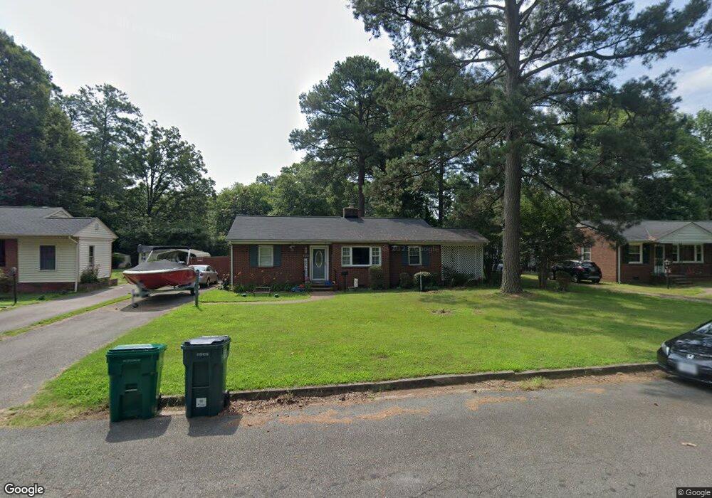
218 Stuttaford Dr Sandston, VA 23150
Estimated Value: $263,881 - $305,000
3
Beds
1
Bath
1,228
Sq Ft
$231/Sq Ft
Est. Value
About This Home
This home is located at 218 Stuttaford Dr, Sandston, VA 23150 and is currently estimated at $283,720, approximately $231 per square foot. 218 Stuttaford Dr is a home located in Henrico County with nearby schools including Sandston Elementary School, Elko Middle School, and Highland Springs High School.
Ownership History
Date
Name
Owned For
Owner Type
Purchase Details
Closed on
Mar 1, 2002
Sold by
Anderson Robert L
Bought by
Seay Tina M
Current Estimated Value
Home Financials for this Owner
Home Financials are based on the most recent Mortgage that was taken out on this home.
Original Mortgage
$95,993
Outstanding Balance
$39,506
Interest Rate
6.85%
Mortgage Type
FHA
Estimated Equity
$244,214
Purchase Details
Closed on
Dec 11, 2000
Sold by
Upshaw Emory M
Bought by
Anderson Robert L
Create a Home Valuation Report for This Property
The Home Valuation Report is an in-depth analysis detailing your home's value as well as a comparison with similar homes in the area
Home Values in the Area
Average Home Value in this Area
Purchase History
| Date | Buyer | Sale Price | Title Company |
|---|---|---|---|
| Seay Tina M | $97,500 | -- | |
| Anderson Robert L | $43,500 | -- |
Source: Public Records
Mortgage History
| Date | Status | Borrower | Loan Amount |
|---|---|---|---|
| Open | Anderson Robert L | $95,993 |
Source: Public Records
Tax History Compared to Growth
Tax History
| Year | Tax Paid | Tax Assessment Tax Assessment Total Assessment is a certain percentage of the fair market value that is determined by local assessors to be the total taxable value of land and additions on the property. | Land | Improvement |
|---|---|---|---|---|
| 2025 | $2,175 | $209,700 | $40,000 | $169,700 |
| 2024 | $2,057 | $193,800 | $38,100 | $155,700 |
| 2023 | $1,653 | $193,800 | $38,100 | $155,700 |
| 2022 | $1,410 | $165,300 | $36,300 | $129,000 |
| 2021 | $1,275 | $139,900 | $32,600 | $107,300 |
| 2020 | $1,221 | $139,900 | $32,600 | $107,300 |
| 2019 | $1,187 | $136,000 | $30,700 | $105,300 |
| 2018 | $1,115 | $127,700 | $30,700 | $97,000 |
| 2017 | $1,043 | $119,500 | $30,700 | $88,800 |
| 2016 | $989 | $113,300 | $30,700 | $82,600 |
| 2015 | $944 | $113,300 | $30,700 | $82,600 |
| 2014 | $944 | $108,100 | $30,700 | $77,400 |
Source: Public Records
Map
Nearby Homes
- 213 Meroyn Dr
- 104 W Union St
- 235 Banks St
- 3 E Sedgwick St
- 206 Naglee Ave
- 204 Cornett St
- 405 Roxana Rd
- 1517 Sir William Ct
- 1928 Repp Cir
- 121 E Magruder St
- 17 Rodes Ave
- 501 Sherilyn Dr
- 305 E Union St
- 216 Casey St
- 219 Defense Ave
- 13 N Rose Ave
- 203 Meadow Rd
- 108 Wootton Rd
- 304 E Jerald St
- 260 Sag Harbor Ct
- 220 Stuttaford Dr
- 216 Stuttaford Dr
- 222 Stuttaford Dr
- 215 Early Ave
- 214 Stuttaford Dr
- 213 Early Ave
- 301 Early Ave
- 219 Stuttaford Dr
- 217 Stuttaford Dr
- 221 Stuttaford Dr
- 224 Stuttaford Dr
- 212 Stuttaford Dr
- 215 Stuttaford Dr
- 211 Early Ave
- 303 Early Ave
- 223 Stuttaford Dr
- 213 Stuttaford Dr
- 306 W Mcclellan St
- 210 Stuttaford Dr
- 226 Stuttaford Dr