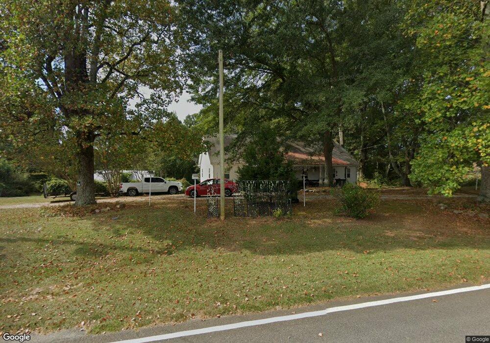
218 Tom Fletcher Rd Carrollton, GA 30117
Estimated Value: $289,718 - $368,000
3
Beds
2
Baths
2,010
Sq Ft
$164/Sq Ft
Est. Value
About This Home
This home is located at 218 Tom Fletcher Rd, Carrollton, GA 30117 and is currently estimated at $329,680, approximately $164 per square foot. 218 Tom Fletcher Rd is a home located in Carroll County with nearby schools including Bowdon Elementary School, Bowdon Middle School, and Bowdon High School.
Ownership History
Date
Name
Owned For
Owner Type
Purchase Details
Closed on
Aug 10, 2018
Sold by
Archer Judith Dale
Bought by
Chambers Judith and Mulkey Daniel
Current Estimated Value
Purchase Details
Closed on
Sep 25, 1997
Sold by
Miller Michael and Miller She
Bought by
Archer Judith Dale
Purchase Details
Closed on
Aug 8, 1996
Sold by
Miller Michael and Miller She
Bought by
Miller Michael and Miller She
Purchase Details
Closed on
Jul 12, 1994
Sold by
Yates Clara F
Bought by
Yates Billy Byron
Purchase Details
Closed on
Dec 31, 1992
Sold by
Yates Billy Byron
Bought by
Miller Michael and Miller She
Purchase Details
Closed on
Mar 25, 1977
Bought by
Yates Clara F
Create a Home Valuation Report for This Property
The Home Valuation Report is an in-depth analysis detailing your home's value as well as a comparison with similar homes in the area
Home Values in the Area
Average Home Value in this Area
Purchase History
| Date | Buyer | Sale Price | Title Company |
|---|---|---|---|
| Chambers Judith | -- | -- | |
| Archer Judith Dale | $55,900 | -- | |
| Miller Michael | $37,000 | -- | |
| Yates Billy Byron | -- | -- | |
| Miller Michael | $38,000 | -- | |
| Yates Clara F | -- | -- |
Source: Public Records
Tax History Compared to Growth
Tax History
| Year | Tax Paid | Tax Assessment Tax Assessment Total Assessment is a certain percentage of the fair market value that is determined by local assessors to be the total taxable value of land and additions on the property. | Land | Improvement |
|---|---|---|---|---|
| 2024 | $338 | $111,945 | $6,210 | $105,735 |
| 2023 | $338 | $101,099 | $4,969 | $96,130 |
| 2022 | $402 | $80,594 | $3,312 | $77,282 |
| 2021 | $406 | $68,831 | $2,650 | $66,181 |
| 2020 | $407 | $61,092 | $2,409 | $58,683 |
| 2019 | $1,427 | $55,153 | $2,409 | $52,744 |
| 2018 | $251 | $45,600 | $1,370 | $44,230 |
| 2017 | $254 | $45,600 | $1,370 | $44,230 |
| 2016 | $254 | $45,600 | $1,370 | $44,230 |
| 2015 | $256 | $38,411 | $2,133 | $36,278 |
| 2014 | $967 | $38,411 | $2,133 | $36,278 |
Source: Public Records
Map
Nearby Homes
- 5119 W Highway 166
- 112 Scarlett Place Dr
- Plan 1709 at Scarlett Place
- Plan 2709 at Scarlett Place
- Plan 2316 at Scarlett Place
- Plan 1902 at Scarlett Place
- Plan 2100 at Scarlett Place
- Plan 1643 at Scarlett Place
- Plan 2307 at Scarlett Place
- Plan 2131 at Scarlett Place
- 132 Scarlett Place Dr
- 313 Melanie Ct
- 103 Red Oak Dr
- 64 Twin Oak Dr
- 102 Red Oak Dr
- 309 Melanie Ct
- 305 Scarlett Place Dr
- 309 Scarlett Place Dr
- 223 Tom Fletcher Rd
- 223 Tom Fletcher Rd
- 223 Tom Fletcher Rd Unit 51
- 222 Tom Fletcher Rd
- 431 Old Antioch Rd
- 401 Old Antioch Rd
- 451 Old Antioch Rd
- 387 Old Antioch Rd
- 120 Tom Fletcher Rd
- 114 Tom Fletcher Rd
- 45 Duffie Dr
- 40 Duffie Dr
- 509 Old Antioch Rd
- 205 Tom Fletcher Rd
- 205 Tom Fletcher Rd Unit A
- 205 Tom Fletcher Rd Unit B
- 200 Duffie Rd
- 333 Old Antioch Rd
- 105 Tom Fletcher Rd
- 375 Old Antioch Rd