Estimated Value: $108,000 - $171,000
--
Bed
--
Bath
--
Sq Ft
0.53
Acres
About This Home
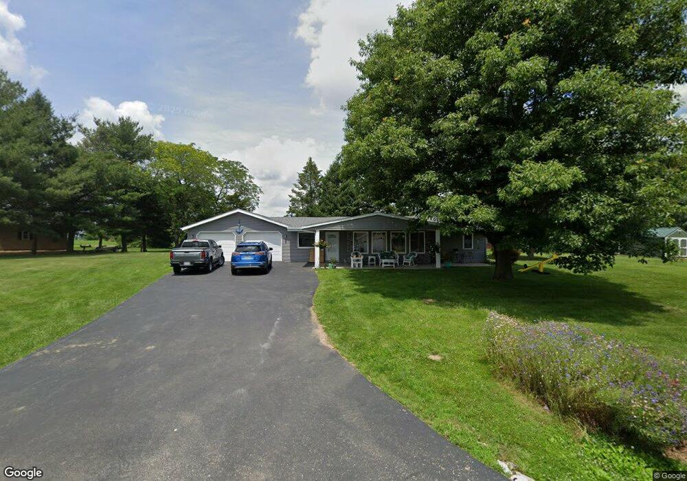
This home is located at 218 Wilkins Cir, Avon, IL 61415 and is currently estimated at $134,017. 218 Wilkins Cir is a home with nearby schools including Avon Elementary School, Hedding Grade School, and Abingdon-Avon Middle School.
Ownership History
Date
Name
Owned For
Owner Type
Purchase Details
Closed on
Mar 8, 2019
Sold by
Millizer Lyman D and Torrance Angela R
Bought by
Millizer Lyman D and Toorance Angela R
Current Estimated Value
Purchase Details
Closed on
Jun 7, 2018
Sold by
Hildreth Margaret L and Steven John Roth Est
Bought by
Millizer Lyman D and Torrance Angela R
Purchase Details
Closed on
Oct 26, 2010
Sold by
Schell Cheryl L
Bought by
Roth Steven
Home Financials for this Owner
Home Financials are based on the most recent Mortgage that was taken out on this home.
Original Mortgage
$60,000
Interest Rate
4.31%
Mortgage Type
New Conventional
Create a Home Valuation Report for This Property
The Home Valuation Report is an in-depth analysis detailing your home's value as well as a comparison with similar homes in the area
Home Values in the Area
Average Home Value in this Area
Purchase History
| Date | Buyer | Sale Price | Title Company |
|---|---|---|---|
| Millizer Lyman D | -- | None Available | |
| Millizer Lyman D | $85,000 | None Available | |
| Roth Steven | $75,000 | None Available |
Source: Public Records
Mortgage History
| Date | Status | Borrower | Loan Amount |
|---|---|---|---|
| Previous Owner | Roth Steven | $60,000 |
Source: Public Records
Tax History Compared to Growth
Tax History
| Year | Tax Paid | Tax Assessment Tax Assessment Total Assessment is a certain percentage of the fair market value that is determined by local assessors to be the total taxable value of land and additions on the property. | Land | Improvement |
|---|---|---|---|---|
| 2024 | $1,938 | $30,690 | $2,200 | $28,490 |
| 2023 | $1,938 | $29,020 | $2,080 | $26,940 |
| 2022 | $1,712 | $26,980 | $1,930 | $25,050 |
| 2021 | $1,645 | $26,170 | $1,880 | $24,290 |
| 2020 | $1,714 | $26,170 | $1,880 | $24,290 |
| 2019 | $1,662 | $25,650 | $1,840 | $23,810 |
| 2018 | $1,674 | $19,830 | $1,850 | $17,980 |
| 2017 | $1,634 | $25,320 | $1,810 | $23,510 |
| 2016 | $1,581 | $24,740 | $1,770 | $22,970 |
| 2015 | -- | $23,810 | $1,700 | $22,110 |
| 2014 | -- | $23,480 | $1,680 | $21,800 |
| 2013 | -- | $24,030 | $1,720 | $22,310 |
Source: Public Records
Map
Nearby Homes
- 140 Palemino Dr
- 88 Oak Ln
- 45 Bricker Cir
- 21 Bricker Cir
- 380 Mcgrew Dr
- 358 Mcgrew Dr
- 307 W Lafayette St
- 300 S Park St
- 897 20th Ave
- 235 N Smith St
- 208 S Main St
- 306 S Main St
- 108 E Grant St
- 301 E Cortland St
- 305 E Washington St
- 315 E Washington St
- 403 E Woods St
- 34495 N Twin Bridge Rd
- 796 60th Ave
- 295 W Harris Ave
- 220 Wilkins Cir
- 216 Wilkins Cir
- 182 Wilkins Cir
- 180 Wilkins Cir
- 181 Wilkins Cir
- 215 Wilkins Cir
- 183 Wilkins Cir
- 222 Wilkins Cir
- 177 Wilkins Cir
- 173 Wilkins Cir
- 176 Wilkins Cir
- 175 Wilkins Cir
- 572 Cabin Dr
- 191 Wing Ln
- 579 Circle c Ct
- 185 Wing Ln
- 189 Wing Ln
- 223 Wilkins Cir
- 224 Wilkins Cir
- 166 Wilkins Cir