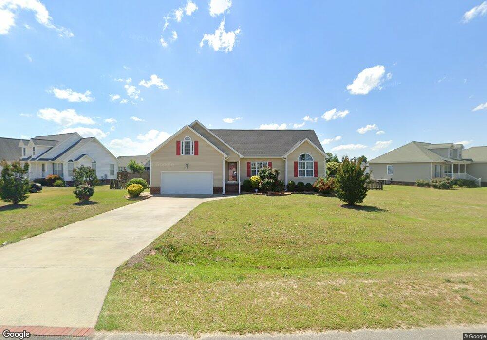
218 Wingspread Dr Goldsboro, NC 27530
Estimated Value: $236,147 - $245,000
3
Beds
2
Baths
1,538
Sq Ft
$157/Sq Ft
Est. Value
About This Home
This home is located at 218 Wingspread Dr, Goldsboro, NC 27530 and is currently estimated at $242,037, approximately $157 per square foot. 218 Wingspread Dr is a home located in Wayne County with nearby schools including Grantham School, Grantham Middle School, and Southern Wayne High School.
Ownership History
Date
Name
Owned For
Owner Type
Purchase Details
Closed on
Nov 4, 2005
Sold by
Ellis David Harold and Ellis Jane E
Bought by
Chen Qiu Lin
Current Estimated Value
Home Financials for this Owner
Home Financials are based on the most recent Mortgage that was taken out on this home.
Original Mortgage
$108,800
Interest Rate
5.39%
Mortgage Type
New Conventional
Create a Home Valuation Report for This Property
The Home Valuation Report is an in-depth analysis detailing your home's value as well as a comparison with similar homes in the area
Home Values in the Area
Average Home Value in this Area
Purchase History
| Date | Buyer | Sale Price | Title Company |
|---|---|---|---|
| Chen Qiu Lin | $136,000 | 9None Availabel |
Source: Public Records
Mortgage History
| Date | Status | Borrower | Loan Amount |
|---|---|---|---|
| Closed | Chen Qiu Lin | $108,800 |
Source: Public Records
Tax History Compared to Growth
Tax History
| Year | Tax Paid | Tax Assessment Tax Assessment Total Assessment is a certain percentage of the fair market value that is determined by local assessors to be the total taxable value of land and additions on the property. | Land | Improvement |
|---|---|---|---|---|
| 2025 | -- | $236,690 | $30,000 | $206,690 |
| 2024 | $1,339 | $158,300 | $22,000 | $136,300 |
| 2023 | $1,339 | $158,300 | $22,000 | $136,300 |
| 2022 | $1,339 | $158,300 | $22,000 | $136,300 |
| 2021 | $1,284 | $158,300 | $22,000 | $136,300 |
| 2020 | $1,214 | $158,300 | $22,000 | $136,300 |
| 2018 | $1,225 | $159,720 | $22,000 | $137,720 |
| 2017 | $1,225 | $159,720 | $22,000 | $137,720 |
| 2016 | $1,225 | $159,720 | $22,000 | $137,720 |
| 2015 | $1,227 | $159,720 | $22,000 | $137,720 |
| 2014 | $1,229 | $159,720 | $22,000 | $137,720 |
Source: Public Records
Map
Nearby Homes
- 1234 Us Highway 13 S
- 1444 Us Highway 13 S
- 202 Torrent Dr
- 208 Saxony Dr
- 205 Torrent Dr
- 212 Saxony Dr Unit 117
- 211 Torrent Dr
- 206 Torrent Dr
- 213 Torrent Dr
- 208 Torrent Dr
- 203 N Bali Ct
- 210 Torrent Dr
- 205 N Bali Ct
- 212 Torrent Dr
- 202 N Bali Ct
- The Piedmont Plan at Drake Estates
- The Telfair Plan at Drake Estates
- The Caldwell Plan at Drake Estates
- The McGinnis Plan at Drake Estates
- 214 Wingspread Dr
- 220 Wingspread Dr
- 104 Kestrel Ct
- 219 Wingspread Dr
- 221 Wingspread Dr
- 210 Wingspread Dr
- 102 Kestrel Ct
- 223 Wingspread Dr
- 217 Wingspread Dr
- 106 Kestrel Ct
- 215 Wingspread Dr
- 206 Wingspread Dr
- 225 Wingspread Dr
- 213 Wingspread Dr
- 105 Kestrel Ct
- 204 Wingspread Dr
- 227 Wingspread Dr
- 401 Wingspread Dr
- 403 Wingspread Dr
- 211 Wingspread Dr