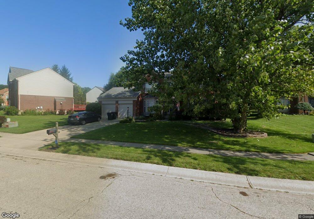
2181 Dalton Ct Miamisburg, OH 45342
Estimated Value: $372,652 - $495,000
4
Beds
3
Baths
2,042
Sq Ft
$202/Sq Ft
Est. Value
About This Home
This home is located at 2181 Dalton Ct, Miamisburg, OH 45342 and is currently estimated at $412,913, approximately $202 per square foot. 2181 Dalton Ct is a home located in Montgomery County with nearby schools including Miamisburg High School and Dayton Christian School.
Ownership History
Date
Name
Owned For
Owner Type
Purchase Details
Closed on
Sep 16, 2013
Sold by
Sperry John P
Bought by
Sperry Kathy K
Current Estimated Value
Home Financials for this Owner
Home Financials are based on the most recent Mortgage that was taken out on this home.
Original Mortgage
$172,000
Interest Rate
4.39%
Mortgage Type
Future Advance Clause Open End Mortgage
Purchase Details
Closed on
Jun 6, 2003
Sold by
Krueger John W and Krueger Christine A
Bought by
Sperry John P and Sperry Kathy K
Home Financials for this Owner
Home Financials are based on the most recent Mortgage that was taken out on this home.
Original Mortgage
$168,800
Interest Rate
5.78%
Mortgage Type
Purchase Money Mortgage
Purchase Details
Closed on
Dec 3, 1997
Sold by
Drees Company
Bought by
Krueger John W and Krueger Christine A
Create a Home Valuation Report for This Property
The Home Valuation Report is an in-depth analysis detailing your home's value as well as a comparison with similar homes in the area
Home Values in the Area
Average Home Value in this Area
Purchase History
| Date | Buyer | Sale Price | Title Company |
|---|---|---|---|
| Sperry Kathy K | -- | Gw Land Title Ltd | |
| Sperry John P | $211,000 | -- | |
| Krueger John W | $180,900 | -- |
Source: Public Records
Mortgage History
| Date | Status | Borrower | Loan Amount |
|---|---|---|---|
| Previous Owner | Sperry Kathy K | $172,000 | |
| Previous Owner | Sperry John P | $168,800 |
Source: Public Records
Tax History Compared to Growth
Tax History
| Year | Tax Paid | Tax Assessment Tax Assessment Total Assessment is a certain percentage of the fair market value that is determined by local assessors to be the total taxable value of land and additions on the property. | Land | Improvement |
|---|---|---|---|---|
| 2024 | $7,092 | $109,380 | $17,960 | $91,420 |
| 2023 | $7,092 | $109,380 | $17,960 | $91,420 |
| 2022 | $7,358 | $95,740 | $15,750 | $79,990 |
| 2021 | $6,523 | $95,740 | $15,750 | $79,990 |
| 2020 | $6,515 | $95,740 | $15,750 | $79,990 |
| 2019 | $6,413 | $86,470 | $15,750 | $70,720 |
| 2018 | $6,434 | $86,470 | $15,750 | $70,720 |
| 2017 | $6,395 | $86,470 | $15,750 | $70,720 |
| 2016 | $5,663 | $73,740 | $15,750 | $57,990 |
| 2015 | $5,228 | $71,350 | $15,750 | $55,600 |
| 2014 | $5,228 | $71,350 | $15,750 | $55,600 |
| 2012 | -- | $74,820 | $17,500 | $57,320 |
Source: Public Records
Map
Nearby Homes
- 1157 Bonniebrook Dr
- 2127 Carrington Ln
- 2141 Rosina Dr
- 2279 Rosina Dr
- 736 Decker Dr
- 1 Pendle Point
- 712 Decker Dr
- 628 Jamestown Dr
- 3902 Augusta Rd
- 9228 Sawgrass Dr
- 9220 Sawgrass Dr
- 1131 Castleton Ct
- 1734 Rosina Dr
- 00 Benner Rd
- 2054 Prestwick Bend
- 1984 Cruden Bay Way
- 1834 Mellow Dr
- 1808 Burnside Dr
- 2475 Byers Ridge Dr
- 9539 Byers Rd
- 2187 Dalton Ct
- 1132 Hollowcreek Dr
- 1122 Hollowcreek Dr
- 1062 Hollowcreek Ct
- 1050 Hollowcreek Ct
- 2178 Dalton Ct
- 2193 Dalton Ct
- 2172 Dalton Ct
- 1102 Hollowcreek Dr
- 2184 Dalton Ct
- 1151 Hollowcreek Dr
- 2190 Dalton Ct
- 1038 Hollowcreek Ct
- 2166 Carrington Ln
- 1175 Hollowcreek Dr
- 1246 Hollowcreek Dr
- 1171 Bonniebrook Dr
- 1185 Bonniebrook Dr
- 1205 Hollowcreek Dr
- 2183 Leeds Ct