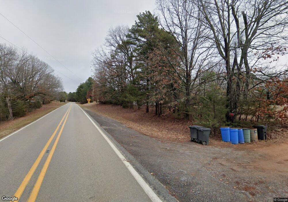
21814 E Highway 12 Rogers, AR 72756
Estimated Value: $114,000 - $374,000
Studio
1
Bath
1,350
Sq Ft
$138/Sq Ft
Est. Value
About This Home
This home is located at 21814 E Highway 12, Rogers, AR 72756 and is currently estimated at $186,735, approximately $138 per square foot. 21814 E Highway 12 is a home located in Benton County with nearby schools including Eastside Elementary School, Lingle Middle School, and Rogers Heritage High School.
Ownership History
Date
Name
Owned For
Owner Type
Purchase Details
Closed on
Jun 2, 2022
Sold by
Elizabeth Chestnut Ina
Bought by
Chestnut Deric Allen
Current Estimated Value
Purchase Details
Closed on
Oct 28, 2016
Sold by
Vs Bradford Investments Llc
Bought by
Chestnut Deric A
Purchase Details
Closed on
Jan 20, 2015
Sold by
Chestnut Deric A and Chestnut Ina
Bought by
Southwest Stage Funding Llc and Cascade Financial Services
Purchase Details
Closed on
Aug 25, 2010
Sold by
Green Daniel and Green Lori
Bought by
Bradford Victor W and Bradford Susan K
Purchase Details
Closed on
Jul 12, 2004
Bought by
Chestnu
Home Financials for this Owner
Home Financials are based on the most recent Mortgage that was taken out on this home.
Original Mortgage
$34,000
Interest Rate
7.5%
Mortgage Type
Seller Take Back
Create a Home Valuation Report for This Property
The Home Valuation Report is an in-depth analysis detailing your home's value as well as a comparison with similar homes in the area
Purchase History
| Date | Buyer | Sale Price | Title Company |
|---|---|---|---|
| Chestnut Deric Allen | -- | Catterlin & Arnold Law Firm Pl | |
| Chestnut Deric A | $37,000 | Pci Advance Title Llc | |
| Southwest Stage Funding Llc | $120,754 | None Available | |
| Bradford Victor W | -- | None Available | |
| Chestnu | -- | -- | |
| Chestnut Deric | $34,500 | None Available |
Source: Public Records
Mortgage History
| Date | Status | Borrower | Loan Amount |
|---|---|---|---|
| Previous Owner | Chestnut Deric | $34,000 |
Source: Public Records
Tax History
| Year | Tax Paid | Tax Assessment Tax Assessment Total Assessment is a certain percentage of the fair market value that is determined by local assessors to be the total taxable value of land and additions on the property. | Land | Improvement |
|---|---|---|---|---|
| 2025 | $668 | $20,949 | $4,040 | $16,909 |
| 2024 | $601 | $20,949 | $4,040 | $16,909 |
| 2023 | $572 | $12,870 | $1,210 | $11,660 |
| 2022 | $213 | $12,870 | $1,210 | $11,660 |
| 2021 | $185 | $12,870 | $1,210 | $11,660 |
| 2020 | $159 | $10,340 | $1,050 | $9,290 |
| 2019 | $159 | $10,340 | $1,050 | $9,290 |
| 2018 | $184 | $10,340 | $1,050 | $9,290 |
| 2017 | $123 | $10,340 | $1,050 | $9,290 |
| 2016 | $123 | $10,340 | $1,050 | $9,290 |
| 2015 | $451 | $9,370 | $670 | $8,700 |
| 2014 | $227 | $11,990 | $3,290 | $8,700 |
Source: Public Records
Map
Nearby Homes
- 11225 Sheppard Place Rd
- 0 Sheppard Place Rd
- 22058 E Highway 12
- 0 Fawns Way
- 22110 Arkansas 12
- 22198 Arkansas 12
- 0 War Eagle Black Top Rd Unit 1329543
- 9324 Tomerlin Grist Mill Rd
- 9001 Valleyview Dr
- 0 Cobble Ln
- 0 Best Creek Rd
- 0 Dogwood Rd
- TBD Lynn St
- 642 Madison 8050
- 0 Huckleberry Hills Rd
- 0 Madison 8105 Unit 1331291
- 20235 Copper Ridge Rd
- Lot 5 Winterberry Ln
- 23918 Woodhaven Dr
- Lot 6 Blisslake Ln
- 21850 E Highway 12
- 21802 E Highway 12
- 21886 E Highway 12
- 21886 Arkansas 12
- 21890 E Highway 12
- 21742 E Highway 12
- 21721 Arkansas 12
- 21721 E Highway 12
- 10700 Sheppard Place Rd
- 10602 Sheppard Place Rd
- 0 Deer Run Trail Unit 1239472
- 0 Deer Run Trail Unit 1238612
- 0 Deer Run Trail Unit 1225920
- 2101 Bell Rd
- 102 Bell Ln
- -- Sheppard Place Rd
- 21910 E Highway 12
- 21875 E Highway 12
- 22052 Arkansas 12
- 0 St
Your Personal Tour Guide
Ask me questions while you tour the home.
