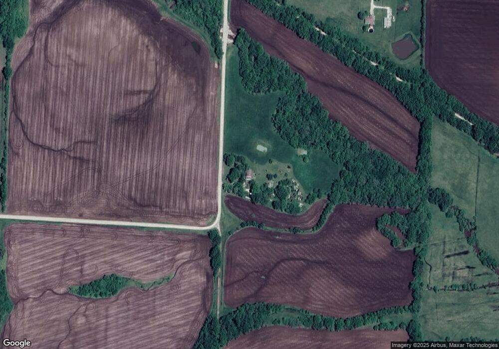
21819 S McKenzie Ridge Rd Pleasant Hill, MO 64080
Estimated Value: $268,000 - $420,876
5
Beds
2
Baths
1,900
Sq Ft
$192/Sq Ft
Est. Value
About This Home
This home is located at 21819 S McKenzie Ridge Rd, Pleasant Hill, MO 64080 and is currently estimated at $365,625, approximately $192 per square foot. 21819 S McKenzie Ridge Rd is a home located in Cass County.
Ownership History
Date
Name
Owned For
Owner Type
Purchase Details
Closed on
Apr 16, 2024
Sold by
Snyder Larry Dean
Bought by
Wood Sandra D and Bunting Tiffanie Denene
Current Estimated Value
Purchase Details
Closed on
Feb 21, 2024
Sold by
Snyder Larry Dean
Bought by
Wood Sandra D
Create a Home Valuation Report for This Property
The Home Valuation Report is an in-depth analysis detailing your home's value as well as a comparison with similar homes in the area
Home Values in the Area
Average Home Value in this Area
Purchase History
| Date | Buyer | Sale Price | Title Company |
|---|---|---|---|
| Wood Sandra D | -- | None Listed On Document | |
| Wood Sandra D | -- | None Listed On Document | |
| Wood Sandra D | -- | None Listed On Document | |
| Wood Sandra D | -- | None Listed On Document |
Source: Public Records
Tax History Compared to Growth
Tax History
| Year | Tax Paid | Tax Assessment Tax Assessment Total Assessment is a certain percentage of the fair market value that is determined by local assessors to be the total taxable value of land and additions on the property. | Land | Improvement |
|---|---|---|---|---|
| 2024 | $1,360 | $19,700 | $2,740 | $16,960 |
| 2023 | $1,360 | $19,700 | $2,740 | $16,960 |
| 2022 | $1,239 | $17,730 | $2,740 | $14,990 |
| 2021 | $1,222 | $17,730 | $2,740 | $14,990 |
| 2020 | $1,077 | $16,030 | $2,740 | $13,290 |
| 2019 | $1,061 | $16,030 | $2,740 | $13,290 |
| 2018 | $953 | $14,260 | $2,450 | $11,810 |
| 2017 | $913 | $14,260 | $2,450 | $11,810 |
| 2016 | $913 | $13,640 | $2,450 | $11,190 |
| 2015 | $925 | $13,640 | $2,450 | $11,190 |
| 2014 | $1,021 | $14,980 | $2,390 | $12,590 |
| 2013 | -- | $14,980 | $2,390 | $12,590 |
Source: Public Records
Map
Nearby Homes
- 0000 E 219th St
- 22920 S Staley Mound Rd
- 227th St
- 000 227th St -124 Acres
- 0 E 215th St
- 0 S Staley Mound Rd
- S Staley Mound Rd
- 21 Acres Staley Mound Rd
- Lot 4 State Rt K Hwy
- Lot 2 State Rt K Hwy
- Lot 3 State Rt K Hwy
- 30909 E 219th St
- 312 N East Hwy
- 23700 S State Rt K Hwy
- 0000 S Pryor Rd
- TBD S Pryor Rd
- 33701 E State Route 58
- Tbd South Pryor Rd
- 23020 S Valley Rd
- 704 Colony Ave
- 35805 E 217th St
- 22001 S McKenzie Ridge Rd
- 35900 E 217th St
- 0 S Dillon Rd
- 22100 S Dillon Rd
- 22115 S Dillon Rd
- 34604 E 219th St
- 21523 S Dillon Rd
- 22301 S Cedar Rd
- 22500 S Dillon Rd
- 22305 S Dillon Rd
- 21322 S Dillon Rd
- 36703 E 213th St
- 22314 S Cedar Rd
- 22419 S Cedar Rd
- 36400 E 213th St
- 22505 S Dillon Rd
- 34707 E 211th St
