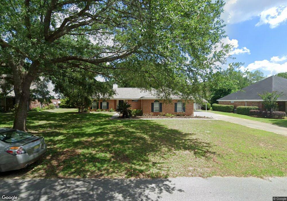
21820 Cedar Ln Silverhill, AL 36576
Estimated Value: $308,685 - $320,000
3
Beds
2
Baths
1,768
Sq Ft
$177/Sq Ft
Est. Value
About This Home
This home is located at 21820 Cedar Ln, Silverhill, AL 36576 and is currently estimated at $313,171, approximately $177 per square foot. 21820 Cedar Ln is a home located in Baldwin County with nearby schools including Silverhill School, Central Baldwin Middle School, and Robertsdale High School.
Ownership History
Date
Name
Owned For
Owner Type
Purchase Details
Closed on
Jan 24, 2023
Sold by
Jackson Pinkney S
Bought by
Jackson Pinkney S
Current Estimated Value
Purchase Details
Closed on
Feb 26, 2020
Sold by
Sherman Coby L and Sherman Amber
Bought by
Michels Thomas J
Purchase Details
Closed on
Jul 5, 2018
Sold by
Bill Mohler
Bought by
Sherman Coby and Sherman Amber
Home Financials for this Owner
Home Financials are based on the most recent Mortgage that was taken out on this home.
Original Mortgage
$160,256
Interest Rate
4.52%
Purchase Details
Closed on
Apr 23, 2010
Sold by
Cain Thomas Joseph and Cain Sandra Diane
Bought by
Mohler Bill
Home Financials for this Owner
Home Financials are based on the most recent Mortgage that was taken out on this home.
Original Mortgage
$165,280
Interest Rate
4.94%
Mortgage Type
VA
Create a Home Valuation Report for This Property
The Home Valuation Report is an in-depth analysis detailing your home's value as well as a comparison with similar homes in the area
Home Values in the Area
Average Home Value in this Area
Purchase History
| Date | Buyer | Sale Price | Title Company |
|---|---|---|---|
| Jackson Pinkney S | $98,100 | -- | |
| Michels Thomas J | $187,000 | None Available | |
| Sherman Coby | $175,000 | -- | |
| Mohler Bill | -- | Alt |
Source: Public Records
Mortgage History
| Date | Status | Borrower | Loan Amount |
|---|---|---|---|
| Previous Owner | Sherman Coby | $160,256 | |
| Previous Owner | Sherman Coby | -- | |
| Previous Owner | Mohler Bill | $165,280 |
Source: Public Records
Tax History
| Year | Tax Paid | Tax Assessment Tax Assessment Total Assessment is a certain percentage of the fair market value that is determined by local assessors to be the total taxable value of land and additions on the property. | Land | Improvement |
|---|---|---|---|---|
| 2024 | $667 | $27,600 | $4,500 | $23,100 |
| 2023 | $604 | $25,420 | $3,300 | $22,120 |
| 2022 | $571 | $24,080 | $0 | $0 |
| 2021 | $390 | $20,680 | $0 | $0 |
| 2020 | $456 | $17,880 | $0 | $0 |
| 2019 | $432 | $17,040 | $0 | $0 |
| 2018 | $411 | $16,280 | $0 | $0 |
| 2017 | $393 | $15,660 | $0 | $0 |
| 2016 | $381 | $15,200 | $0 | $0 |
| 2015 | $409 | $14,620 | $0 | $0 |
| 2014 | $414 | $14,780 | $0 | $0 |
| 2013 | -- | $14,920 | $0 | $0 |
Source: Public Records
Map
Nearby Homes
- 21801 Sedlack Rd
- 14200 South Blvd
- 0 Sedlack Rd Unit 10 362555
- 0 Sedlack Rd Unit 21 362553
- 0 Sedlack Rd Unit 7389816
- 21601 Westside Loop
- 14590 Chenin Blanc Dr
- 14585 Arrowhead Ct
- 14589 Arrowhead Ct
- 15185 Alabama 104
- 14500 Chenin Blanc Dr
- 14947 Silver Oaks Loop
- 21172 Chardonnay Dr
- 21114 Chardonnay Dr
- 14876 Arrowhead Ct
- 14898 Arrowhead Ct
- 14863 Arrowhead Ct
- 14910 Arrowhead Ct
- 14778 Arrowhead Ct
- 14310 Chenin Blanc Dr
- 21818 Cedar Ln
- 14178 Laura Lea Cir
- 14215 Gabrielle Ct
- 14196 Laura Lea Cir
- 14196 Laura Lea Cir
- 21825 Cedar Ln
- 21837 Cedar Ln
- 21801 Cedar Ln
- 14220 Laura Lea Cir
- 14217 Gabrielle Ct
- 14189 Laura Lea Cir
- 21871 Cedar Ln
- 14186 Gabrielle Ct
- 14182 Gabrielle Ct
- 14197 Laura Lea Cir
- 21793 Cedar Ln
- 21793 Cedar Ln
- 14230 Laura Lea Cir
- 14212 Gabrielle Ct
- 14223 Gabrielle Ct
Your Personal Tour Guide
Ask me questions while you tour the home.