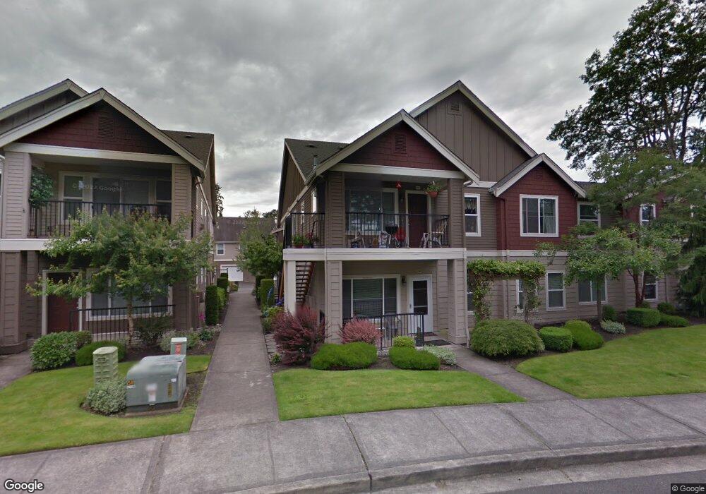
2183 Hammond Ave Unit 12E Dupont, WA 98327
Estimated Value: $342,302 - $363,000
2
Beds
2
Baths
1,067
Sq Ft
$329/Sq Ft
Est. Value
About This Home
This home is located at 2183 Hammond Ave Unit 12E, Dupont, WA 98327 and is currently estimated at $350,826, approximately $328 per square foot. 2183 Hammond Ave Unit 12E is a home located in Pierce County with nearby schools including Chloe Clark Elementary School, Saltars Point Elementary School, and Pioneer Middle School.
Ownership History
Date
Name
Owned For
Owner Type
Purchase Details
Closed on
Apr 22, 2019
Sold by
Brown Billy A
Bought by
Billy A Brown Living Trust
Current Estimated Value
Purchase Details
Closed on
Nov 4, 1998
Sold by
Carino Homes Inc
Bought by
Brown Bill A and Brown Karey L
Home Financials for this Owner
Home Financials are based on the most recent Mortgage that was taken out on this home.
Original Mortgage
$89,700
Interest Rate
6.61%
Mortgage Type
Purchase Money Mortgage
Create a Home Valuation Report for This Property
The Home Valuation Report is an in-depth analysis detailing your home's value as well as a comparison with similar homes in the area
Home Values in the Area
Average Home Value in this Area
Purchase History
| Date | Buyer | Sale Price | Title Company |
|---|---|---|---|
| Billy A Brown Living Trust | -- | None Available | |
| Brown Billy A | -- | None Available | |
| Brown Bill A | $92,500 | Rainier Title Company |
Source: Public Records
Mortgage History
| Date | Status | Borrower | Loan Amount |
|---|---|---|---|
| Previous Owner | Brown Bill A | $89,700 |
Source: Public Records
Tax History Compared to Growth
Tax History
| Year | Tax Paid | Tax Assessment Tax Assessment Total Assessment is a certain percentage of the fair market value that is determined by local assessors to be the total taxable value of land and additions on the property. | Land | Improvement |
|---|---|---|---|---|
| 2025 | $2,470 | $307,900 | $73,000 | $234,900 |
| 2024 | $2,470 | $306,400 | $58,100 | $248,300 |
| 2023 | $2,470 | $306,400 | $58,100 | $248,300 |
| 2022 | $2,423 | $306,400 | $58,100 | $248,300 |
| 2021 | $2,559 | $253,800 | $48,500 | $205,300 |
| 2019 | $2,081 | $230,600 | $44,000 | $186,600 |
| 2018 | $2,262 | $203,200 | $56,700 | $146,500 |
| 2017 | $1,813 | $193,500 | $56,700 | $136,800 |
| 2016 | $1,604 | $149,300 | $56,700 | $92,600 |
| 2014 | $1,639 | $142,200 | $56,700 | $85,500 |
| 2013 | $1,639 | $121,000 | $46,000 | $75,000 |
Source: Public Records
Map
Nearby Homes
- 2176 Palisade Blvd Unit F-3
- 2147 Hammond Ave Unit B10
- 2176 McDonald Ave
- 2237 Tolmie St
- 1331 Rowan Ct Unit 1331
- 1373 Hudson St Unit 1373
- 1607 Kincaid St Unit E-8
- 1285 Griggs St
- 1856 Spencer Ct Unit 12F
- 1680 Kennedy Place Unit A4
- 1263 Hudson St
- 2699 Erwin Ave Unit 2699
- 605 Louviers Ave
- 1975 Garry Oaks Ave Unit C
- 504 Dupont Ave
- 2055 Garry Oaks Ave Unit B
- 403 Louviers Ave
- 205 Brandywine Ave
- 2420 Simmons St Unit B
- 3114 Walker Rd
- 2189 Hammond Ave Unit 12F
- 2191 Hammond Ave Unit 12D
- 2181 Hammond Ave Unit 12C
- 2187 Hammond Ave Unit 12B
- 2185 Hammond Ave Unit 12A
- 2191 Hammond Ave Unit D-12
- 2198 Palisade Blvd Unit 2C
- 2190 Palisade Blvd Unit 2F
- 2188 Palisade Blvd Unit 2D
- 2192 Palisade Blvd Unit 2B
- 2188 Palisade Blvd Unit D-2
- 2192 Palisade Blvd Unit B-2
- 2194 Palisade Blvd Unit A-2
- 2161 Hammond Ave Unit D-11
- 2173 Hammond Ave Unit 11H
- 2167 Hammond Ave Unit 11G
- 2163 Hammond Ave Unit 11F
- 2175 Hammond Ave Unit 11E