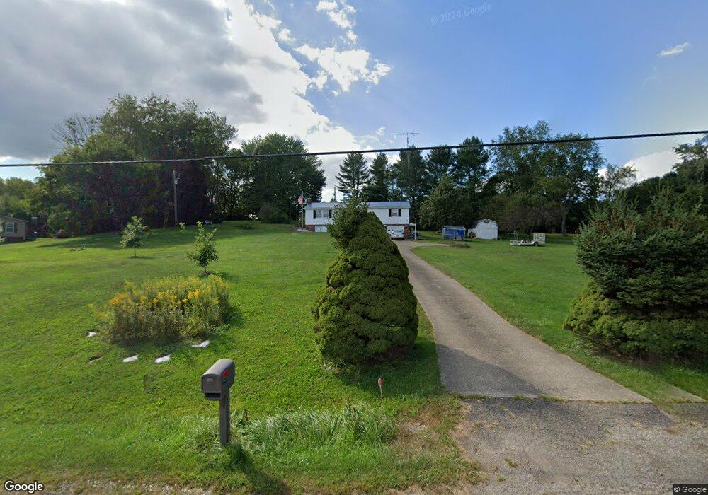
2183 State Route 83 Millersburg, OH 44654
Estimated Value: $234,311 - $297,000
--
Bed
1
Bath
1,248
Sq Ft
$215/Sq Ft
Est. Value
About This Home
This home is located at 2183 State Route 83, Millersburg, OH 44654 and is currently estimated at $268,828, approximately $215 per square foot. 2183 State Route 83 is a home located in Holmes County with nearby schools including West Holmes High School, Clark Valley, and Walnut Grove School C/O David L. Troyer.
Ownership History
Date
Name
Owned For
Owner Type
Purchase Details
Closed on
Oct 30, 2020
Sold by
Harris Betty E
Bought by
Harris Ronald H
Current Estimated Value
Home Financials for this Owner
Home Financials are based on the most recent Mortgage that was taken out on this home.
Original Mortgage
$50,000
Outstanding Balance
$44,493
Interest Rate
2.8%
Mortgage Type
New Conventional
Estimated Equity
$224,335
Purchase Details
Closed on
Oct 23, 2009
Sold by
Harris Ronald H and Harris Betty E
Bought by
Harris Ronald H and Harris Betty E
Purchase Details
Closed on
Jan 1, 1990
Bought by
Harris Ronald H and Harris Betty E
Create a Home Valuation Report for This Property
The Home Valuation Report is an in-depth analysis detailing your home's value as well as a comparison with similar homes in the area
Home Values in the Area
Average Home Value in this Area
Purchase History
| Date | Buyer | Sale Price | Title Company |
|---|---|---|---|
| Harris Ronald H | $50,000 | None Available | |
| Harris Ronald H | -- | None Available | |
| Harris Ronald H | -- | -- |
Source: Public Records
Mortgage History
| Date | Status | Borrower | Loan Amount |
|---|---|---|---|
| Open | Harris Ronald H | $50,000 |
Source: Public Records
Tax History Compared to Growth
Tax History
| Year | Tax Paid | Tax Assessment Tax Assessment Total Assessment is a certain percentage of the fair market value that is determined by local assessors to be the total taxable value of land and additions on the property. | Land | Improvement |
|---|---|---|---|---|
| 2024 | $1,811 | $47,950 | $8,190 | $39,760 |
| 2023 | $1,811 | $47,950 | $8,190 | $39,760 |
| 2022 | $1,879 | $47,950 | $8,190 | $39,760 |
| 2021 | $1,649 | $39,170 | $6,300 | $32,870 |
| 2020 | $1,253 | $39,170 | $6,300 | $32,870 |
| 2019 | $1,223 | $39,170 | $6,300 | $32,870 |
| 2018 | $1,073 | $34,530 | $5,160 | $29,370 |
| 2017 | $1,072 | $34,530 | $5,160 | $29,370 |
| 2016 | $1,073 | $34,530 | $5,160 | $29,370 |
| 2015 | $1,066 | $34,800 | $4,870 | $29,930 |
| 2014 | $1,072 | $34,800 | $4,870 | $29,930 |
| 2013 | $548 | $34,800 | $4,870 | $29,930 |
Source: Public Records
Map
Nearby Homes
- 118 Bern Dr
- 3190 Buckhorn Dr
- 7675 Wild Horn Dr
- 1910 Susten Dr
- 7636 Arbon Dr Unit 1222
- 7771 Buckhorn Cove
- 2770 Stammheim Dr
- 0 Ohio 83
- 3515 County Road 58
- 3605 State Route 83
- 8800 U S Highway 62
- 7077 County Road 68
- 30945 County Road 126
- 0 Berlin Township 309
- 989 N Railroad St
- 6866 Township Road 310
- 241 Fairway Dr
- 0 County Road 19
- 41443 County Road 19
- 0 Township Road 219
- 2075 State Route 83
- 2065 State Route 83
- 2230 State Route 83
- 2212 State Route 83
- 2243 State Route 83 Unit 211
- 2243 State Route 83
- 2053 State Route 83
- 2190 Miller Dr Unit 163
- 2190 Miller Dr Unit 162.163,223,224
- 2190 Zermatt St Unit 162.163,223,224
- 2190 Zermatt St
- 2190 Zermatt St Unit 163
- S/L 1475-7 Buckhorn Dr
- 1475 Buckhorn Dr
- 249 Buckhorn Dr
- 195 Buckhorn Dr
- 198 Buckhorn Dr
- 198 Buckhorn Dr Unit 303
- 84 Buckhorn Dr
- 82 Buckhorn Dr