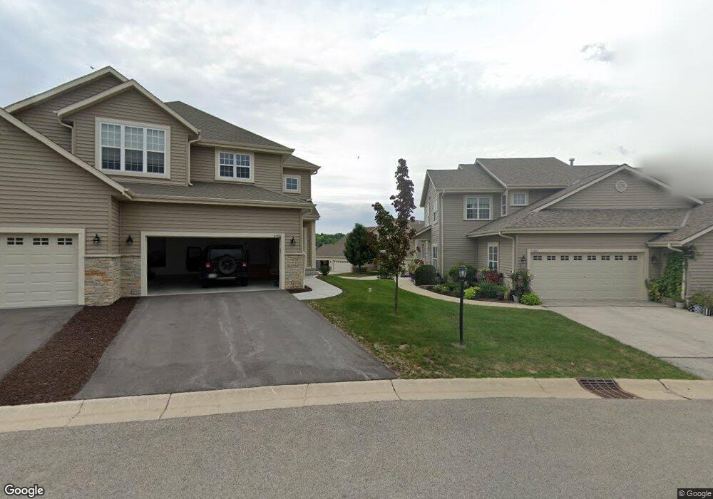
21834F N Weather Edge Cir Unit 426 Lannon, WI 53046
Estimated Value: $327,541 - $370,000
--
Bed
--
Bath
--
Sq Ft
12
Acres
About This Home
This home is located at 21834F N Weather Edge Cir Unit 426, Lannon, WI 53046 and is currently estimated at $342,135. 21834F N Weather Edge Cir Unit 426 is a home located in Waukesha County with nearby schools including Lannon Elementary School, Templeton Middle School, and Hamilton High School.
Ownership History
Date
Name
Owned For
Owner Type
Purchase Details
Closed on
Jul 1, 2021
Sold by
Herder Mark A and Herder Jody J
Bought by
Smith Trust
Current Estimated Value
Purchase Details
Closed on
May 21, 2015
Sold by
Byal Albert B and Byal Elaine F
Bought by
Herder Mark A and Herder Jody J
Home Financials for this Owner
Home Financials are based on the most recent Mortgage that was taken out on this home.
Original Mortgage
$125,625
Interest Rate
0.78%
Mortgage Type
New Conventional
Purchase Details
Closed on
Sep 22, 2014
Sold by
Kerr Margaret Carol and Bayless Christine E
Bought by
Byal Albert B and Byal Elaine F
Purchase Details
Closed on
Jun 26, 2008
Sold by
Whispering Ridge Group Llc
Bought by
Kerr Margaret Carol and Bayliss Christine E
Create a Home Valuation Report for This Property
The Home Valuation Report is an in-depth analysis detailing your home's value as well as a comparison with similar homes in the area
Home Values in the Area
Average Home Value in this Area
Purchase History
| Date | Buyer | Sale Price | Title Company |
|---|---|---|---|
| Smith Trust | $281,000 | Frontier Title | |
| Herder Mark A | $167,500 | None Available | |
| Byal Albert B | $168,000 | None Available | |
| Kerr Margaret Carol | $205,200 | None Available |
Source: Public Records
Mortgage History
| Date | Status | Borrower | Loan Amount |
|---|---|---|---|
| Previous Owner | Herder Mark A | $125,625 |
Source: Public Records
Tax History Compared to Growth
Tax History
| Year | Tax Paid | Tax Assessment Tax Assessment Total Assessment is a certain percentage of the fair market value that is determined by local assessors to be the total taxable value of land and additions on the property. | Land | Improvement |
|---|---|---|---|---|
| 2024 | $3,380 | $211,800 | $46,000 | $165,800 |
| 2023 | $3,202 | $211,800 | $46,000 | $165,800 |
| 2022 | $3,172 | $211,800 | $46,000 | $165,800 |
| 2021 | $2,668 | $211,800 | $46,000 | $165,800 |
| 2020 | $2,546 | $211,800 | $46,000 | $165,800 |
| 2019 | $2,437 | $170,100 | $40,000 | $130,100 |
| 2018 | $2,291 | $170,100 | $40,000 | $130,100 |
| 2017 | $2,515 | $170,100 | $40,000 | $130,100 |
| 2016 | $2,402 | $170,100 | $40,000 | $130,100 |
| 2015 | $2,433 | $170,100 | $40,000 | $130,100 |
| 2014 | -- | $189,300 | $45,000 | $144,300 |
| 2013 | -- | $189,300 | $45,000 | $144,300 |
Source: Public Records
Map
Nearby Homes
- 7837 W Stone Ridge Dr
- 21665 S Weather Edge Cir
- N66W21277 Sagebrush Dr
- The Julia Plan at Bella Vista Estates
- The Charlotte Plan at Bella Vista Estates
- The Eliza Plan at Bella Vista Estates
- The Aubrey Plan at Bella Vista Estates
- The Elsa Plan at Bella Vista Estates
- N66W20903 Sweet Clover Dr
- N66W20955 Sweet Clover Dr
- N66W21009 Sagebrush Dr
- W214N6672 Fairview Dr
- Lt15 Fairview Dr
- W214N6683 Fairview Dr
- W212N6831 Fairview Dr
- N68W21252 Fairview Dr
- W214N6711 Fairview Dr
- W214N6684 Fairview Dr
- 20910 Gray St
- 20900 Gray St
- 21790B N Weather Edge Cir Unit 452
- 21864F N Weather Edge Cir Unit 446
- 21834A N Weather Edge Cir Unit 421
- 21790H N Weather Edge Cir Unit 458
- 21834E N Weather Edge Cir Unit 425
- 21834C N Weather Edge Cir Unit 423
- 21834H N Weather Edge Cir Unit 428
- 21890B N Weather Edge Cir Unit 432
- 21890C N Weather Edge Cir Unit 433
- 21890G N Weather Edge Cir Unit 437
- 21727A Outcropping Ct Unit 461
- 21727E Outcropping Ct Unit 465
- 21864B N Weather Edge Cir Unit 442
- 21864E N Weather Edge Cir Unit 445
- 21790F N Weather Edge Cir Unit 456
- 21790E N Weather Edge Cir Unit 455
- 21727B Outcropping Ct Unit 462
- 21890F N Weather Edge Cir Unit 436
- 21890H N Weather Edge Cir
- 7865 W Stone Ridge Dr