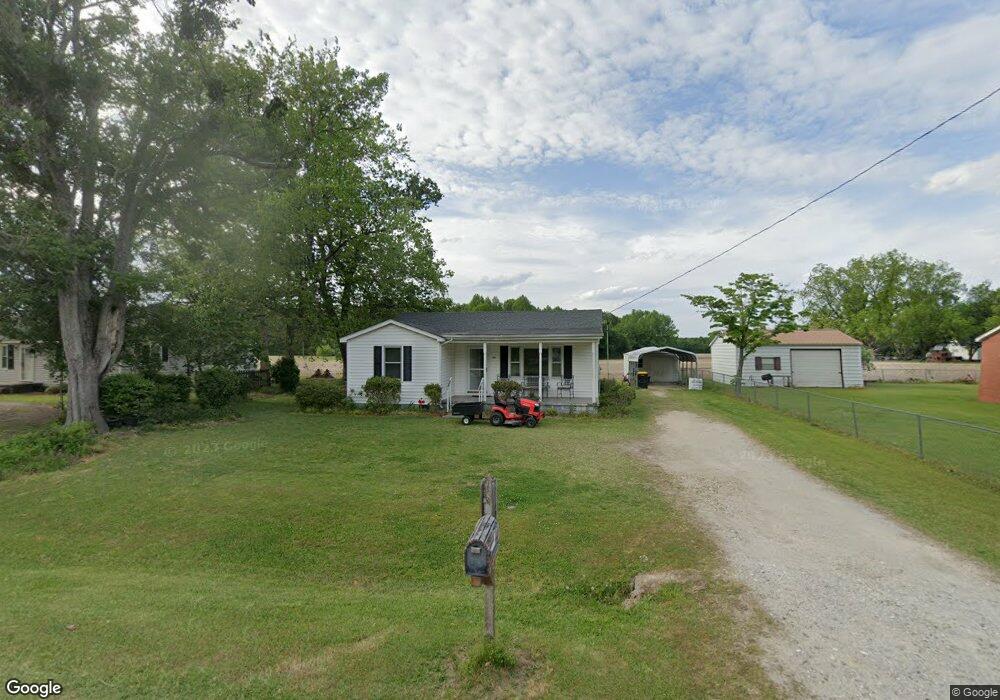
2184 Pauls Path Rd Kinston, NC 28504
Estimated Value: $111,162 - $173,000
3
Beds
1
Bath
1,056
Sq Ft
$139/Sq Ft
Est. Value
About This Home
This home is located at 2184 Pauls Path Rd, Kinston, NC 28504 and is currently estimated at $146,791, approximately $139 per square foot. 2184 Pauls Path Rd is a home located in Lenoir County with nearby schools including Banks Elementary School, E.B. Frink Middle School, and North Lenoir High School.
Ownership History
Date
Name
Owned For
Owner Type
Purchase Details
Closed on
Nov 13, 2024
Sold by
Fulton Rhue Lora
Bought by
Thornton Laverne Rhue and Rhue Duffy Wayne
Current Estimated Value
Purchase Details
Closed on
Sep 20, 2024
Sold by
Fulton Lora
Bought by
Thornton Laverne Rhue and Rhue Duffy Wayne
Purchase Details
Closed on
Mar 28, 2014
Sold by
Rhue Myrtle W
Bought by
Rhue Vernal James and Thornton Laverne Rhufe
Create a Home Valuation Report for This Property
The Home Valuation Report is an in-depth analysis detailing your home's value as well as a comparison with similar homes in the area
Home Values in the Area
Average Home Value in this Area
Purchase History
| Date | Buyer | Sale Price | Title Company |
|---|---|---|---|
| Thornton Laverne Rhue | -- | None Listed On Document | |
| Thornton Laverne Rhue | -- | None Listed On Document | |
| Thornton Laverne Rhue | -- | None Listed On Document | |
| Rhue Vernal James | -- | None Available |
Source: Public Records
Tax History Compared to Growth
Tax History
| Year | Tax Paid | Tax Assessment Tax Assessment Total Assessment is a certain percentage of the fair market value that is determined by local assessors to be the total taxable value of land and additions on the property. | Land | Improvement |
|---|---|---|---|---|
| 2025 | $735 | $101,440 | $8,326 | $93,114 |
| 2024 | $449 | $49,772 | $9,072 | $40,700 |
| 2023 | $449 | $49,772 | $9,072 | $40,700 |
| 2022 | $449 | $49,772 | $9,072 | $40,700 |
| 2021 | $448 | $49,772 | $9,072 | $40,700 |
| 2020 | $448 | $49,772 | $9,072 | $40,700 |
| 2019 | $449 | $49,772 | $9,072 | $40,700 |
| 2018 | $442 | $49,772 | $9,072 | $40,700 |
| 2017 | $528 | $49,772 | $9,072 | $40,700 |
| 2014 | $332 | $55,839 | $9,072 | $46,767 |
| 2013 | -- | $55,839 | $9,072 | $46,767 |
| 2011 | -- | $55,839 | $9,072 | $46,767 |
Source: Public Records
Map
Nearby Homes
- 2443 Creekside Rd
- Lot 2 Branchwood Dr
- 2886 Fox Run Cir
- 2912 Fox Run Cir
- 58 Old English Ln
- 3178 Alton Phillips Rd
- 2193 Dogwood Ln
- 3128 Kelly Rd
- 1957 Country Squire Rd
- 0 Hwy 258 N Unit LotWP001 22409279
- 2673 Stokes Cir
- 2683 Stokes Cir
- 2544 Dogwood Ln
- 2712 Stokes Cir
- 2445 Tammy Dr
- 2100 Hwy 258 N
- 2746 Pinewood Dr
- 2321 Fred Everett Rd
- 2634 Forrest Dr
- 2585 Cabin Branch Rd
- 2180 Pauls Path Rd
- 2189 Pauls Path Rd
- 2197 Pauls Path Rd
- 2205 Pauls Path Rd
- 2177 Pauls Path Rd
- 2225 Pauls Path Rd
- 2133 Pauls Path Rd
- 2677 Brookwood Rd
- 2237 Pauls Path Rd
- 2695 Brookwood Rd
- 2701 Brookwood Rd
- 2856 Gray Grant Rd
- 2665 Brookwood Rd
- 2857 Branchwood Dr
- 2202 Pauls Path Rd
- 2202 Pauls Path Rd
- 2851 Branchwood Dr
- 2132 Charlie Grant Rd
- 2869 Gray Grant Rd
- 2721 Brookwood Rd