Estimated Value: $399,823
--
Bed
2
Baths
10,224
Sq Ft
$39/Sq Ft
Est. Value
About This Home
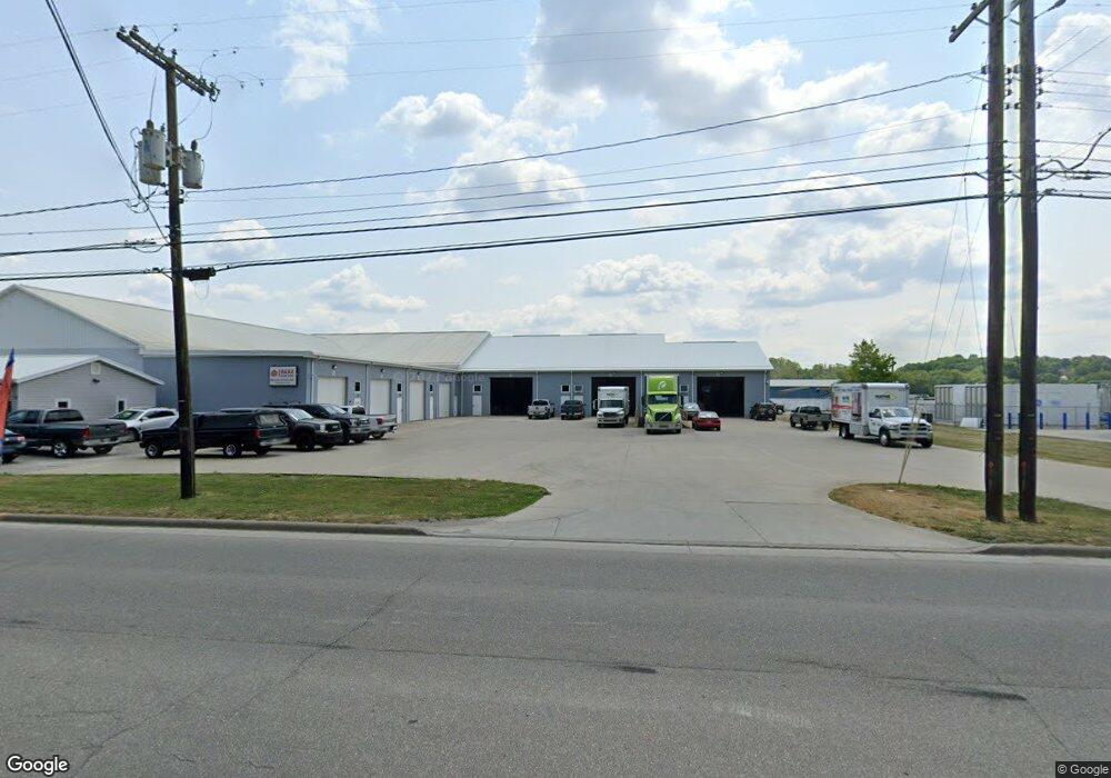
This home is located at 2184 State Route 39 NW, Dover, OH 44622 and is currently estimated at $399,823, approximately $39 per square foot. 2184 State Route 39 NW is a home located in Tuscarawas County with nearby schools including Dover High School, Tuscarawas Central Catholic Elementary School, and Tuscarawas Central Catholic Junior/Senior High School.
Ownership History
Date
Name
Owned For
Owner Type
Purchase Details
Closed on
May 15, 2009
Sold by
Rothacher Dorothy
Bought by
Wayne Real Estate Company Ltd
Current Estimated Value
Purchase Details
Closed on
Jul 22, 1999
Sold by
Rothacher Dorothy M
Bought by
Wells Anthony O and Wells Lois J
Home Financials for this Owner
Home Financials are based on the most recent Mortgage that was taken out on this home.
Original Mortgage
$7,085
Interest Rate
7.54%
Mortgage Type
Commercial
Create a Home Valuation Report for This Property
The Home Valuation Report is an in-depth analysis detailing your home's value as well as a comparison with similar homes in the area
Home Values in the Area
Average Home Value in this Area
Purchase History
| Date | Buyer | Sale Price | Title Company |
|---|---|---|---|
| Wayne Real Estate Company Ltd | $180,000 | American Title | |
| Wells Anthony O | $20,000 | -- |
Source: Public Records
Mortgage History
| Date | Status | Borrower | Loan Amount |
|---|---|---|---|
| Previous Owner | Wells Anthony O | $7,085 |
Source: Public Records
Tax History Compared to Growth
Tax History
| Year | Tax Paid | Tax Assessment Tax Assessment Total Assessment is a certain percentage of the fair market value that is determined by local assessors to be the total taxable value of land and additions on the property. | Land | Improvement |
|---|---|---|---|---|
| 2024 | $7,377 | $141,330 | $17,090 | $124,240 |
| 2023 | $7,377 | $403,790 | $48,820 | $354,970 |
| 2022 | $7,517 | $141,327 | $17,087 | $124,240 |
| 2021 | $7,804 | $132,216 | $12,257 | $119,959 |
| 2020 | $7,816 | $132,216 | $12,257 | $119,959 |
| 2019 | $7,896 | $132,759 | $12,800 | $119,959 |
| 2018 | $8,088 | $132,760 | $12,800 | $119,960 |
| 2017 | $8,106 | $132,760 | $12,800 | $119,960 |
| 2016 | $8,114 | $132,760 | $12,800 | $119,960 |
| 2014 | $1,672 | $35,940 | $12,270 | $23,670 |
| 2013 | $1,674 | $35,940 | $12,270 | $23,670 |
Source: Public Records
Map
Nearby Homes
- 2180 Kimberley Dr NW
- 500 W 13th St
- 159 Charles Dr
- 1411 Chestnut St
- 1319 N Walnut St
- 0000 Red Hill Rd NW
- 3030 N Wooster Ave
- 227 E Slingluff Ave
- 306 E 15th St
- 0 Bair Rd NW Unit 5124469
- 0 Bair Rd NW Unit 5124477
- 0 Bair Rd NW Unit 5124464
- 0 Bair Rd NW Unit 5124485
- 0 Bair Rd NW Unit 5124339
- 0 Bair Rd NW Unit 5124397
- 0 Bair Rd NW Unit 5124402
- 0 Bair Rd NW Unit 5124415
- 0 Bair Rd NW Unit 5124421
- 450 E 5th St
- 442 E 4th St
- 2170 State Route 39 NW
- 2226 Donald St
- 2150 Ohio 39
- 2161 State Route 39 NW
- 2213 State Route 39 NW
- 2198 Donald St
- 2120 Ohio 39
- 2391 Circleview Dr NW
- 3361 Circleview Dr NW
- 2158 Donald St
- 3326 Circleview Dr NW
- 2024 State Route 39 NW
- 2135 State Route 39 NW
- 3272 Circleview Dr NW
- 3183 Reese Rd NW
- 2563 Circleview Dr NW
- 2340 State Route 39 NW
- 3254 Circleview Dr NW
- 2117 State Route 39 NW
- 3259 Circleview Dr NW