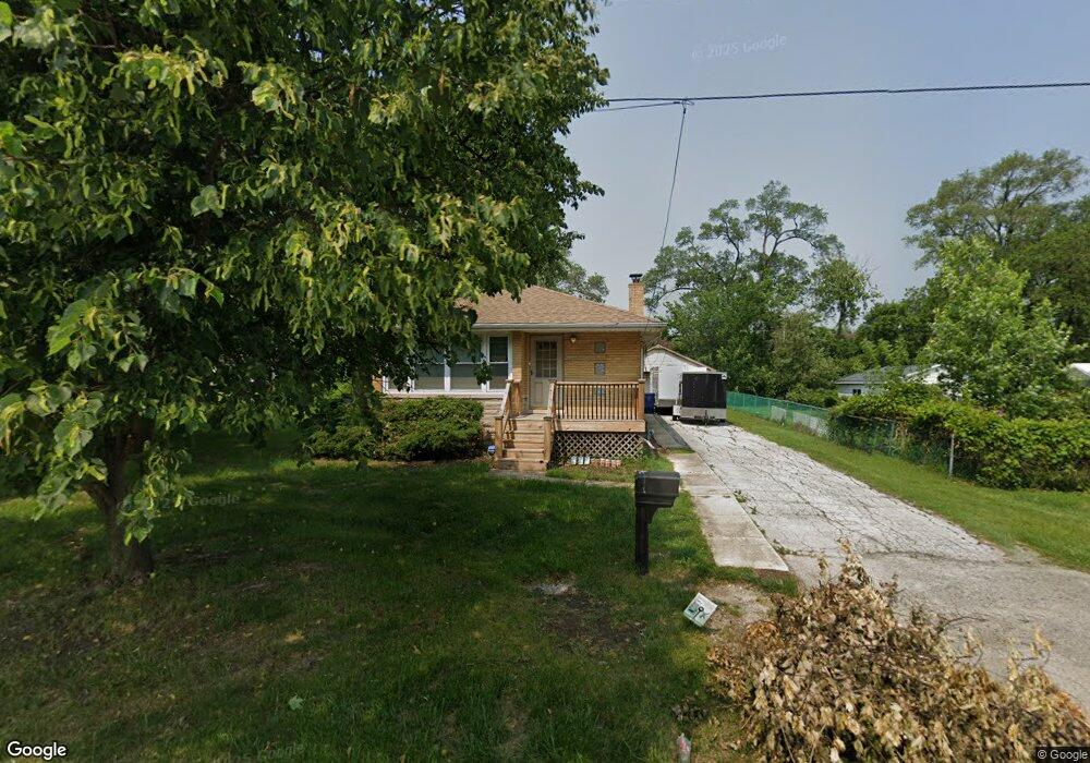
21844 Main St Matteson, IL 60443
Old Matteson NeighborhoodEstimated Value: $175,379 - $220,000
3
Beds
2
Baths
1,082
Sq Ft
$180/Sq Ft
Est. Value
About This Home
This home is located at 21844 Main St, Matteson, IL 60443 and is currently estimated at $194,845, approximately $180 per square foot. 21844 Main St is a home located in Cook County with nearby schools including Illinois School, Matteson Elementary School, and Sauk Elementary School.
Ownership History
Date
Name
Owned For
Owner Type
Purchase Details
Closed on
Apr 23, 2010
Sold by
Ramirez Dorothy and Ramirez Monica
Bought by
Prude Jonnette L
Current Estimated Value
Home Financials for this Owner
Home Financials are based on the most recent Mortgage that was taken out on this home.
Original Mortgage
$122,352
Interest Rate
5.25%
Mortgage Type
FHA
Purchase Details
Closed on
Oct 14, 2009
Sold by
Ramirez Jerome and Ramirez Dorothy
Bought by
Ramirez Jerome and Ramirez Dorothy
Create a Home Valuation Report for This Property
The Home Valuation Report is an in-depth analysis detailing your home's value as well as a comparison with similar homes in the area
Home Values in the Area
Average Home Value in this Area
Purchase History
| Date | Buyer | Sale Price | Title Company |
|---|---|---|---|
| Prude Jonnette L | $124,000 | None Available | |
| Ramirez Jerome | -- | None Available |
Source: Public Records
Mortgage History
| Date | Status | Borrower | Loan Amount |
|---|---|---|---|
| Previous Owner | Prude Jonnette L | $122,352 |
Source: Public Records
Tax History Compared to Growth
Tax History
| Year | Tax Paid | Tax Assessment Tax Assessment Total Assessment is a certain percentage of the fair market value that is determined by local assessors to be the total taxable value of land and additions on the property. | Land | Improvement |
|---|---|---|---|---|
| 2024 | $3,590 | $12,000 | $5,490 | $6,510 |
| 2023 | $2,550 | $12,000 | $5,490 | $6,510 |
| 2022 | $2,550 | $8,122 | $4,804 | $3,318 |
| 2021 | $2,634 | $8,120 | $4,803 | $3,317 |
| 2020 | $2,556 | $8,120 | $4,803 | $3,317 |
| 2019 | $3,299 | $9,804 | $4,460 | $5,344 |
| 2018 | $3,296 | $9,804 | $4,460 | $5,344 |
| 2017 | $3,194 | $9,804 | $4,460 | $5,344 |
| 2016 | $3,418 | $9,449 | $4,117 | $5,332 |
| 2015 | $3,327 | $9,449 | $4,117 | $5,332 |
| 2014 | $3,249 | $9,449 | $4,117 | $5,332 |
| 2013 | $3,701 | $11,205 | $4,117 | $7,088 |
Source: Public Records
Map
Nearby Homes
- 3704 Linden Rd
- 183 Washington St
- 21945 Millard Ave
- 197 Washington St
- 4083 Appleby Ct
- 408 Westgate Dr
- 433 Wildwood Dr
- 363 Winnebago St
- 5013 Euclid Ln
- 116 Walnut St
- 506 Wildwood Dr
- 510 Wildwood Dr
- 505 Wildwood Dr
- 109 Walnut St
- 216 Washington St
- 21607 Main St
- 21829 Richton Rd
- 2077 Lioncrest Dr
- 3817 216th Place
- 3762 216th Place