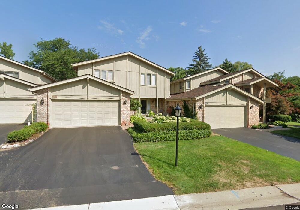
2185 Colony Club Ct West Bloomfield, MI 48322
Estimated Value: $381,000 - $586,000
3
Beds
3
Baths
2,359
Sq Ft
$205/Sq Ft
Est. Value
About This Home
This home is located at 2185 Colony Club Ct, West Bloomfield, MI 48322 and is currently estimated at $483,794, approximately $205 per square foot. 2185 Colony Club Ct is a home located in Oakland County with nearby schools including Wylie E. Groves High School, West Maple Elementary School, and Berkshire Middle School.
Ownership History
Date
Name
Owned For
Owner Type
Purchase Details
Closed on
Apr 15, 2003
Sold by
Freedman Eric and Fredrica Harris Trust
Bought by
Bank Eliot H and Bank Elizabeth M
Current Estimated Value
Purchase Details
Closed on
May 21, 2002
Sold by
Harris Fredrica
Bought by
Fredrica Harris Tr
Create a Home Valuation Report for This Property
The Home Valuation Report is an in-depth analysis detailing your home's value as well as a comparison with similar homes in the area
Home Values in the Area
Average Home Value in this Area
Purchase History
| Date | Buyer | Sale Price | Title Company |
|---|---|---|---|
| Bank Eliot H | $385,000 | Multiple | |
| Fredrica Harris Tr | -- | -- |
Source: Public Records
Tax History Compared to Growth
Tax History
| Year | Tax Paid | Tax Assessment Tax Assessment Total Assessment is a certain percentage of the fair market value that is determined by local assessors to be the total taxable value of land and additions on the property. | Land | Improvement |
|---|---|---|---|---|
| 2024 | $2,479 | $166,900 | $0 | $0 |
| 2022 | $2,379 | $165,970 | $43,800 | $122,170 |
| 2021 | $4,013 | $160,090 | $0 | $0 |
| 2020 | $2,285 | $158,300 | $25,000 | $133,300 |
| 2018 | $3,958 | $125,200 | $15,280 | $109,920 |
| 2015 | -- | $114,720 | $0 | $0 |
| 2014 | -- | $105,290 | $0 | $0 |
| 2011 | -- | $90,810 | $0 | $0 |
Source: Public Records
Map
Nearby Homes
- 2014 Waldons Ct
- 7371 Lindenmere Dr
- 7315 Lindenmere Dr
- 27170 W 14 Mile Rd
- 6800 N Clunbury Rd
- 7250 Ten Hill
- 32620 Inkster Rd
- 6730 Halyard Rd
- 32500 Rock Ridge Ln
- 28786 Rockledge Dr
- 27261 Willowgreen Ct
- 4647 Private Lake Dr
- 29020 Ramblewood Dr
- 6940 Castle Dr
- 7209 Stonebrook Rd
- 6420 Apple Grove Ln Unit 10
- 5312 Cambourne Place
- 7477 Gramercy Cir Unit 17
- 7479 Gramercy Cir Unit 16
- 6720 Castle Dr
- 2181 Colony Club Ct
- 2189 Colony Club Ct
- 2177 Colony Club Ct
- 2200 Colony Club Dr
- 2173 Colony Club Ct
- 2169 Colony Club Ct
- 2165 Colony Club Ct
- 2145 Colony Club Ct
- 2141 Colony Club Ct
- 7142 Suncrest Rd
- 2149 Colony Club Ct
- 2153 Colony Club Ct
- 2161 Colony Club Ct
- 2157 Colony Club Ct
- 7160 Suncrest Rd
- 7136 Suncrest Rd
- 7166 Suncrest Rd
- 7206 Suncrest Rd
- 7172 Suncrest Rd
- 7214 Suncrest Rd