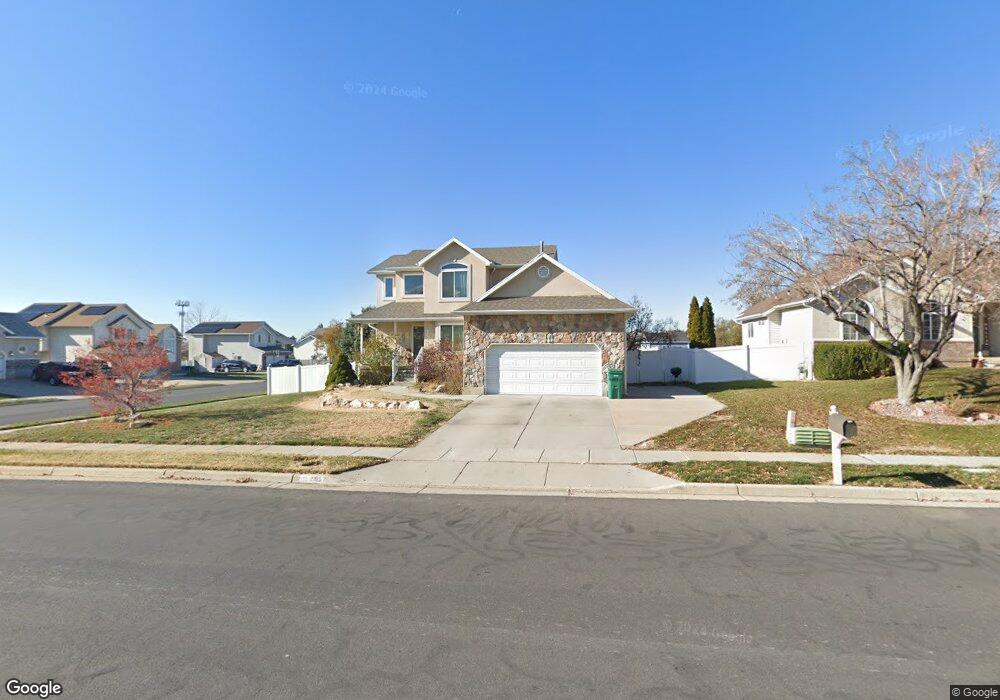
2185 N 800 W Layton, UT 84041
Estimated Value: $542,000 - $580,000
3
Beds
4
Baths
2,692
Sq Ft
$208/Sq Ft
Est. Value
About This Home
This home is located at 2185 N 800 W, Layton, UT 84041 and is currently estimated at $559,353, approximately $207 per square foot. 2185 N 800 W is a home located in Davis County with nearby schools including Lincoln Elementary School, North Layton Junior High School, and Northridge High School.
Ownership History
Date
Name
Owned For
Owner Type
Purchase Details
Closed on
Oct 26, 1998
Sold by
Kirk Darrell G
Bought by
Beasley David A and Beasley Carole A
Current Estimated Value
Home Financials for this Owner
Home Financials are based on the most recent Mortgage that was taken out on this home.
Original Mortgage
$185,334
Outstanding Balance
$40,525
Interest Rate
6.61%
Mortgage Type
VA
Estimated Equity
$518,828
Purchase Details
Closed on
Jun 30, 1998
Sold by
Sli Commercial Real Estate Co
Bought by
Kirk Darrell G
Home Financials for this Owner
Home Financials are based on the most recent Mortgage that was taken out on this home.
Original Mortgage
$3,718
Interest Rate
7.17%
Mortgage Type
Seller Take Back
Create a Home Valuation Report for This Property
The Home Valuation Report is an in-depth analysis detailing your home's value as well as a comparison with similar homes in the area
Home Values in the Area
Average Home Value in this Area
Purchase History
| Date | Buyer | Sale Price | Title Company |
|---|---|---|---|
| Beasley David A | -- | First American Title Co | |
| Kirk Darrell G | -- | Bonneville Title Company Inc |
Source: Public Records
Mortgage History
| Date | Status | Borrower | Loan Amount |
|---|---|---|---|
| Open | Beasley David A | $185,334 | |
| Previous Owner | Kirk Darrell G | $3,718 |
Source: Public Records
Tax History Compared to Growth
Tax History
| Year | Tax Paid | Tax Assessment Tax Assessment Total Assessment is a certain percentage of the fair market value that is determined by local assessors to be the total taxable value of land and additions on the property. | Land | Improvement |
|---|---|---|---|---|
| 2024 | -- | $258,500 | $114,644 | $143,856 |
| 2023 | $369 | $472,000 | $135,424 | $336,576 |
| 2022 | $369 | $264,550 | $71,861 | $192,689 |
| 2021 | $2,405 | $363,000 | $101,491 | $261,509 |
| 2020 | $2,182 | $316,000 | $85,106 | $230,894 |
| 2019 | $2,101 | $298,000 | $80,567 | $217,433 |
| 2018 | $1,938 | $276,000 | $80,567 | $195,433 |
| 2016 | $1,872 | $137,500 | $25,928 | $111,572 |
| 2015 | $1,919 | $133,815 | $25,928 | $107,887 |
| 2014 | $457 | $131,849 | $25,928 | $105,921 |
| 2013 | -- | $117,534 | $26,884 | $90,650 |
Source: Public Records
Map
Nearby Homes
- 781 W 2150 N
- 2402 N 725 W
- 2211 N 525 W
- 2378 N 675 W
- 2187 N 450 W
- 1837 N 440 W
- 1676 Forbes Ave W
- 1094 N Angel St W
- 1413 W 1650 N
- 1500 N Angel St Unit 12
- 1500 N Angel St Unit 64
- 1500 N Angel St Unit 22
- 1615 N Angel St Unit E
- 1615 N Angel St Unit H
- 1615 N Angel St Unit I
- 1615 N Angel St Unit F
- 1615 N Angel St Unit G
- 1615 N Angel St
- 1615 N Angel St Unit D
- 1615 N Angel St Unit C