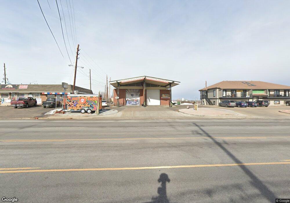
2185 W 84th Ave Denver, CO 80260
Estimated Value: $455,539
--
Bed
--
Bath
2,204
Sq Ft
$207/Sq Ft
Est. Value
About This Home
This home is located at 2185 W 84th Ave, Denver, CO 80260 and is currently estimated at $455,539, approximately $206 per square foot. 2185 W 84th Ave is a home located in Adams County with nearby schools including Rocky Mountain Elementary School, Thornton Middle School, and Northglenn High School.
Ownership History
Date
Name
Owned For
Owner Type
Purchase Details
Closed on
Aug 29, 2018
Sold by
Highway 2 Llc
Bought by
Hall Matthew and Valentine Michael David
Current Estimated Value
Home Financials for this Owner
Home Financials are based on the most recent Mortgage that was taken out on this home.
Original Mortgage
$350,000
Outstanding Balance
$222,129
Interest Rate
5.57%
Mortgage Type
Future Advance Clause Open End Mortgage
Estimated Equity
$233,410
Purchase Details
Closed on
Oct 6, 2014
Sold by
The Southwest Adams County Fire Protecti
Bought by
Highway 2 Llc
Create a Home Valuation Report for This Property
The Home Valuation Report is an in-depth analysis detailing your home's value as well as a comparison with similar homes in the area
Home Values in the Area
Average Home Value in this Area
Purchase History
| Date | Buyer | Sale Price | Title Company |
|---|---|---|---|
| Hall Matthew | $450,000 | Land Title Guarantee Co | |
| Highway 2 Llc | $255,000 | Heritage Title |
Source: Public Records
Mortgage History
| Date | Status | Borrower | Loan Amount |
|---|---|---|---|
| Open | Hall Matthew | $350,000 |
Source: Public Records
Tax History Compared to Growth
Tax History
| Year | Tax Paid | Tax Assessment Tax Assessment Total Assessment is a certain percentage of the fair market value that is determined by local assessors to be the total taxable value of land and additions on the property. | Land | Improvement |
|---|---|---|---|---|
| 2024 | $12,658 | $133,890 | $54,710 | $79,180 |
| 2023 | $12,559 | $116,840 | $56,540 | $60,300 |
| 2022 | $11,207 | $91,390 | $58,770 | $32,620 |
| 2021 | $11,172 | $91,390 | $58,770 | $32,620 |
| 2020 | $11,255 | $91,390 | $58,770 | $32,620 |
| 2019 | $11,266 | $91,390 | $58,770 | $32,620 |
| 2018 | $9,674 | $76,220 | $43,600 | $32,620 |
| 2017 | $8,859 | $76,220 | $43,600 | $32,620 |
| 2016 | $8,652 | $72,430 | $39,810 | $32,620 |
| 2015 | $8,646 | $72,430 | $39,810 | $32,620 |
| 2014 | -- | $45,620 | $13,000 | $32,620 |
Source: Public Records
Map
Nearby Homes
- 8361 Wyandot St
- 4809 N Tejon St
- 4815 N Tejon St
- 8330 Zuni St Unit 101
- 8330 Zuni St Unit 109
- 8330 Zuni St Unit 212
- 8330 Zuni St Unit 117
- 8330 Zuni St Unit 209
- 2200 W 82nd Place
- 2430 W 82nd Place Unit 2F
- 8247 Vanguard Dr
- 8188 Pecos Way
- 2420 W 82nd Place Unit F
- 8450 Decatur St Unit 97
- 8450 Decatur St Unit 98
- 8470 Decatur St Unit 80
- 8077 Bryant St
- 2760 W 86th Ave Unit 147
- 2740 W 86th Ave Unit 188
- 2740 W 86th Ave Unit 186
- 2235 W 84th Ave
- 8387 Umatilla St
- 8386 Vallejo St
- 8455 Umatilla St
- 8377 Umatilla St
- 8376 Vallejo St
- 8384 Umatilla St
- 8389 Vallejo St
- 8367 Umatilla St
- 8444 Zuni St
- 8374 Umatilla St
- 8379 Vallejo St
- 8366 Vallejo St
- 8385 Tejon St
- 8378 Wyandot St
- 8369 Vallejo St
- 8357 Umatilla St
- 8364 Umatilla St
- 8375 Tejon St
- 8356 Vallejo St
