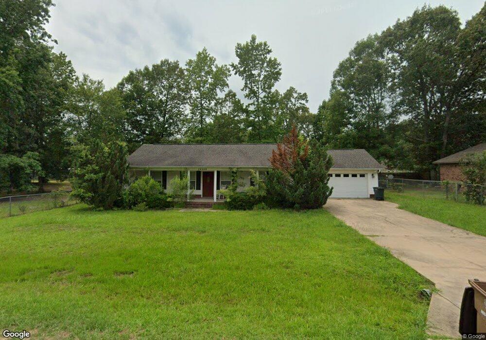
21851 Mountain Maple Cir Hensley, AR 72065
Estimated Value: $163,000 - $176,000
--
Bed
2
Baths
1,288
Sq Ft
$133/Sq Ft
Est. Value
About This Home
This home is located at 21851 Mountain Maple Cir, Hensley, AR 72065 and is currently estimated at $171,026, approximately $132 per square foot. 21851 Mountain Maple Cir is a home located in Saline County with nearby schools including Sheridan High School.
Ownership History
Date
Name
Owned For
Owner Type
Purchase Details
Closed on
Jan 31, 2008
Sold by
Freeman Boby Dwain and Freeman Rutha Lee
Bought by
Smith James Mark
Current Estimated Value
Home Financials for this Owner
Home Financials are based on the most recent Mortgage that was taken out on this home.
Original Mortgage
$125,853
Outstanding Balance
$79,400
Interest Rate
6.15%
Mortgage Type
New Conventional
Estimated Equity
$91,626
Purchase Details
Closed on
Apr 16, 2004
Bought by
B and Freeman
Purchase Details
Closed on
Apr 4, 2004
Bought by
B and Freeman
Purchase Details
Closed on
Apr 8, 1999
Bought by
Maple Creek
Purchase Details
Closed on
Aug 24, 1994
Bought by
Plct
Purchase Details
Closed on
Jul 1, 1992
Bought by
Easley
Purchase Details
Closed on
May 1, 1988
Bought by
Guaranty
Create a Home Valuation Report for This Property
The Home Valuation Report is an in-depth analysis detailing your home's value as well as a comparison with similar homes in the area
Home Values in the Area
Average Home Value in this Area
Purchase History
| Date | Buyer | Sale Price | Title Company |
|---|---|---|---|
| Smith James Mark | $125,000 | First National Title Company | |
| B | $10,000 | -- | |
| B | $10,000 | -- | |
| Maple Creek | $32,000 | -- | |
| Comm Venture | -- | -- | |
| Plct | $26,000 | -- | |
| Easley | $28,000 | -- | |
| Guaranty | -- | -- |
Source: Public Records
Mortgage History
| Date | Status | Borrower | Loan Amount |
|---|---|---|---|
| Open | Smith James Mark | $125,853 |
Source: Public Records
Tax History Compared to Growth
Tax History
| Year | Tax Paid | Tax Assessment Tax Assessment Total Assessment is a certain percentage of the fair market value that is determined by local assessors to be the total taxable value of land and additions on the property. | Land | Improvement |
|---|---|---|---|---|
| 2025 | $1,310 | $29,508 | $5,520 | $23,988 |
| 2024 | $1,201 | $29,508 | $5,520 | $23,988 |
| 2023 | $1,673 | $29,508 | $5,520 | $23,988 |
| 2022 | $1,548 | $29,508 | $5,520 | $23,988 |
| 2021 | $1,392 | $24,920 | $4,600 | $20,320 |
| 2020 | $1,392 | $24,920 | $4,600 | $20,320 |
| 2019 | $1,392 | $24,920 | $4,600 | $20,320 |
| 2018 | $1,310 | $24,920 | $4,600 | $20,320 |
| 2017 | $1,301 | $24,920 | $4,600 | $20,320 |
| 2016 | $986 | $23,540 | $4,000 | $19,540 |
| 2015 | $986 | $23,540 | $4,000 | $19,540 |
| 2014 | $1,127 | $23,540 | $4,000 | $19,540 |
Source: Public Records
Map
Nearby Homes
- 3042 E Woodson Lateral Rd
- 1436 Lakeshore Dr
- 000 Nabholtz Rd
- 000 Hwy 167
- 1102 Wilma Sue
- 12697 Highway 167 N
- Lot 10 Three Corners Acres
- 188 Kelton Ln
- 157 Kelton Ln
- 149 Kelton Ln
- 000 Warnix Ln
- 000 Buddy Dr
- 348 Alyece Ln
- 17825 Cullipher Ln
- 19101 Oaklawn Cove
- 3401 W Hensley Rd
- 25601 Sunshine Ln
- 1627 Lorance Dr
- 1024 Ridgewood Dr
- 1641 Lorance Dr
- 21829 Mountain Maple Cir
- 21939 Mountain Maple Cir
- 21919 Mountain Maple Cir
- 21821 Mountain Maple Cir
- 21860 Mountain Maple Cir
- 21887 Mountain Maple Cir
- 21830 Mountain Maple Cir
- 21945 Mountain Maple Cir
- 21905 Mountain Maple Cir
- 21874 Mountain Maple Cir
- 21820 Mountain Maple Cir
- 21813 Mountain Maple Cir
- 21930 Mountain Maple Cir
- 21924 Mountain Maple Cir
- 21938 Mountain Maple Cir
- 21940 Silver Maple Dr
- 21936 Silver Maple Dr
- 21946 Silver Maple Dr
- 21918 Mountain Maple Cir
- 0 Mountain Maple Cir