Estimated Value: $395,099 - $440,000
4
Beds
3
Baths
2,194
Sq Ft
$187/Sq Ft
Est. Value
About This Home
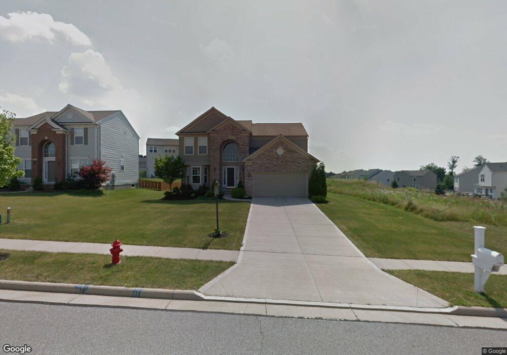
This home is located at 2186 Crockett Cir, Stow, OH 44224 and is currently estimated at $410,775, approximately $187 per square foot. 2186 Crockett Cir is a home located in Summit County with nearby schools including Stow-Munroe Falls High School, Primrose School of Hudson, and Holy Family Elementary School.
Ownership History
Date
Name
Owned For
Owner Type
Purchase Details
Closed on
Feb 26, 2010
Sold by
Kline Vicki A
Bought by
Reef Ii James S and Schrader Kelly A
Current Estimated Value
Home Financials for this Owner
Home Financials are based on the most recent Mortgage that was taken out on this home.
Original Mortgage
$210,600
Interest Rate
5.11%
Mortgage Type
New Conventional
Purchase Details
Closed on
Jul 18, 2007
Sold by
Juvan Dennis P
Bought by
Kline Vicki A
Purchase Details
Closed on
Oct 3, 2005
Sold by
Pulte Homes Of Ohio Llc
Bought by
Juvan Dennis P and Kline Vicki A
Home Financials for this Owner
Home Financials are based on the most recent Mortgage that was taken out on this home.
Original Mortgage
$100,000
Interest Rate
5.83%
Mortgage Type
Fannie Mae Freddie Mac
Create a Home Valuation Report for This Property
The Home Valuation Report is an in-depth analysis detailing your home's value as well as a comparison with similar homes in the area
Home Values in the Area
Average Home Value in this Area
Purchase History
| Date | Buyer | Sale Price | Title Company |
|---|---|---|---|
| Reef Ii James S | $234,000 | Kingdom Title | |
| Kline Vicki A | -- | Attorney | |
| Juvan Dennis P | $248,525 | Pulte Title Agency Llc |
Source: Public Records
Mortgage History
| Date | Status | Borrower | Loan Amount |
|---|---|---|---|
| Previous Owner | Reef Ii James S | $210,600 | |
| Previous Owner | Juvan Dennis P | $100,000 |
Source: Public Records
Tax History Compared to Growth
Tax History
| Year | Tax Paid | Tax Assessment Tax Assessment Total Assessment is a certain percentage of the fair market value that is determined by local assessors to be the total taxable value of land and additions on the property. | Land | Improvement |
|---|---|---|---|---|
| 2025 | $6,179 | $109,855 | $21,368 | $88,487 |
| 2024 | $6,179 | $109,855 | $21,368 | $88,487 |
| 2023 | $6,179 | $109,855 | $21,368 | $88,487 |
| 2022 | $5,789 | $90,889 | $17,658 | $73,231 |
| 2021 | $5,181 | $90,889 | $17,658 | $73,231 |
| 2020 | $5,092 | $90,890 | $17,660 | $73,230 |
| 2019 | $4,703 | $78,400 | $17,300 | $61,100 |
| 2018 | $4,626 | $78,400 | $17,300 | $61,100 |
| 2017 | $4,620 | $78,400 | $17,300 | $61,100 |
| 2016 | $4,755 | $76,130 | $17,300 | $58,830 |
| 2015 | $4,620 | $76,130 | $17,300 | $58,830 |
| 2014 | $4,624 | $76,130 | $17,300 | $58,830 |
| 2013 | $4,515 | $74,790 | $17,300 | $57,490 |
Source: Public Records
Map
Nearby Homes
- 4846 Garnet Cir
- 2327 Crockett Cir
- 2380 Port Williams Dr Unit 2380
- 0 Stow Rd Unit 5102979
- 4630 Red Willow Rd
- 1938 Higby Dr
- 5114 Bayside Lake Blvd
- 2017 Kingsdale Dr
- 1884 Village Ct Unit X66
- 2410 Wrens Dr S
- 5217 Beckett Ridge
- V/L Norton Rd
- 2028 Crestdale Dr
- 4944 Friar Rd Unit D
- 1808 Higby Dr Unit A
- 1664 Cypress Ct
- 1668 Cypress Ct
- 1525 Spruce Hill Dr
- 4877 Cedar Crest Ln
- 4901 Independence Cir Unit B
- 2194 Crockett Cir
- 2202 Crockett Cir
- 2191 Duxbury
- 2380 Harvester Dr
- 2187 Crockett Cir
- 2195 Crockett Cir
- 2181 Duxbury
- 2374 Harvester Dr
- 2201 Duxbury
- 2203 Crockett Cir
- 2220 Crockett Cir
- 2368 Harvester Dr
- 2211 Crockett Cir
- 2219 Duxbury
- 4864 Somerset Dr
- 2178 Duxbury
- 2388 Harvester Dr
- 4858 Somerset Dr
- 2214 Cranford Dr
- 2221 Crockett Cir