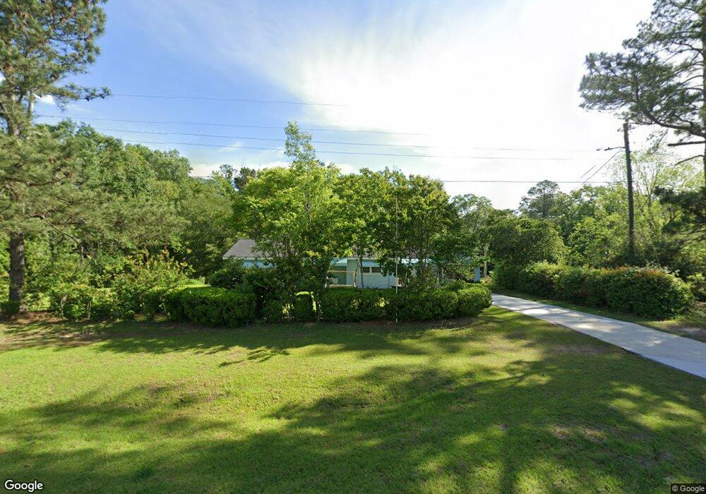
2186 Old Doerun Rd Moultrie, GA 31768
Estimated Value: $148,962 - $194,000
--
Bed
2
Baths
1,464
Sq Ft
$120/Sq Ft
Est. Value
About This Home
This home is located at 2186 Old Doerun Rd, Moultrie, GA 31768 and is currently estimated at $175,741, approximately $120 per square foot. 2186 Old Doerun Rd is a home located in Colquitt County with nearby schools including Doerun Elementary School, C.A. Gray Junior High School, and Willie J. Williams Middle School.
Ownership History
Date
Name
Owned For
Owner Type
Purchase Details
Closed on
May 23, 2024
Sold by
Dasher Carl M
Bought by
Kent Joseph Lamar
Current Estimated Value
Purchase Details
Closed on
Oct 27, 2004
Sold by
Dasher Carl M Life Estat
Bought by
Kent Joseph Lamar
Purchase Details
Closed on
Oct 11, 1996
Bought by
Lairsey Lola May-Lf Est
Purchase Details
Closed on
Aug 10, 1995
Bought by
Lairsey Lola May
Purchase Details
Closed on
Aug 8, 1978
Bought by
Lairsey Marshall L
Create a Home Valuation Report for This Property
The Home Valuation Report is an in-depth analysis detailing your home's value as well as a comparison with similar homes in the area
Home Values in the Area
Average Home Value in this Area
Purchase History
| Date | Buyer | Sale Price | Title Company |
|---|---|---|---|
| Kent Joseph Lamar | -- | -- | |
| Kent Joseph Lamar | -- | -- | |
| Lairsey Lola May-Lf Est | -- | -- | |
| Lairsey Lola May | -- | -- | |
| Lairsey Marshall L | -- | -- |
Source: Public Records
Tax History Compared to Growth
Tax History
| Year | Tax Paid | Tax Assessment Tax Assessment Total Assessment is a certain percentage of the fair market value that is determined by local assessors to be the total taxable value of land and additions on the property. | Land | Improvement |
|---|---|---|---|---|
| 2024 | $926 | $40,028 | $11,704 | $28,324 |
| 2023 | $711 | $29,239 | $11,704 | $17,535 |
| 2022 | $504 | $27,364 | $10,402 | $16,962 |
| 2021 | $565 | $29,528 | $10,402 | $19,126 |
| 2020 | $552 | $28,570 | $10,402 | $18,168 |
| 2019 | $618 | $28,729 | $10,402 | $18,327 |
| 2018 | $735 | $28,729 | $10,402 | $18,327 |
| 2017 | $522 | $25,446 | $7,119 | $18,327 |
| 2016 | $462 | $22,993 | $7,119 | $15,874 |
| 2015 | $466 | $22,993 | $7,119 | $15,874 |
| 2014 | $455 | $22,993 | $7,119 | $15,874 |
| 2013 | -- | $22,992 | $7,118 | $15,874 |
Source: Public Records
Map
Nearby Homes
- 107 30th Ave NW
- 3233 Sylvester Dr
- 15,23,27 29th Ave NW
- 178 Cool Breeze Dr
- 218 Gusty Rd
- 102 Schley Church Rd
- 1208 Maple St
- 0 S U Highway 319 N
- 2393 Georgia 37
- 722 Martin Luther King jr Dr
- 410 W Bypass Pass NW
- 410 West Bypass NW
- 1321 Hallmark Dr
- 408 9th St NW
- 00 Rossman Dairy Rd
- 316 5th Ave NW
- 521 5th Ave NW
- 216 Circle Rd
- 615 1st St NW
- 503 2nd St NW
- 2170 Old Doerun Rd
- 2160 Old Doerun Rd
- 2204 Old Doerun Rd
- 2220 Old Doerun Rd
- 2234 Old Doerun Rd
- 3128 Old Doerun Rd
- 3128 Old Doerun Rd
- 2122 Old Doerun Rd
- 166 Halls Ln
- 2290 Old Doerun Rd
- 165 Halls Ln
- 2310 Old Doerun Rd
- 1381 Woodmen Rd
- 2334 Old Doerun Rd
- 135 Halls Ln
- 231 Halls Ln
- 2344 Old Doerun Rd
- 181 Halls Trail
- 110 Halls Ln
- 2057 Old Doerun Rd