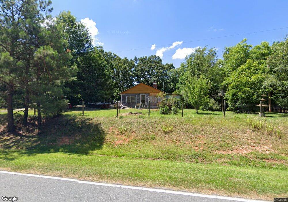
2187 Chrisco Rd W Seagrove, NC 27341
Estimated Value: $89,000 - $231,000
3
Beds
1
Bath
1,258
Sq Ft
$127/Sq Ft
Est. Value
About This Home
This home is located at 2187 Chrisco Rd W, Seagrove, NC 27341 and is currently estimated at $160,000, approximately $127 per square foot. 2187 Chrisco Rd W is a home located in Moore County with nearby schools including Westmoore Elementary School, Elise Middle School, and North Moore High School.
Ownership History
Date
Name
Owned For
Owner Type
Purchase Details
Closed on
Nov 3, 2006
Sold by
Davis Donald R
Bought by
Kennedy William H and Kennedy Pamela M
Current Estimated Value
Home Financials for this Owner
Home Financials are based on the most recent Mortgage that was taken out on this home.
Original Mortgage
$37,000
Interest Rate
6.31%
Mortgage Type
Unknown
Purchase Details
Closed on
Mar 16, 2004
Sold by
Davis Donald Ray
Bought by
Kennedy William H and Kennedy Pamela M
Create a Home Valuation Report for This Property
The Home Valuation Report is an in-depth analysis detailing your home's value as well as a comparison with similar homes in the area
Home Values in the Area
Average Home Value in this Area
Purchase History
| Date | Buyer | Sale Price | Title Company |
|---|---|---|---|
| Kennedy William H | $42,000 | None Available | |
| Kennedy William H | -- | -- |
Source: Public Records
Mortgage History
| Date | Status | Borrower | Loan Amount |
|---|---|---|---|
| Closed | Kennedy William H | $37,000 |
Source: Public Records
Tax History Compared to Growth
Tax History
| Year | Tax Paid | Tax Assessment Tax Assessment Total Assessment is a certain percentage of the fair market value that is determined by local assessors to be the total taxable value of land and additions on the property. | Land | Improvement |
|---|---|---|---|---|
| 2024 | $357 | $82,140 | $39,790 | $42,350 |
| 2023 | $374 | $82,140 | $39,790 | $42,350 |
| 2022 | $408 | $64,780 | $34,490 | $30,290 |
| 2021 | $424 | $64,780 | $34,490 | $30,290 |
| 2020 | $418 | $63,910 | $34,490 | $29,420 |
| 2019 | $418 | $64,780 | $34,490 | $30,290 |
| 2018 | $368 | $61,300 | $34,490 | $26,810 |
| 2017 | $359 | $61,300 | $34,490 | $26,810 |
| 2015 | $346 | $61,300 | $34,490 | $26,810 |
| 2014 | -- | $65,040 | $39,630 | $25,410 |
| 2013 | -- | $65,040 | $39,630 | $25,410 |
Source: Public Records
Map
Nearby Homes
- 2244 Chrisco Rd W
- 2324 Chrisco Rd W
- 2344 Chrisco Rd W
- 2015 Chrisco Rd W
- 2428 Chrisco Rd W
- 2019 Chrisco Rd W
- 1950 Chrisco Rd W
- 231 Thompson Rd
- 1995 Chrisco Rd W
- 2472 Chrisco Rd W
- 1910 Chrisco Rd W
- 1888 Chrisco Rd W
- 1875 Chrisco Rd W
- 1171 Adams Rd
- 0 W Chrisco Rd
- 1119 Adams Rd
- 1938 Chrisco Rd W
- 320 Thompson Rd
- 1808 Chrisco Rd W
- 1808 Chrisco Rd W