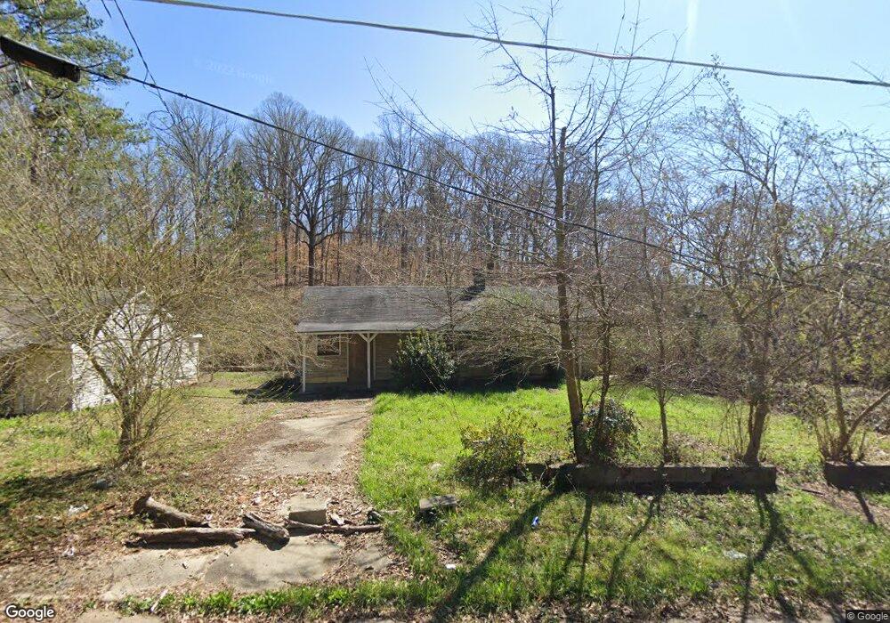
2188 Alvin Dr NW Atlanta, GA 30318
Almond Park NeighborhoodEstimated Value: $187,000 - $263,000
3
Beds
2
Baths
1,200
Sq Ft
$195/Sq Ft
Est. Value
About This Home
This home is located at 2188 Alvin Dr NW, Atlanta, GA 30318 and is currently estimated at $234,239, approximately $195 per square foot. 2188 Alvin Dr NW is a home located in Fulton County with nearby schools including Boyd Elementary School, John Lewis Invictus Academy, and Frederick Douglass High School.
Ownership History
Date
Name
Owned For
Owner Type
Purchase Details
Closed on
Oct 16, 2012
Sold by
Derrick Michael
Bought by
Gill Pablo Sabastian
Current Estimated Value
Purchase Details
Closed on
Jul 22, 2009
Sold by
Federal Home Loan Mortgage Corporation
Bought by
Derrick Michael
Purchase Details
Closed on
Jun 2, 2009
Sold by
Indymac Federal Bank Fsb
Bought by
Federal Home Loan Mortgage Corporation
Purchase Details
Closed on
Jun 11, 2002
Sold by
Pittman Helen B
Bought by
Visionary Property Investment Ll
Home Financials for this Owner
Home Financials are based on the most recent Mortgage that was taken out on this home.
Original Mortgage
$66,500
Interest Rate
6.75%
Mortgage Type
New Conventional
Create a Home Valuation Report for This Property
The Home Valuation Report is an in-depth analysis detailing your home's value as well as a comparison with similar homes in the area
Home Values in the Area
Average Home Value in this Area
Purchase History
| Date | Buyer | Sale Price | Title Company |
|---|---|---|---|
| Gill Pablo Sabastian | $7,800 | -- | |
| Derrick Michael | -- | -- | |
| Federal Home Loan Mortgage Corporation | -- | -- | |
| Indymac Federal Bank Fsb | $116,796 | -- | |
| Visionary Property Investment Ll | $66,500 | -- |
Source: Public Records
Mortgage History
| Date | Status | Borrower | Loan Amount |
|---|---|---|---|
| Previous Owner | Visionary Property Investment Ll | $66,500 |
Source: Public Records
Tax History Compared to Growth
Tax History
| Year | Tax Paid | Tax Assessment Tax Assessment Total Assessment is a certain percentage of the fair market value that is determined by local assessors to be the total taxable value of land and additions on the property. | Land | Improvement |
|---|---|---|---|---|
| 2025 | $2,501 | $85,560 | $31,040 | $54,520 |
| 2023 | $3,246 | $78,400 | $22,320 | $56,080 |
| 2022 | $2,579 | $63,720 | $11,880 | $51,840 |
| 2021 | $1,748 | $43,160 | $11,680 | $31,480 |
| 2020 | $1,465 | $35,760 | $7,800 | $27,960 |
| 2019 | $485 | $34,080 | $4,440 | $29,640 |
| 2018 | $623 | $15,040 | $3,000 | $12,040 |
| 2017 | $627 | $14,520 | $2,920 | $11,600 |
| 2016 | $629 | $14,520 | $2,920 | $11,600 |
| 2015 | $1,099 | $14,520 | $2,920 | $11,600 |
| 2014 | $658 | $14,520 | $2,920 | $11,600 |
Source: Public Records
Map
Nearby Homes
- 0 Lotus Ave NW Unit 7651300
- 0 Lotus Ave NW Unit 10607153
- 1799 Willow Way NW
- 1131 Cato St NW
- 1075 Cato St NW
- 1050 Cato St NW
- 0 Hollywood Rd NW Unit 7480423
- 0 Hollywood Rd NW Unit 7525127
- 889 Hollywood Rd
- 2371 Saint James Dr NW
- 2332 Saint James Dr NW
- 2395 Saint James Dr NW
- 879 Samples Ln NW
- 965 Cato St NW
- 1947 Drew Dr
- 1987 Ruth St NW
- 2015 Lois Place NW
- 2470 Saint Paul Ave NW
- 1985 Lois Place NW
- 1981 Lois Place NW
- 2184 Alvin Dr NW
- 1272 Gun Club Rd NW
- 2239 Alvin Dr NW
- 1273 Gun Club Rd NW
- 0 Gun Club Dr NW Unit 5243429
- 0 Gun Club Dr NW Unit 9077349
- 1430 Gun Club Rd NW
- 0 Gun Club Dr NW Unit 7342278
- 1043 Gun Club Rd NW
- 1286 Gun Club Rd NW
- 2206 Mack Dr NW
- 2182 Mack Dr NW
- 2487 Sycamore Rd NW Unit 7
- 2443 Sycamore Rd NW
- 2487 Sycamore Rd NW
- 0 Mack Dr NW Unit 7192442
- 0 Mack Dr NW Unit 5226301
- 0 Mack Dr NW Unit 9037887
- 0 Mack Dr NW Unit 6907231
- 0 Mack Dr NW Unit 7192472