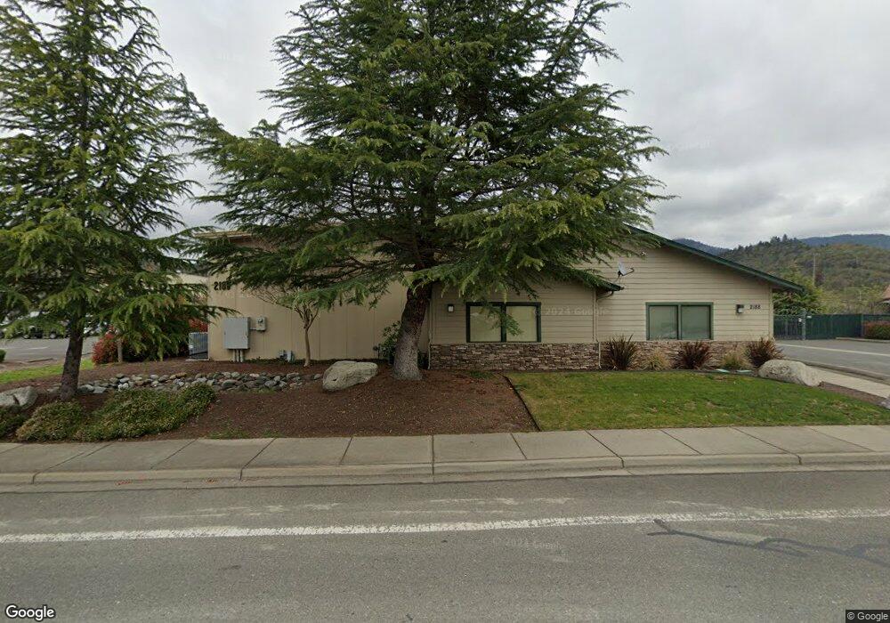
2188 NE Spalding Ave Grants Pass, OR 97526
Estimated Value: $716,170
--
Bed
--
Bath
6,200
Sq Ft
$116/Sq Ft
Est. Value
About This Home
This home is located at 2188 NE Spalding Ave, Grants Pass, OR 97526 and is currently estimated at $716,170, approximately $115 per square foot. 2188 NE Spalding Ave is a home located in Josephine County with nearby schools including Riverside Elementary School, North Middle School, and Grants Pass High School.
Ownership History
Date
Name
Owned For
Owner Type
Purchase Details
Closed on
Oct 1, 2025
Sold by
Play Pen Toys Llc
Bought by
Mills Machining Llc
Current Estimated Value
Purchase Details
Closed on
Dec 9, 2019
Sold by
Wheeler Off Road Holdings Llc
Bought by
Org Industry Llc
Purchase Details
Closed on
Apr 7, 2015
Sold by
Urias Nanci M
Bought by
Wheelers Off Road Holdings Llc
Home Financials for this Owner
Home Financials are based on the most recent Mortgage that was taken out on this home.
Original Mortgage
$228,500
Interest Rate
3.76%
Mortgage Type
Commercial
Purchase Details
Closed on
Oct 3, 2005
Sold by
Urias Ex Llc
Bought by
Urias Raymond L
Purchase Details
Closed on
Apr 22, 2005
Sold by
Spalding & Son Inc
Bought by
Urias Ex Llc
Home Financials for this Owner
Home Financials are based on the most recent Mortgage that was taken out on this home.
Original Mortgage
$97,000
Interest Rate
5.92%
Mortgage Type
Purchase Money Mortgage
Create a Home Valuation Report for This Property
The Home Valuation Report is an in-depth analysis detailing your home's value as well as a comparison with similar homes in the area
Home Values in the Area
Average Home Value in this Area
Purchase History
| Date | Buyer | Sale Price | Title Company |
|---|---|---|---|
| Mills Machining Llc | $800,000 | Ticor Title | |
| Org Industry Llc | $645,000 | First American | |
| Wheelers Off Road Holdings Llc | $532,000 | First American | |
| Urias Raymond L | -- | -- | |
| Urias Ex Llc | $93,201 | First American Title Ins Co |
Source: Public Records
Mortgage History
| Date | Status | Borrower | Loan Amount |
|---|---|---|---|
| Previous Owner | Wheelers Off Road Holdings Llc | $228,500 | |
| Previous Owner | Urias Ex Llc | $97,000 |
Source: Public Records
Tax History Compared to Growth
Tax History
| Year | Tax Paid | Tax Assessment Tax Assessment Total Assessment is a certain percentage of the fair market value that is determined by local assessors to be the total taxable value of land and additions on the property. | Land | Improvement |
|---|---|---|---|---|
| 2025 | $7,611 | $586,120 | -- | -- |
| 2024 | $7,611 | $569,050 | -- | -- |
| 2023 | $7,133 | $536,390 | $153,110 | $383,280 |
| 2022 | $6,939 | $536,390 | $153,110 | $383,280 |
| 2021 | $6,879 | $536,390 | $0 | $0 |
| 2020 | $6,861 | $536,390 | $0 | $0 |
| 2019 | $6,848 | $536,390 | $0 | $0 |
| 2018 | $7,166 | $536,390 | $0 | $0 |
| 2017 | $7,614 | $552,480 | $0 | $0 |
| 2016 | $6,554 | $536,390 | $0 | $0 |
| 2015 | $6,529 | $536,390 | $0 | $0 |
| 2014 | $6,541 | $536,390 | $0 | $0 |
Source: Public Records
Map
Nearby Homes
- 2024 Kayleigh Way
- 2215 SE Portola Dr
- 1708 Softwood Way
- 2250 Rogue River Hwy
- 2700 Rogue River Hwy
- 4424 Foothill Blvd
- 1034 SE Camelot Dr
- 1004 SE Camelot Dr
- 2060 NE Fairview Ave
- 1455 SE Rogue Dr
- 905 SE Fern St
- 1752 NE Foothill Blvd
- 1035 SE Ashley Place
- 409 NE Royal Dr
- 1060 SE Oriole St
- 1405 NE Laura Ct
- 2798 Foothill Blvd
- 3039 Pearce Park Rd
- 1059 SE Belle Aire Dr
- 1665 Fruitdale Dr
- 2185 NE Spalding Ave Unit 8
- 2163 NE Spalding Ave Unit 20
- 2163 NE Spalding Ave
- 2245 NE Spalding Ave Unit B
- 2150 N Spalding Ave
- 2150 NE Spalding Ave
- 2214 Industry Way
- 2214 NE Industry Dr
- 2151 NE Industry Way
- 2106 Kayleigh Way
- 2112 SE Kayleigh Way
- 2118 SE Kayleigh Way
- 2124 SE Kayleigh Way
- 320 Shannon Ln
- 2186 NE Industry Dr
- 2172 NE Industry Dr
- 2100 SE Kayleigh Way
- 2130 SE Kayleigh Way
- 2137 NE Industry Dr
- 114 Assembly Cir