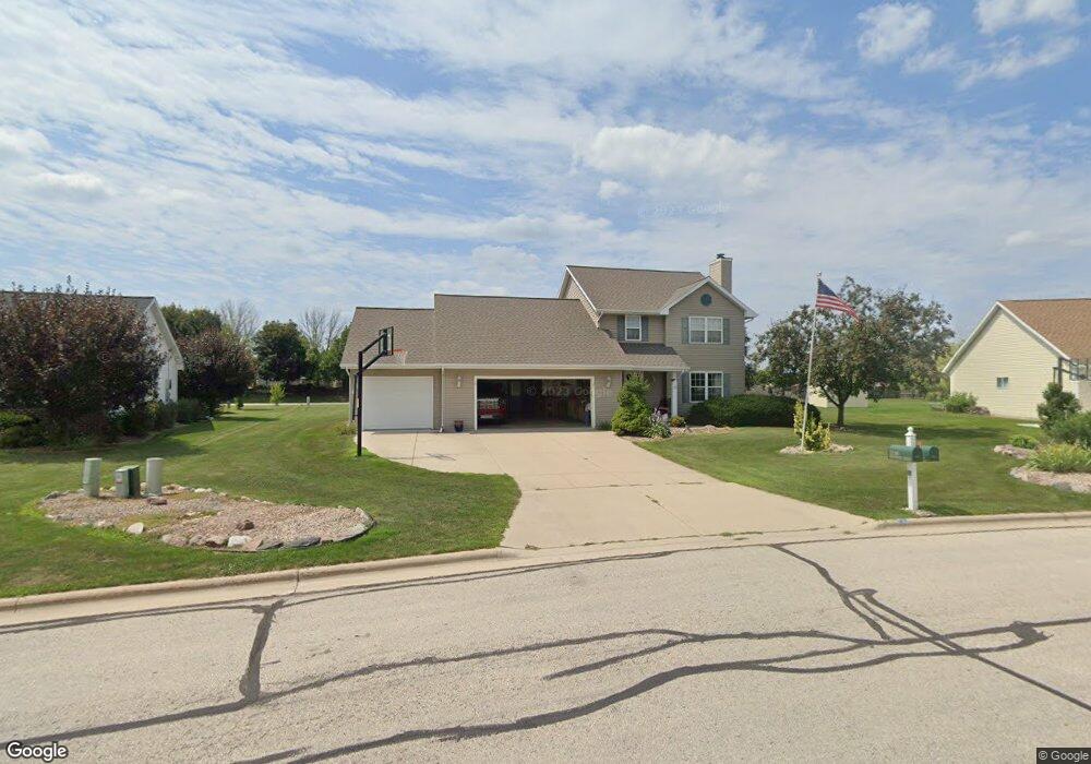
2188 Swanstone Cir de Pere, WI 54115
Estimated Value: $365,989 - $478,000
--
Bed
--
Bath
--
Sq Ft
0.38
Acres
About This Home
This home is located at 2188 Swanstone Cir, de Pere, WI 54115 and is currently estimated at $436,747. 2188 Swanstone Cir is a home located in Brown County with nearby schools including Heritage Elementary School, De Pere Middle School, and Foxview Intermediate School.
Ownership History
Date
Name
Owned For
Owner Type
Purchase Details
Closed on
Mar 21, 2006
Sold by
Sinner Glen A and Sinner Diana M
Bought by
Morley Richard M
Current Estimated Value
Home Financials for this Owner
Home Financials are based on the most recent Mortgage that was taken out on this home.
Original Mortgage
$49,000
Outstanding Balance
$28,019
Interest Rate
6.37%
Mortgage Type
Fannie Mae Freddie Mac
Estimated Equity
$408,728
Purchase Details
Closed on
Aug 3, 1998
Sold by
Garot Family Investments Inc
Bought by
Chic Builders Inc
Create a Home Valuation Report for This Property
The Home Valuation Report is an in-depth analysis detailing your home's value as well as a comparison with similar homes in the area
Home Values in the Area
Average Home Value in this Area
Purchase History
| Date | Buyer | Sale Price | Title Company |
|---|---|---|---|
| Morley Richard M | $189,900 | Bay Title & Abstract | |
| Chic Builders Inc | $28,000 | Land Office Title Corp |
Source: Public Records
Mortgage History
| Date | Status | Borrower | Loan Amount |
|---|---|---|---|
| Open | Morley Richard M | $49,000 |
Source: Public Records
Tax History Compared to Growth
Tax History
| Year | Tax Paid | Tax Assessment Tax Assessment Total Assessment is a certain percentage of the fair market value that is determined by local assessors to be the total taxable value of land and additions on the property. | Land | Improvement |
|---|---|---|---|---|
| 2024 | $4,441 | $301,500 | $53,200 | $248,300 |
| 2023 | $3,958 | $301,500 | $53,200 | $248,300 |
| 2022 | $3,617 | $301,500 | $53,200 | $248,300 |
| 2021 | $3,341 | $216,800 | $44,300 | $172,500 |
| 2020 | $3,312 | $216,800 | $44,300 | $172,500 |
| 2019 | $3,549 | $216,800 | $44,300 | $172,500 |
| 2018 | $3,631 | $216,800 | $44,300 | $172,500 |
| 2017 | $3,603 | $216,800 | $44,300 | $172,500 |
| 2016 | $3,463 | $176,700 | $34,900 | $141,800 |
| 2015 | $3,616 | $176,700 | $34,900 | $141,800 |
| 2014 | $3,526 | $176,700 | $34,900 | $141,800 |
| 2013 | $3,526 | $176,700 | $34,900 | $141,800 |
Source: Public Records
Map
Nearby Homes
- 1653 Remington Ridge Way Unit 1653
- 1655 Remington Ridge Way Unit 1655
- 1658 Remington Ridge Way Unit 1658
- 1724 Remington Ridge Way Unit 1724
- 1853 Swan Rd
- 1871 Ledgeview Rd
- 1144 Jordan Rd
- 0 S Broadway St
- 2206 Blue Stem Ln
- 2188 Trellis Dr
- 906 Silver St
- 3910 Monroe Rd
- 3980 N Parker Way
- 1403 Quinnette Ln
- 821 Killarny Trail Unit 1
- 1764 Other
- 2171 Trailside Ln Unit 16
- 801 S Erie St
- 2200 Dickinson Rd
- 830 Roth Rd
- 2182 Swanstone Cir
- 2194 Swanstone Cir
- 2200 Swanstone Cir
- 1402 Swan Ridge Trail
- 2195 Swanstone Cir
- 1402 Swan Ridge Tr
- 1397 Swan Rd
- 2176 Swanstone Cir
- 2206 Swanstone Cir
- 1390 Swan Ridge Trail
- 1373 Swan Rd
- 2209 Swanstone Cir
- 2177 Swanstone Cir
- 2212 Swanstone Cir
- 2170 Swanstone Cir
- 1353 Swan Rd
- 1380 Swan Ridge Trail
- 2217 Swanstone Cir
- 2171 Swanstone Cir
- 1395 Swan Ridge Trail