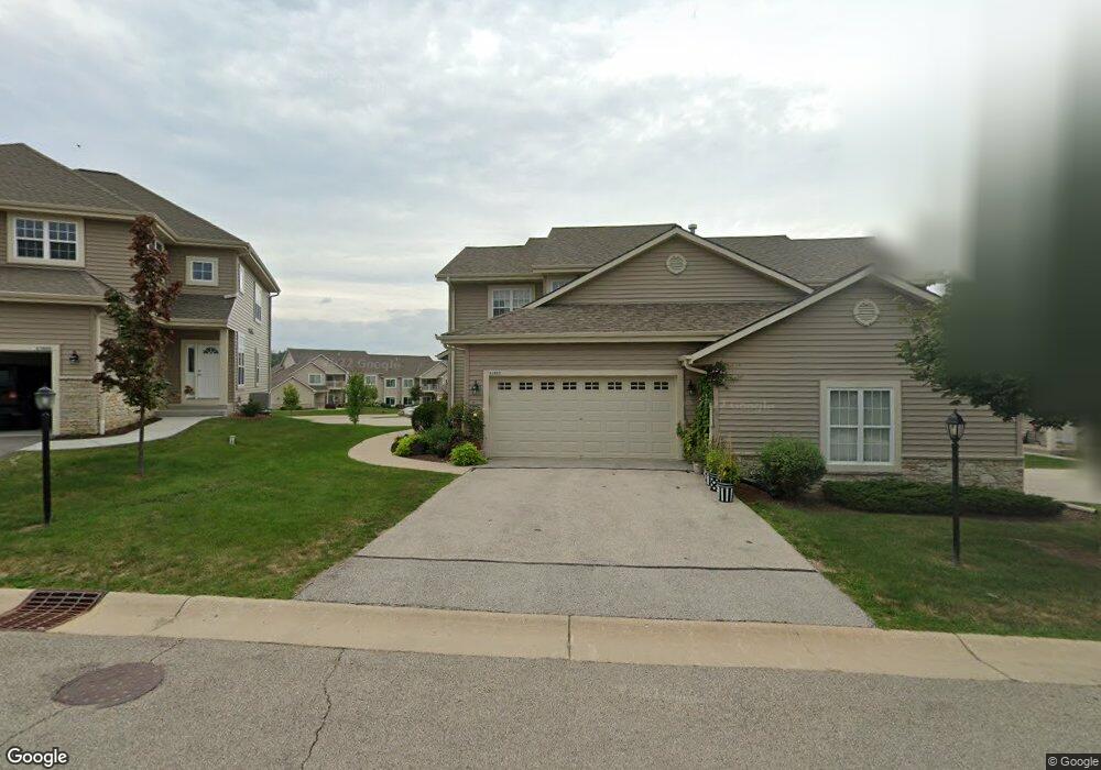
21890E N Weather Edge Cir Unit 435 Lannon, WI 53046
Estimated Value: $353,982 - $468,000
--
Bed
--
Bath
--
Sq Ft
12
Acres
About This Home
This home is located at 21890E N Weather Edge Cir Unit 435, Lannon, WI 53046 and is currently estimated at $399,996. 21890E N Weather Edge Cir Unit 435 is a home located in Waukesha County with nearby schools including Lannon Elementary School, Templeton Middle School, and Hamilton High School.
Ownership History
Date
Name
Owned For
Owner Type
Purchase Details
Closed on
Mar 15, 2019
Sold by
Mclay Michael and Mclay Michael
Bought by
Mclay Michael and Mclay Janice R
Current Estimated Value
Purchase Details
Closed on
Oct 5, 2018
Sold by
Pawlowski Suleeporn and Estate Of Michael A Pawlowski
Bought by
Mclay Michael
Purchase Details
Closed on
Nov 30, 2006
Sold by
Whispering Ridge Group Llc
Bought by
Pawlowski Michael A
Home Financials for this Owner
Home Financials are based on the most recent Mortgage that was taken out on this home.
Original Mortgage
$154,300
Interest Rate
6.47%
Mortgage Type
Purchase Money Mortgage
Create a Home Valuation Report for This Property
The Home Valuation Report is an in-depth analysis detailing your home's value as well as a comparison with similar homes in the area
Home Values in the Area
Average Home Value in this Area
Purchase History
| Date | Buyer | Sale Price | Title Company |
|---|---|---|---|
| Mclay Michael | -- | None Available | |
| Mclay Michael | $200,000 | None Available | |
| Pawlowski Michael A | $192,900 | None Available |
Source: Public Records
Mortgage History
| Date | Status | Borrower | Loan Amount |
|---|---|---|---|
| Previous Owner | Pawlowski Michael A | $154,300 |
Source: Public Records
Tax History Compared to Growth
Tax History
| Year | Tax Paid | Tax Assessment Tax Assessment Total Assessment is a certain percentage of the fair market value that is determined by local assessors to be the total taxable value of land and additions on the property. | Land | Improvement |
|---|---|---|---|---|
| 2024 | $3,277 | $218,600 | $46,000 | $172,600 |
| 2023 | $3,068 | $218,600 | $46,000 | $172,600 |
| 2022 | $3,054 | $218,600 | $46,000 | $172,600 |
| 2021 | $2,545 | $218,600 | $46,000 | $172,600 |
| 2020 | $2,482 | $218,600 | $46,000 | $172,600 |
| 2019 | $2,335 | $175,400 | $40,000 | $135,400 |
| 2018 | $2,212 | $175,400 | $40,000 | $135,400 |
| 2017 | $2,594 | $175,400 | $40,000 | $135,400 |
| 2016 | $2,366 | $175,400 | $40,000 | $135,400 |
| 2015 | $2,410 | $175,400 | $40,000 | $135,400 |
| 2014 | $2,888 | $195,600 | $45,000 | $150,600 |
| 2013 | $2,888 | $195,600 | $45,000 | $150,600 |
Source: Public Records
Map
Nearby Homes
- 21834 N Weather Edge Cir Unit A
- 21679 S Weather Edge Cir
- 21864 N Weather Edge Cir Unit A
- N66W21277 Sagebrush Dr
- N66W21471 Sagebrush Dr
- N66W21075 Sweet Clover Dr
- N66W20903 Sweet Clover Dr
- N66W21009 Sagebrush Dr
- Lt15 Fairview Dr
- W214N6672 Fairview Dr
- W214N6683 Fairview Dr
- 7018 Stonewood Ln
- 7022 Stonewood Ln
- 7034 Stonewood Ln
- 7038 Stonewood Ln
- 20910 Gray St
- 20900 Gray St
- 20860 Gray St
- 20840 Gray St
- 20820 Gray St
- 21890 N Weather Edge Cir Unit D
- 21890 N Weather Edge Cir Unit 21890
- 21890 N Weather Edge Cir Unit H
- 21790G N Weather Edge Cir Unit 457
- 21890A N Weather Edge Cir Unit 431
- 21834 N Weather Edge Cir Unit B
- 21834 N Weather Edge Cir Unit G
- 21834 N Weather Edge Cir Unit H
- 21834 N Weather Edge Cir Unit F
- 21834 N Weather Edge Cir Unit E
- 6958 N Weather Edge Cir Unit 252
- 6954 N Weather Edge Cir Unit 251
- 21834D N Weather Edge Cir Unit 424
- 21864C N Weather Edge Cir Unit 443
- 6974 N Weather Edge Cir
- 6984 N Weather Edge Cir
- 21864G N Weather Edge Cir Unit 447
- 21790 N Weather Edge Cir Unit D
- 21790 N Weather Edge Cir Unit C
- 21790 N Weather Edge Cir Unit A