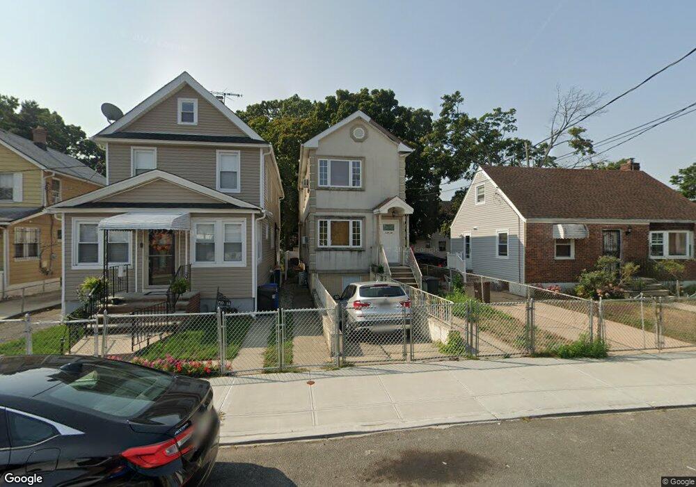
219-10 132nd Rd Springfield Gardens, NY 11413
Laurelton NeighborhoodEstimated Value: $600,000 - $774,000
3
Beds
4
Baths
1,500
Sq Ft
$480/Sq Ft
Est. Value
About This Home
This home is located at 219-10 132nd Rd, Springfield Gardens, NY 11413 and is currently estimated at $720,022, approximately $480 per square foot. 219-10 132nd Rd is a home located in Queens County with nearby schools including P.S. 132 - Ralph Bunche, Is 59 Springfield Gardens, and Success Academy Springfield Gardens.
Ownership History
Date
Name
Owned For
Owner Type
Purchase Details
Closed on
Dec 21, 2016
Sold by
Edward-Husbands Yasmin and Vincent Stanley
Bought by
Blagrove David G
Current Estimated Value
Home Financials for this Owner
Home Financials are based on the most recent Mortgage that was taken out on this home.
Original Mortgage
$416,874
Outstanding Balance
$340,909
Interest Rate
3.94%
Mortgage Type
Purchase Money Mortgage
Estimated Equity
$379,113
Purchase Details
Closed on
Mar 11, 2009
Sold by
Queens Renovators Corp
Bought by
Edward-Husbands Yasmin and Vincent Stanley
Home Financials for this Owner
Home Financials are based on the most recent Mortgage that was taken out on this home.
Original Mortgage
$385,881
Interest Rate
5.14%
Mortgage Type
Purchase Money Mortgage
Create a Home Valuation Report for This Property
The Home Valuation Report is an in-depth analysis detailing your home's value as well as a comparison with similar homes in the area
Home Values in the Area
Average Home Value in this Area
Purchase History
| Date | Buyer | Sale Price | Title Company |
|---|---|---|---|
| Blagrove David G | $410,000 | -- | |
| Edward-Husbands Yasmin | $393,000 | -- |
Source: Public Records
Mortgage History
| Date | Status | Borrower | Loan Amount |
|---|---|---|---|
| Open | Blagrove David G | $416,874 | |
| Previous Owner | Edward-Husbands Yasmin | $385,881 |
Source: Public Records
Tax History Compared to Growth
Tax History
| Year | Tax Paid | Tax Assessment Tax Assessment Total Assessment is a certain percentage of the fair market value that is determined by local assessors to be the total taxable value of land and additions on the property. | Land | Improvement |
|---|---|---|---|---|
| 2025 | $5,484 | $28,939 | $8,876 | $20,063 |
| 2024 | $5,484 | $27,302 | $8,296 | $19,006 |
| 2023 | $5,484 | $27,302 | $8,071 | $19,231 |
| 2022 | $5,409 | $33,120 | $11,760 | $21,360 |
| 2021 | $5,380 | $33,000 | $11,760 | $21,240 |
| 2020 | $5,105 | $28,560 | $11,760 | $16,800 |
| 2019 | $4,760 | $27,360 | $11,760 | $15,600 |
| 2018 | $4,638 | $22,752 | $10,668 | $12,084 |
| 2017 | $4,603 | $22,580 | $10,221 | $12,359 |
| 2016 | $4,258 | $22,580 | $10,221 | $12,359 |
| 2015 | $2,595 | $20,097 | $11,560 | $8,537 |
| 2014 | $2,595 | $18,960 | $13,080 | $5,880 |
Source: Public Records
Map
Nearby Homes
- 21931 133rd Ave
- 21917 132nd Rd
- 133-15 220th St
- 218-36 133rd Rd
- 131-35 222nd St
- 21924 130th Dr
- 130-45 220th St
- 134-16 221st St
- 134-15 221st St
- 13049 217th St
- 220-27 134th Rd
- 22310 131st Ave
- 21608 Merrick Blvd
- 130-55 222nd St
- 131-20 224th St
- 220-24 134th Rd
- 130-25 217th St
- 22126 134th Rd
- 22014 130th Ave
- 22014 130th Ave
- 21908 132nd Rd
- 21910 132nd Rd
- 13231 219th St
- 13231 219th St
- 21914 132nd Rd
- 132-22 219th St
- 219-14 132nd Rd
- 21814 132nd Rd
- 13222 219th St
- 219-25 219 St
- 21918 132nd Rd
- 13235 219th St
- 21810 132nd Rd
- 21911 132nd Rd
- 13232 219th St
- 219-22 132nd Rd
- 21922 132nd Rd
- 13241 219th St
- 21802 132nd Ave
- 13236 219th St