Estimated Value: $176,000 - $206,000
3
Beds
2
Baths
1,353
Sq Ft
$143/Sq Ft
Est. Value
About This Home
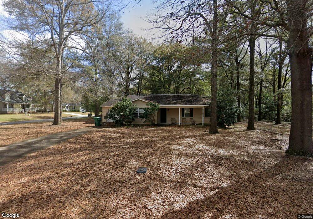
This home is located at 219 Anna's Way, Perry, GA 31069 and is currently estimated at $192,837, approximately $142 per square foot. 219 Anna's Way is a home located in Houston County with nearby schools including Langston Road Elementary School, Mossy Creek Middle School, and Perry High School.
Ownership History
Date
Name
Owned For
Owner Type
Purchase Details
Closed on
Feb 14, 2013
Sold by
Secretary Of Hud
Bought by
Foster Charles Kevin
Current Estimated Value
Home Financials for this Owner
Home Financials are based on the most recent Mortgage that was taken out on this home.
Original Mortgage
$81,525
Outstanding Balance
$36,878
Interest Rate
3.43%
Mortgage Type
VA
Estimated Equity
$155,959
Purchase Details
Closed on
Sep 18, 2012
Sold by
Jpmorgan Chase Bank N A
Bought by
Secretary Of Hud
Purchase Details
Closed on
Jan 7, 2002
Sold by
Raines Bruce M
Bought by
Robinson Michael and Robinson Audry
Purchase Details
Closed on
Feb 10, 2000
Sold by
La Development Inc
Bought by
Raines Bruce M
Create a Home Valuation Report for This Property
The Home Valuation Report is an in-depth analysis detailing your home's value as well as a comparison with similar homes in the area
Home Values in the Area
Average Home Value in this Area
Purchase History
| Date | Buyer | Sale Price | Title Company |
|---|---|---|---|
| Foster Charles Kevin | -- | None Available | |
| Secretary Of Hud | -- | None Available | |
| Robinson Michael | $86,500 | -- | |
| Raines Bruce M | $76,900 | -- |
Source: Public Records
Mortgage History
| Date | Status | Borrower | Loan Amount |
|---|---|---|---|
| Open | Foster Charles Kevin | $81,525 |
Source: Public Records
Tax History Compared to Growth
Tax History
| Year | Tax Paid | Tax Assessment Tax Assessment Total Assessment is a certain percentage of the fair market value that is determined by local assessors to be the total taxable value of land and additions on the property. | Land | Improvement |
|---|---|---|---|---|
| 2024 | $1,256 | $52,520 | $6,000 | $46,520 |
| 2023 | $1,058 | $43,760 | $6,000 | $37,760 |
| 2022 | $1,047 | $43,320 | $6,000 | $37,320 |
| 2021 | $907 | $37,320 | $6,000 | $31,320 |
| 2020 | $824 | $33,760 | $4,400 | $29,360 |
| 2019 | $824 | $33,760 | $4,320 | $29,440 |
| 2018 | $824 | $33,760 | $4,320 | $29,440 |
| 2017 | $825 | $33,760 | $4,320 | $29,440 |
| 2016 | $794 | $32,440 | $4,320 | $28,120 |
| 2015 | $795 | $32,440 | $4,320 | $28,120 |
| 2014 | -- | $32,440 | $4,320 | $28,120 |
| 2013 | -- | $35,320 | $7,200 | $28,120 |
Source: Public Records
Map
Nearby Homes
- 104 Arcadia Ln
- 113 Loneoak Trail
- 436 Courtney Ln
- 313 Ruger Place
- 201 Boulder Creek Rd
- 304 N Lake Dr
- 205 Canvass Back Trail
- 109 Village Blvd
- 203 Saraland Trail
- 312 Cambrian Dr
- 115 Woody Dr
- 425 Cambrian Dr
- 431 Sawtooth Ct
- 107 Waldorf Dr
- 224 Otters Ridge Dr
- 103 Waldorf Dr
- 250 Hathersage Dr
- 0 Hunt Rd Unit 253426
- 0 Hunt Rd Unit 10529566
- 107 Gallberry Ln
- 219 Annas Way
- 295 Merry Way
- 217 Annas Way
- 214 Annas Way
- 298 Merry Way
- 293 Merry Way
- 296 Merry Way
- 300 Merry Way
- 224 Addison Ln
- 212 Annas Way
- 294 Merry Way
- 215 Annas Way
- 215 Annas Way Unit 23
- 215 Anna's Way
- 302 Merry Way
- 212 Anna's Way
- 291 Merry Way
- 226 Addison Ln
- 703 Wooden Eagle Trail
- 701 Wooden Eagle Trail